Park End Moss wetland walk at Sizergh
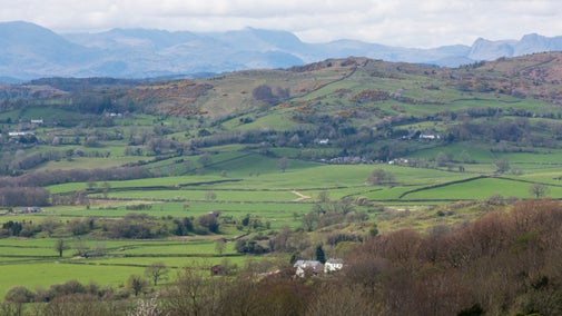
Park End Moss was once an area of degraded farmland which has now been transformed into a haven for wildlife. This circular walk takes you through historic parkland and ancient woodlands of the Sizergh estate and on to the wetland area which is popular with a variety of bird species.
Total steps: 11
Total steps: 11
Start point
Sizergh Castle, near Kendal, Cumbria, LA8 8DZ
Step 1
Leave Sizergh car park at the north side and take a left onto Ashbank Lane, which is an old drover's track. As the track goes uphill, admire the two large sweet chestnuts on the left side. The lane rises and then drops down to a large gate, which is hung from some impressive limestone stoops.
Step 2
Go through the gate, onto Flashbank, which was an old deer park dating from around 1700. Follow the track as it hugs the old deer park wall, until you come to a large field gate. Go through the gate and continue on the track.
Step 3
Go through another large deer park gate and cross Brigsteer Road, into a small informal car park in the wood. Go around the gate, crossing the track at the back of the car park and follow it into Brigsteer Park Wood. This wood has a long history of being managed as a coppice and there is evidence of old charcoal burning platforms throughout it.
Step 4
Follow the track down into the wood, past an information sign on your left. When the path forks take the left route, which goes downhill. The whole woodland is on a west-facing slope, which means it gets lots of sunshine.

Step 5
Follow the path to the bottom of the hill, and take a right onto the public footpath at the bottom of the wood. Almost immediately you'll come upon a small spring to cross. This is a level path, which is just above the catchwater for the Lyth Valley. Follow this path all the way through the wood, until you reach a gate onto Park End Meadow.
Step 6
If you would like to visit the Park End Wetland hide take a left, through a gate and onto the track that leads to the hide. Otherwise, follow the path up the hill and across the field, until you are at a gate opposite Park End Farm's house.
Step 7
Cross the road, walk through the small farmyard and follow the path up the steep hill towards a couple of houses and the beck. Once at the top, pause to catch your breath and enjoy the views behind you over the wetland and beyond to Morecambe Bay.
Step 8
Go through the gate and turn right up a track, which comes out at the bottom of Church Fell. Follow the path to the right as it stays close to the wall. This brings you out onto a stoned track. If you turn left you can walk towards St John's Church, where there is a toposcope, benches and brilliant views across to the Lakeland Fells. Otherwise, follow the track past a cattle grid and down the hill.
Step 9
Follow the track as it comes to an old farmhouse (Holeslack) and a farmyard. Cross through the farmyard, which is flanked by a traditional orchard, and keep on the track as you go through a large gate across the track.

Step 10
Once through the gate, there's another small gate on your right which takes you down a few steps and onto a footpath through Rash Spring Wood. Follow the path all the way through the wood until you reach a barn with a small yard.
Step 11
From the small yard, you should be able to see the castle. Go through a large gate and out onto a track which heads downhill along the side of the field. At the bottom of the hill, keep straight, through a gate onto a smaller stoned footpath which leads you back to the main car park at Sizergh, where you began.
End point
Sizergh Castle, near Kendal, Cumbria, LA8 8DZ
Trail map

More near here


Holeslack Accessible Trail
Take this accessible circular route for a flavour of the Sizergh estate, from ancient woodlands and traditional Westmorland orchards to historic farm buildings and parklands.

Sizergh wildlife walk
Follow this route from Sizergh Castle for views of the Lakeland Fells, the Pennines and Morecambe Bay, as well as birds, butterflies, wildflowers and some unusual animals.

Windermere to Townend walk
Discover the area around Townend, a 17th-century farmhouse a stone's throw from Lake Windermere.
Get in touch
Our partners

We’ve partnered with Cotswold Outdoor to help everyone make the most of their time outdoors in the places we care for.
You might also be interested in

Walking
Explore some of the finest landscapes in our care on coastal paths, accessible trails, woodland walks and everything in between. Find the best places to walk near you.

Walking in the Lake District
From gentle ambles to more challenging hikes, these are some of the best walks to explore the heart of the Lake District.

Cotswold Outdoor: our exclusive walking partner
Find out more about the National Trust’s ongoing partnership with Cotswold Outdoor as our exclusive walking partner.

Staying safe at National Trust places
The special places in National Trust care sometimes come with a few risks for visitors, be it coastline or countryside. Find out how to keep safe throughout your visits.

Follow the Countryside Code
Help to look after National Trust places by observing a few simple guidelines during your visit and following the Countryside Code.

Exploring the estate at Sizergh
Connect with nature in Sizergh’s woodland, wetland and farmland. Find out about the wildlife you can spot while exploring this 1,600-acre estate.

Eating and shopping at Sizergh
Can we tempt you to afternoon tea in the café, a new pair of gardening gloves from the shop or a pre-loved book during your visit to Sizergh?

Visiting Sizergh with your dog
Sizergh is a two pawprint rated place. Find out which areas of the estate you can explore with your dog.