Skip to content
Aerial photograph of Blakeney National Nature Reserve, Norfolk Coast
Blakeney National Nature Reserve from the air | © National Trust Images / Ian Hart
Norfolk

Blakeney Point coastal walk

Take a leisurely, but active stroll, along Blakeney Point’s 4 mile-long (6.4km) shingle spit to the sand dunes near the Lifeboat House, home to a variety of unusual plants and wildlife.

Wildlife and restrictions

Blakeney Point is an important area for breeding wildlife. Please obey all signs and do not cross any fence lines. Some the birds are protected and it is a prosecutable offence to disturb them. It is not possible to see the seal colony on Blakeney Point on foot outside of the pupping and breeding season (between late October and mid-January). If you wish to see the seals during the spring and summer months, then please hop on a boat from Morston Quay.

Total steps: 4

Total steps: 4

Start point

Cley Beach, Norfolk Wildlife Trust car park, grid ref: TG048453

Step 1

From the car park walk onto the shingle ridge towards the sea and turn left. If the tide is out, you can walk along the beach, which is a slightly easier surface to walk. The shingle ridge, which begins at Weybourne, is 8 miles (12km) long. and has grown westwards over time, forming Blakeney Point spit. Vegetated shingle is a rare habitat, home to scarce plants such as horned sea poppy, sea pea and shrubby sea blight. Half way along the ridge you will come across the Watch House From here, continue along the beach for another mile.

Blakeney Point. A big blue sky with some fluffy white clouds on the horizon. Sea to the right and a shingle beach to the left
The shingle ridge of Blakeney Point | © National Trust Images / Alex Green

Step 2

At the start of the main dunes walk onto the top of the ridge and turn left, away from the sea, along a track towards the blue Lifeboat House, keeping the main dunes and fence line on your right. During the pupping season, there may be seals outside of the fence lines. Ensure you give them a wide berth as they can be particularly aggressive, especially if they have a pup. **Please note** depending on where pupping seals are located, this maybe as far as you are able to safely walk. In this situation we will have closed the walk from section two for public safety. We apologise in advance for any disappointment caused.

Step 3

Once you reach the crest of the boardwalk you have arrived at the end of the walk. From here you get fantastic, elevated views of the seal pup colony and surrounding dunes during the mating and pupping season (between late October and mid-January). Please do not enter fenced areas as this is for your own safety as well as that of the seals. From here follow your route back to Cley Beach car park.

Many seals from the Grey Seal Colony laying on the sand at Blakeney Point, Norfolk at sunset,
The Grey Seal Colony at Blakeney Point, at sunset. | © National Trust Images / Ian Ward

Step 4

From here, turn right and walk along the beach, with the sea on your left, returning all the way to Cley Beach car park.

End point

Cley Beach, Norfolk Wildlife Trust car park, grid ref: TG048453

Trail map

An OS map showing the route to Blakeney Point.
Blakeney Point Coastal Walk map | © Crown copyright and database rights 2013 Ordnance Survey

You made it

Share your experience

More near here

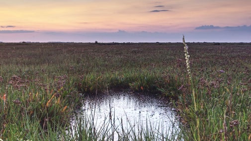
Purple sea lavender surrounding a pool of water in a marsh landscape with purple-grey moody, cloudy sky above, which is reflected in the pool
Trail
Trail

Blakeney to Stiffkey coastal walk 

Enjoy views across Norfolk's open landscape on this coastal walk, starting at Blakeney Nature Reserve and taking in Morston and Stiffkey salt marshes.
Activities
Walking
DistanceMiles: 4 (km: 6.4)
The view of Blakeney Freshes from Friary Hills at Blakeney National Nature Reserve, Norfolk
Trail
Trail

Blakeney Freshes coastal wildlife walk 

This family-friendly circular walk through Blakeney village and around Blakeney Freshes offers impressive coastal views and is ideal for spotting birds and wildlife.

Activities
Walking
DistanceMiles: 3 (km: 4.8)
The Mausoleum Pyramid, designed by Joseph Bonomi 1796-97, on the Blickling Estate, Norfolk
Trail
Trail

Blickling mausoleum walk 

This historical scenic stroll through woods and open land at Blickling Park leads you to its striking Mausoleum. Look out for barn owls along the way.

Activities
Walking
DistanceMiles: 1.8 (km: 2.88)

Get in touch

Blakeney Office, Friary Farm, Cley Road, Norfolk, NR25 7NW (No Public Access)

Our partners

Cotswold Outdoor

We’ve partnered with Cotswold Outdoor to help everyone make the most of their time outdoors in the places we care for.

Visit website 

You might also be interested in

Walkers climbing rocks against a bright blue sky with the mountains in the distance at Sugarloaf, Monmouthshire

Walking 

Explore some of the finest landscapes in our care on coastal paths, accessible trails, woodland walks and everything in between. Find the best places to walk near you.

A group of people in a hiking group are being guided on a hike by rangers at Marsden Moor, West Yorkshire
Article
Article

Cotswold Outdoor: our exclusive walking partner 

Find out more about the National Trust’s ongoing partnership with Cotswold Outdoor as our exclusive walking partner.

An aerial view of an adult and baby walking a dog along a path at Baggy Point, Devon
Article
Article

Staying safe at National Trust places 

The special places in National Trust care sometimes come with a few risks for visitors, be it coastline or countryside. Find out how to keep safe throughout your visits.

Two visitors walking along a pathway with another visitor on a mobility scooter

Walking in Norfolk 

Discover the best walks around Norfolk, from a stroll around the estate at Blickling to a bracing trek on the Norfolk Coast Path.