Skip to content
The view from Gorge Walk at Cheddar Gorge
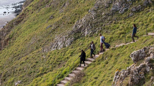
View from Gorge Walk at Cheddar Gorge | © National Trust Images / John Miller
Somerset

Cheddar Gorge trail

At almost 400ft (122m) deep and 3 miles (4.8km) long, Cheddar Gorge is England’s largest gorge. Explore one of the country's most spectacular sights along this trail, where you'll discover weathered crags and pinnacles, alongside a wide variety of plants and wildlife that call this landscape home.

Safety at Cheddar Gorge

Please do not stand under the cliffs as small rocks may fall at any time. Use only the footpaths signed for the gorge walk at the top and bottom of Cheddar Gorge. It is dangerous to depart from these footpaths.

Total steps: 10

Total steps: 10

Start point

Cheddar Visitor Information Centre, grid ref: ST 46636 53911

Step 1

Take the stony road (Cufic Lane) diagonally opposite the Visitor Information Centre in the lower Gorge area; the gatepost has markings for the Cheddar Gorge walk.

Step 2

Continue up Cufic Lane ignoring the steps on the right, and stay on the lane up past the houses. At the top of the lane, turn right to follow the public footpath and Gorge Walk waymarking arrows. Take a sharp right, turning back on yourself, up the path and through a gate. Follow this path up through the woodland for 10–15 minutes, then pass through another gate. Exit the wooded area through a gate and turn sharp right through a gap in the stone wall, keeping straight ahead on the path toward the clifftop viewpoint. Join a wide grassy path leading diagonally across the field towards the stone wall at the top of the cliffs. Keep the stone wall to your right as you ascend – you will see some wooden marker posts en-route.

Step 3

Follow the path to the top, through the kissing gate marked with the Gorge walk sign. Look back from this point for magnificent views of Cheddar, Glastonbury Tor, the Somerset levels and Bridgwater Bay. The following section is rocky in places and can become very muddy in wet weather. Follow the obvious path along the side of the Gorge before descending via a long set of steps to a deep valley.

Step 4

At the bottom of the steps head through the wooden kissing gate (marked with a Gorge walk sign) and continue straight ahead. After heading through the gate, the path leads through a wooded area and descends to meet the 'Black Rock' stony path. This stretch can become muddy.

Step 5

Where the path joins the stony track turn immediately right through a farm type gate and onto another gate to join the main Gorge road.

Step 6

Carefully cross the road, and slightly diagonally to your right join the path which rises to the other side of the Gorge (signposted Draycott and West Mendip Way). This path is steep, rocky and uneven as it rises through the woods.

Step 7

At the top the path levels out and passes through a gate to join a wide grassy path. Keep to the right; do not follow the West Mendip Way sign which branches off left. Follow the path through a set of high gates with a wooded area to your right. Rise to the brow of the hill before gradually descending. Keep the wire fence to your left and do not approach the sheer side of the Gorge over to your right. Keep to the obvious wide grassy path for your decent. This section can become exposed in windy weather so ensure you wear suitable layers.

Step 8

Follow the rocky path downwards through the woods passing through another tall gate with Pavey’s lookout tower in front of you. Please note Pavey’s lookout tower and Jacob’s Ladder steps are only open to Cheddar Gorge and Caves Explorer Ticket holders.

Step 9

Before the tower follow the path heading left and downhill through the woods (no signs) to join Lynch Lane. As you join Lynch Lane turn right and then at the end right again to walk down the narrow Lippiatt road.

Step 10

At the bottom of The Lippiatt at the junction with the main Gorge road turn right to follow the pavement back to the Visitor Information Centre.

End point

Visitor Information Centre, grid ref: ST468543

Trail map

An Ordnance Survey map of Cheddar Gorge outlining a circular walk
Cheddar Gorge trail | © Crown copyright and database rights 2013 Ordnance Survey

You made it

Share your experience

More near here

The view from Gorge Walk at Cheddar Gorge, Somerset, with rocky outcrops and thickly wooded gorge sides, and far-reaching countryside views
Place
Place

Cheddar Gorge 

Discover the heights of Somerset's famous Cheddar Gorge

Cheddar, Somerset

Fully open today

Get in touch

The Cliffs, Cheddar, Somerset, BS27 3QE

Our partners

Cotswold Outdoor

We’ve partnered with Cotswold Outdoor to help everyone make the most of their time outdoors in the places we care for.

Visit website 

You might also be interested in

A group of people in a hiking group are being guided on a hike by rangers at Marsden Moor, West Yorkshire
Article
Article

Cotswold Outdoor: our exclusive walking partner 

Find out more about the National Trust’s ongoing partnership with Cotswold Outdoor as our exclusive walking partner.

An aerial view of an adult and baby walking a dog along a path at Baggy Point, Devon
Article
Article

Staying safe at National Trust places 

The special places in National Trust care sometimes come with a few risks for visitors, be it coastline or countryside. Find out how to keep safe throughout your visits.

A visitor carrying a backpack and walking along a footpath at Divis and the Black Mountain with stone walls either side, the countryside visible in the background.
Article
Article

Follow the Countryside Code 

Help to look after National Trust places by observing a few simple guidelines during your visit and following the Countryside Code.

View of the geological features in the limestone gorge at Cheddar Gorge, Somerset
Article
Article

Things to see and do at Cheddar Gorge 

Discover the heights of England’s largest gorge. Head out for a walk, take in the views and spot wildlife including Cheddar Gorge’s famous feral goats.

Sunny view of a carpet of bluebells on a clifftop with a tree and the sea in the distance

Walking in Somerset 

From the majestic crags of Cheddar Gorge and the sea views at Bossington to gentle strolls through Tudor parkland at Montacute House, these are some of the best walks in Somerset.
Walkers climbing rocks against a bright blue sky with the mountains in the distance at Sugarloaf, Monmouthshire

Walking 

Explore some of the finest landscapes in our care on coastal paths, accessible trails, woodland walks and everything in between. Find the best places to walk near you.