Skip to content
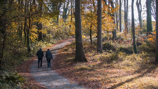
Glorious autumnal woodland with crisp brown leaves littering the narrow footpath and the tall beech trees resplendent in yellow and orange
The coppice at Bradenham, Chilterns Countryside, Buckinghamshire | © National Trust Images/Hugh Mothersole
Oxfordshire, Buckinghamshire & Berkshire

Bradenham beech woods walk

This walk takes you from the pretty Chiltern village of Bradenham into the Bradenham Estate and a classic Chiltern landscape that blends hills topped with beech woodlands and gently rolling valleys. You'll get a number of glimpses into the deep and varied history of this part of the Chilterns, ranging from ancient earthworks to wartime bunkers and ballrooms.

Total steps: 14

Total steps: 14

Start point

National Trust car park in Bradenham village, near the cricket pavilion. Grid ref: SU827969. Satnav: HP27 0PR.

Step 1

From the car park, head away from the village green, following the track that runs alongside the wall to Bradenham Manor’s garden. The track turns left at the corner of the wall. Follow the track uphill. After it bends sharply to the left again, the track forks. Take the left fork, parallel to the manor house garden wall. Where the track curves right, go straight ahead on a footpath, ignoring any joining paths. The path soon starts to climb, and eventually it levels out. After 440 yards (400m), you'll come across some large pieces of rock that look like weathered concrete.

Step 2

Continue along the path. Where the path splits, take the left-hand fork and continue until you reach a distinct crossing path. Turn left, then immediately take the left fork towards a footpath sign by a road. The road here possibly follows the line of The Queen’s Gap or Ride.

Step 3

Cross the road with care, and then continue along a bridleway. The path takes you in a more or less straight line through beech woods and across the head of a small valley that dips to your left. Keep right ignoring any downhill paths on the left. After the path bends to the right, you'll come to a fork in the path with a marker post in the centre. Take the right fork, initially keeping parallel to the chain link fence on your right. After passing a log jump for runners on your right, you'll come to a junction of three paths. Take the middle path, straight ahead and just to the left of a small marker post. Follow this path round to the right. About 100 yards (91 metres) after passing a white footpath marker on a post you'll reach a fork. Continue slightly right ahead towards a second marker post. Just past this post you'll cross a causeway over Grim's Ditch.

Step 4

Continue in the same direction for about 150 yards (137 metres) until you reach a T-junction with a wooden fence ahead.

Step 5

Turn left at the T-junction. The cleared area you pass for the next 80 yards (73 metres) on your left is the site of a cluster of buildings built and used by the RAF during the Second World War. Explore this area while taking care on the uneven surfaces, before continuing along the path. This area can become quite overgrown in the summer months, and the foundations of the buildings may not be easily visible from the footpath. About 160 yards (146 metres) beyond the RAF site turn left on to a downhill track away from the boundary fence. After another 220 yards (200 metres), turn right uphill onto a crossing path next to a footpath marker. Then, after another 50 yards (46 metres), turn left at a T-junction. Follow this path around to the right and downhill until you join a wide track coming uphill from your left. Around 15 yards (14 metres) after joining this track, another path forks left away from the track. Almost opposite on the right is a cylindrical green pillbox dating from the Cold War.

Step 6

Take the left fork, following a path uphill. This soon levels out, becoming a track that meanders through Park Wood. Pass a footpath sign on a post and, after 440 yards (402 metres) look out for a shallow circular depression in the ground just over a metre deep, immediately to the right of the track. This is the remains of one of the many sawpits, associated with ‘bodgers’ and the High Wycombe Chair industry. These were a common sight in the 19th century. After the sawpit, continue to a fork in the track just next to a small depression on the right, and marked by a white marker ahead of you on a post set back from the right fork (There is a fenced off clearing on your left).

Step 7

At the fork in the track, turn right past a more open area on the right containing a pond. This may be concealed by vegetation in the summer months. Pass to the right of the marker post, and then continue for 30 yards (27 metres) to another white marker post. Turn right onto a much narrower footpath, which wanders through trees, eventually turning left over a small fallen tree and heading gently downhill. As it curves right again, you'll cross a deep ditch. Soon after the ditch you'll reach a T-junction.

Step 8

At the T-junction turn left, following the path downhill for 600 yards (548 metres). On reaching a junction in front of a wooden kissing gate that leads into the conservation area at Small Dean Bank, turn right, following a sunken path uphill. The path curves to your left and follows the inside edge of the woodland, with Small Dean Bank on your left. After 200 yards (183 metres) you'll meet a crossing path leading to a gate on your left. Go through the gate, where you can pause to admire the far reaching views across the Saunderton Valley towards Bledlow Ridge and Lodge Hill. Cross Small Dean Bank on a steep downhill path that leads through a gate to the National Trust car park.

Step 9

From the car park, turn left, following the narrow lane downhill. This is usually a very quiet lane, but please keep a look out for traffic. After 270 yards (247 metres), you'll reach the buildings of Small Dean Farm. Turn left, following a footpath sign. Follow a track past some farm sheds on your right until you reach a field. Turn left and follow the path along the left field boundary for 765 yards (700 metres).

Step 10

As you reach the end of the woodland on your left, you'll see the Art Deco buildings of The Residence ahead of you, although this may be obscured by trees in summer. Turn left, again following the left field boundary. Pass through a gap in the trees, turn left uphill then immediately right, and continue following the left field boundary for another 440 yards (402 metres).

Step 11

As you approach the corner of the field, turn left uphill along a short, wide avenue towards an area of tall, mature woodland (part of Park Wood). As you approach the woodland, turn right and continue downhill along a clear path, following the left field boundary. After 440 yards (402 metres) you'll meet a crossing track.

Step 12

Cross the track, and with a fence on your right, continue along the field's edge towards Bradenham. After another 440 yards (402 metres), pass through two gates to a track which emerges into Bradenham Village, by the former youth hostel's car park near the village pond.

Step 13

From the car park, cross the road. Here you'll see further examples of sarsens and puddingstones along the edge of the village green. Keeping the churchyard wall on your left, head along the edge of the village green, past the parish church of St. Botolph.

Step 14

Continue past the gate to Bradenham Manor House. After a few more yards, you'll arrive back at the car park where your walk began.

End point

National Trust car park in Bradenham village, near the cricket pavilion. Grid ref: SU827969. Satnav: HP27 0PR.

Trail map

A map of the Bradenham beech woods walk
A map of the Bradenham beech woods walk | © Crown copyright and database rights 2013 Ordnance Survey

You made it

Share your experience

More near here

View of the manor and the church in Bradenham village in February at Bradenham Estate, Chilterns Countryside, Buckinghamshire
Trail
Trail

Bradenham: Chiltern Hills, Valleys and Woodlands Walk 

Enjoy an 8-mile (13km) walk starting at Bradenham village in Buckinghamshire, leading you through a mix of chalk meadows, beech woodlands and farmland.

Activities
Walking
DistanceMiles: 8.0 (km: 12.8)
The Boer War memorial on Coombe Hill in the summer with purple flowers in the grass
Trail
Trail

Coombe Hill and Chequers trail 

Enjoy a moderately energetic circular walk from Coombe Hill, taking in views across the Aylesbury Vale. You'll wander through woodlands, past rare chalk grassland and the pretty village of Ellesborough.

Activities
Walking
DistanceMiles: 5 (km: 8) to miles: 7 (km: 11.2)
Bradenham in early spring in the Chilterns countryside, Buckinghamshire
Trail
Trail

Bradenham countryside trail 

Enjoy a short walk around the village of Bradenham and neighbouring meadows, with views across the Chilterns and a visit to St Botolph's church on the route.

Activities
Walking
DistanceMiles: 2 (km: 3.2)
A distant view of West Wycombe Park taken from a nearby hill, Buckinghamshire
Trail
Trail

Chiltern Hills three-in-one walk 

Discover a challenging 8½-mile scenic walk linking three National Trust places in the Chiltern Hills: West Wycombe, Bradenham and Hughenden. Longer and shorter routes can be completed depending on your choice.

Activities
Walking
DistanceMiles: 5.5 (km: 8.8) to miles: 8.5 (km: 13.6)

Get in touch

Chilterns Countryside, c/o Hughenden estate, High Wycombe, Buckinghamshire, HP14 4LA

You might also be interested in

Visitors walking in the woodland at Blickling, Norfolk
Article
Article

Woodland walks 

From tree-lined avenues to ancient woodland, find a sense of calm among the trees with our pick of the best woodland and forest walks.
View to the north from Coombe Hill, showing fields and trees stretching to the horizon
Article
Article

Things to see and do in the Chilterns Countryside 

Discover the countryside sites of the Chilterns. Find the best viewpoints, walk through ancient woodland or pick a quiet spot to watch for wildlife.

An aerial view of an adult and baby walking a dog along a path at Baggy Point, Devon
Article
Article

Staying safe at National Trust places 

The special places in National Trust care sometimes come with a few risks for visitors, be it coastline or countryside. Find out how to keep safe throughout your visits.

A group of people in a hiking group are being guided on a hike by rangers at Marsden Moor, West Yorkshire
Article
Article

Cotswold Outdoor: our exclusive walking partner 

Find out more about the National Trust’s ongoing partnership with Cotswold Outdoor as our exclusive walking partner.

Walkers climbing rocks against a bright blue sky with the mountains in the distance at Sugarloaf, Monmouthshire

Walking 

Explore some of the finest landscapes in our care on coastal paths, accessible trails, woodland walks and everything in between. Find the best places to walk near you.

A winter's day at Cock Marsh, Maidenhead and Cookham Commons, Berkshire

Walking in Oxfordshire, Buckinghamshire and Berkshire 

From gentle strolls for little legs to longer hikes through the rolling Chiltern hills, these are some of the best walks in Oxfordshire, Buckinghamshire and Berkshire.