Bradenham countryside trail
This is a 2.0 miles (3.2 kilometres) walk taking you around the pretty Chiltern village of Bradenham and neighbouring farmland, where the young Benjamin Disraeli spent much of his childhood. The two gentle uphill climbs are rewarded by beautiful views across the local Chiltern Countryside of Bradenham village, and towards West Wycombe and Bledlow Ridge. The landscape is a classical Chiltern blend of hills topped with beech woodlands, and gently rolling valleys with a mixture of grazed and ploughed fields divided by hedgerows.


Start:
National Trust Bradenham village car park
1
From the car park, head gently downhill following the track to the car park along the southern edge of the village green. In the summer months, you may encounter a cricket match. Please keep an eye out for the ball! From this side of the green, you have an opportunity to see the layout of the unspoilt Chiltern village of Bradenham and its flint and brick cottages.
Bradenham Village
Bradenham is a scenic village with cottages clustered around a village green with its notorious sloping cricket pitch. The village name is Anglo-Saxon and means 'broad enclosure', referring to the fact that the village sits in a broad valley among the surrounding Chiltern Hills. In the Domesday Book of 1086, the village was recorded as ‘Bradeham’. The majority of cottages are 18th century, and the area around the green has been designated a conservation area, with 18 listed buildings. The entire village of Bradenham is now in the care of the National Trust.

2
Turn right at the T-junction at the end of the village green. You soon see on your right a large boulder in the green. Bear right towards the boulder, which is a large sarsen stone.
Sarsen Stones
The valley sides and bottoms around Bradenham are littered with sarsen stones, many of which have been moved off neighbouring farmland to allow the unimpeded use of machinery. This specimen at Bradenham is particularly large and was relocated here from a neighbouring field in 2000 to mark the new millennium. The sarsens represent an ancient river deposit and they are made of a very tough material called silcrete. This formed in a semiarid climate around 20 million years ago, when Britain had a much warmer climate. None of the sarsens are in the place they were originally formed, although they have probably not moved far.

3
From the sarsen stone, head directly towards the church along the northern side of the village green. Along the edge of the road, you will encounter more pieces of sarsen stone as well as pieces of Bradenham Puddingstone.
Puddingstones
These comprise very well-rounded, flint pebbles in a very hard silcrete matrix. The flints originate from ancient chalk rock that was weathered and eroded away when sea levels rose in the Palaeocene (66-56 million years ago), leaving behind tough flint nodules. Some of these flints were subsequently rounded into pebbles on ancient beaches associated with shorelines that extended across Buckinghamshire and Hertfordshire. The matrix of the rock is sandy, and like the sarsen stones, it is cemented together by silcrete, which formed under the same warm, semi-arid climate around 20 million years ago. Like the sarsens, none of the puddingstones are in the place they were originally formed, although they have probably not moved far.

4
You are now approaching the Parish Church of St Botolph and the to right of it, Bradenham Manor House.
The parish church of St Botolph
The church was restored in 1863 by G.E. Street, although the south door dates from the early Norman period and is reputedly the oldest church doorway in Buckinghamshire. The earliest part is the nave, dating from 1100. The remainder of the building dates from the fourteenth century onwards, the north chapel being added in 1542. In the medieval tower hang two of the oldest bells in England, which were cast in about 1300. The church contains a tablet to Isaac and Maria D’Israeli, Benjamin Disraeli’s parents, both of whom lie at rest here. Note the inscriptions carved into the wooden archway gate dedicated to the local soldiers fallen during the First World War. The building stones are local, consisting of flint with some sarsen stones and Portland Limestone (from North Bucks).

5
On reaching the brick wall in front of the church, turn left. Taking care, cross the road to a small car park by the village pond. To the right of the pond, turn left following a Public Footpath sign along a wide track between hedges towards a gate. Head through the gate, then a second gate and continue in the same direction for about 400metres on a path through a field, with a wooden fence on your left.

6
On meeting a wide crossing track, head straight across. There is an unusual star shaped bench here, with room for the whole family! The path now heads gently uphill, with a line of trees on a bank on the right.

7
After a further 400 metres, at the junction of several tracks, turn sharp right up a short slope and through a metal kissing gate into a field. Follow the edge of the field uphill, with Park Wood on your left and fine views back towards Bradenham over the field on your right.
Park Wood
Archaeological surveys undertaken in Park Wood have revealed a fascinating past for this quiet area of deciduous woodland. Lynchets and banks within the woods give evidence of ancient field systems which may date back to the late Iron Age/early Roman period (or they may be medieval). There is evidence of a late thirteenth/early fourteenth homestead in the woodlands and in Tudor times (1485 – 1603) the woodland was a deer park. Much of Park Wood was converted to beech woodland from the late 18th until the early 20th century to cater for the High Wycombe furniture industry. Associated features include sawpits, tracks, and charcoal burning platforms.

8
On reaching the corner of the field, go through a metal kissing gate. Go down some steps and continue directly down the slope ahead of you, crossing an area of rough meadow (marked on OS maps as woodland) to a track below. Cross the track and turn half right following a path which crosses the meadow diagonally to end of a hedge. Carry on in the same direction following a clear path that runs diagonally up hill to a gate in the corner. Notice the many anthills on this sunny south-facing slope. From here you can see back across the Bradenham valley towards Park Wood and the hilltop village of Bledlow Ridge.
Bradenham valley
Like other major valleys or gaps in the Chilterns that run approximately NW – SE, the Bradenham valley was predominantly formed during Pleistocene Epoch (the Ice Ages), between 2.5 million and 10,000 years ago. Like most other Chiltern valleys, it is now a dry valley because the underlying chalk is permeable to water. During the Ice Age, in permafrost conditions, water could not pass through the frozen ground. Seasonal thawing, particularly of the ice sheets to the north, would have released large amounts of water, which would have cut down into the chalk to create the present “fossil” valley.

9
Go through the normally open field gate and turn right along a path, initially with a post-and-wire fence on your left and woodland on your right. Look out for a tall, isolated tree stump on your left full of holes, where woodpeckers have been busy pecking for insects. About 150 metres from the gate, where a diagonal crossing track joins the path from the left, bear right. Follow this path downhill along the firebreak between two areas of woodland. This woodland has recently been partially logged in order to provide a grassland corridor for the various butterfly species found in this area, such as the speckled wood and silver-washed fritillaries. After about 200 metres you will reach a gate from which you can see views of Bradenham, including the Manor House and the Church.

10
Go through the gate and continue to follow the path downhill through an area of shrubs. The path soon starts to cross a field diagonally (half left) towards a gate. Go through the two gates that take you back to the car park by the village pond. Take care crossing the busy road and head straight on past the church and the entrance to Bradenham Manor to reach your starting point.
Bradenham Manor (Not open to the public)
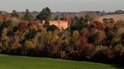
There has been a manor house at Bradenham since the 13th century, when it was a property belonging to the Earl of Warwick. In 1566 Queen Elizabeth I was entertained here by Lord Windsor. The current manor house was substantially built in the 17th century, with tall sash windows, steep roofs and slim brick chimneys. In the 19th century it was the home of Isaac D'Israeli who died here in 1848. His son Benjamin Disraeli, who became Prime Minister, lived here as a child, but spent much of his adult life at the nearby Hughenden Manor, which is also a National Trust property. Hughenden Manor is open to the public throughout the year.

End:
National Trust Bradenham village car park