Chiltern Hills, Valleys and Woodlands Walk
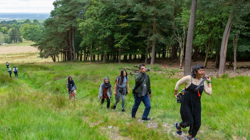
This is an 8 mile (13 kilometre) walk starting in the National Trust’s Bradenham Village and leading you through a mix of chalk meadows, beech woodlands and a variety of farmland. This is a walk of contrasts, starting with far-reaching views across the Chiltern Countryside around Bradenham, Smalldean, Loosley Row and Lacey Green, followed by a gentle descent along a typical chalk dry valley to the village of North Dean, before returning to Bradenham through the mature beech woodlands of Naphill Common.
Recent forestry operations on parts of the route across Naphill Common may lead to poor path conditions after heavy rain - see Terrain.
We strongly recommend using the local 1:25 000 Ordnance Survey map in addition to these instructions.


Start:
Start at the National Trust car park in Bradenham village near the cricket pavilion, Grid. Ref. SU827969
1
From the car park head north along the top edge of the village green. From this side of the green, you can see the layout of the unspoilt Chiltern village of Bradenham with its flint and brick cottages. Pass in front of Bradenham Manor, the childhood home of Benjamin Disraeli, and St. Botolph Church. Take great care crossing Bradenham Wood Lane and take the footpath opposite which passes between the pond and the Old School. Go through two gates and continue straight ahead across open grassland with woodlands above you on your right hand side.
Bradenham Village
Bradenham is a scenic village with cottages clustered around a village green with its notorious sloping cricket pitch. The village name is Anglo-Saxon and means 'broad enclosure', referring to the fact that the village sits in a broad valley among the surrounding Chiltern Hills. In the Domesday Book of 1086, the village was recorded as ‘Bradeham’. The majority of cottages are 18th century, and the area around the green has been designated a conservation area, with 18 listed buildings. The entire village of Bradenham is now in the care of the National Trust.

2
Cross over a rough track by a star shaped wooden bench and continue gently uphill along the edge of a field with the field boundary on your right. There are often horses grazing in the adjacent field. Near the top of the hill and before crossing another path, pause and enjoy the view back towards Bradenham. Continue up along a grassy path with Park Wood on your right hand side. At the top of the hill there is a view to your left towards Saunderton village and Bledlow Ridge. You may see one of the Chiltern Line trains running between London and Birmingham The track runs along the valley bottom.
Park Wood
Archaeological Surveys undertaken in Park Wood have revealed a fascinating past for this quiet area of deciduous beech woodland. Lynchets and banks within the woods give evidence of ancient field systems which may date back to the late Iron Age/early Roman period (or they may be medieval). Much of Park Wood was converted to beech woodland from the late 18th until the early 20th century to cater for the High Wycombe furniture industry. Associated features include sawpits, tracks and charcoal burning platforms.

3
The path now turns sharp left and downhill. Instead, bear right and pass through a gate into Park Woods. After about 100m bear left onto a wide footpath which joins from the right. After about 500m continue downhill along a sunken path with a mix of beech, yew and holly trees. There are views of Smalldean Farm between the trees on your left hand side. Go up a short steep incline then merge onto a footpath joining from the right. Continue downhill ignoring any side paths to a small National Trust car park. Turn left onto Smalldean Lane. Beware of occasional cars & bicycles as this is part of the Chiltern Cycleway. You pass Smalldean Farm on your left. After heading uphill for another 100m you come to a small lay-by on your right..
Small Dean Bank
Adjacent to the carpark is an area of permanent grassland rich in flora and fauna, which is now in the care of the National Trust. The Trust successfully re-introduced the rare Duke of Burgundy butterfly here in 2011 (full name: His Grace the Duke of Burgundy Butterfly, Hamearis lucina). Considerable work has been done to ensure the habitat at these sites is suitable for the butterfly's lifecycle. This is a great local conservation success story for a species which on a national scale is one of the most rapidly-declining butterflies in the UK.

4
Turn right onto a footpath which heads uphill across a field then runs to the left of a hedge. Continue uphill across 3 fields, always keeping the hedge on your right hand side. At the top of the second field pause and enjoy the views back along the valley, You may be able spot the Golden Ball on the hill above West Wycombe in the distance. On the right there are views of Lacey Green and Promised Land Farm. As you reach the top of the hill go through a gate (this may be muddy). Continue straight ahead, ignoring the first metal gate on your left and after about 25 m pass through a second metal gate, then through a short section of woods before emerging onto an open field with far-reaching views towards Chinnor, Lodge Hill and across the Oxford Plain. Pass through a gate or over a stile and continue gently downhill towards the village of Loosley Row, ignoring a path that bears right. Go over another stile, take care crossing Little Lane into Foundry Lane and continue downhill for about 200m where you will see Gommes Forge on your left.
Gommes Forge
Gommes Forge was built in 1784 and is a family run business, in operation since the mid-19th century, originally employing up to 16 workers. It originally made parts for farm machinery, band saws and cast iron heating stoves for the furniture factories and kilns. Today it makes mainly aluminium castings and wrought iron items such as fire canopies, baskets and guards, gates, benches, curtain poles and name plates. The workshop & showroom is open Mon to Fri 9am - 5pm and Sat 9am – 12am. Tel 01844 345546. Check www.gommesforge.co.uk for more information and opening times.

5
Turn right up Loosley Hill, across Lower Road up to a cross roads, where you will find the Whip Inn and the Lacey Green Windmill at the junction of Pink Road and Main Road.
Lacey Green Windmill
Lacey Green Windmill is Britain’s oldest smock mill, built in 1650 and operational until 1915. The mill fell into disrepair but was saved by a group of volunteers. Restoration started in 1971 and was mostly completed by 1982, but work is ongoing. Open 2-5pm on Sundays and Bank Holidays from early April to the end of September.

6
Take care crossing the busy road, then turn right and continue along Main Road for about 300m, then turn left into Goodacres Lane. At the end of the lane turn right along a narrow path between a barbed wire fence and a hedge. To your left you can see the fields and paddocks of Widmer Equestrian Centre. (Note - this narrow path can become very overgrown in the summer, so an alternative route is to continue another 500m along Main Road, past the Black Horse pub, then turn left into Kiln Lane.)
7
At the end of the path turn left down Kiln Lane and follow this track for the next 1.5 km down along this typical chalkland dry valley (notice that there is no stream or river). Pass several cottages until the track emerges from Highwood Bottom onto Flowers Bottom Lane. Bear right downhill along the road (beware of any cars or bicycles), then back up towards a brick and flint cottage, which was once a popular gastro-pub called The Old Plow (closed in 2015), owned by the daughter of former Prime Minister Ramsay MacDonald.
Chiltern dry valleys
Although they are dry today, during the coldest parts of the Ice Age, valleys like Flowers Bottom were once sites of surface streams. Rainwater and melting snow was unable to penetrate the permanently frozen ground (permafrost) so it was forced to flow over the surface, forming river channels and allowing valleys to be eroded into the chalk. When the climate warmed and the permanently frozen ground thawed the rainwater began to percolate beneath the surface once again, leaving the newly formed valleys dry.

8
Just before reaching the brick and flint cottage on a right hand bend in the road, turn left and follow a path between paddocks containing alpacas and chickens. Follow the path that runs along the valley bottom for the next 1.5 km, crossing several stiles until you reach North Dean village. Some of the fields contain grazing horses belonging to the Rest home for Retired Horses, many of which are ex-military, ex-police or former racehorses. There may also be grazing cattle belonging to Dean Farm. Please ensure dogs are kept on a lead through this section As you enter the village go through a gate into a farmyard then turn right along a footpath to the left of the large metal gate, which takes you to the main road.

9
Turn right along the road for 250m through Upper North Dean and then turn right into Clappins Lane. After about 100m go through a gate in the hedge on your left and follow a path diagonally uphill towards the woods. Look back for a good view of Upper North Dean village. Climb over a stile and follow a path uphill through Stocking Woods, marked with white arrows. As you emerge from the woods climb over a stile and follow a path across a field. At a crossing of paths, pass through a gate or over a stile and bear right across another field past two lone trees. After yet another stile follow a winding path until you reach a kissing gate onto Main Road.

10
Take great care crossing this busy road (visibility may be restricted) and follow a narrow footpath directly opposite between houses and hedges. (If you wish to visit The Black Horse pub, it is about 50m along a rough road to your right.) Bear slight right and follow a footpath through Naphill Common woods, ignoring any crossing paths. When you come to a fork, bear right until you merge onto a wide path (H18) that joins from the right. Soon you will reach Lady Horse Pond on your left. Continue straight ahead to a crossing of paths. Keep in the same direction as before, now beneath telephone lines. At the next junction of paths you will see an Information Board on your left.
Naphill Common
Naphill Common is a 71.1 hectare Site of Special Scientific Interest. It consists of common land, with commoners' rights to estovers (the right to collect constructional materials), grazing (for cattle and swine) and firebote (the right to collect firewood).This oak and beech wood is thought to be the most natural of all the Chilterns woodlands. It has a diverse range of trees and shrubs, areas of acid heath, wet rides and ponds. Many of the oaks and beech trees are ancient pollards, and they provide an important habitat for invertebrates and lichens. Heathland clearings have some species which are uncommon in the county, such as heath bedstraw and common heather.

11
Turn left to go past the information board then immediately turn right along a footpath through oak woodlands. Merge onto an unmade road / track joining from Bradenham Hill Farm on the left. Pass another information board at The Clumps and follow the track downhill, taking the left hand fork when the track splits. On reaching the Bradenham Manor garden wall, follow the track downhill keeping the wall on your right hand side back to the National Trust village car park where you started.
End:
National Trust car park in Bradenham