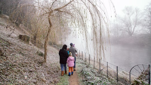
Whiteleaf and The Hampdens
This 7.5 mile walk takes you from beautiful Chiltern woodlands near Whiteleaf, then beside Grim’s Ditch to the grounds of the stunning Hampden House. It then explores the farmland and wooded hillsides around the Hampden valley, including the remote village of Little Hampden, before returning to Whiteleaf Hill and a wonderful viewpoint over the Aylesbury Vale.
We strongly recommend using the local 1:25 000 Ordnance Survey map in addition to these instructions.
Restrictive Covenants
Most of the area around Little Hampden is protected by a restricted covenant, a permanent legal agreement between the landowners and The National Trust, which protects the land in perpetuity. Any changes to the land or buildings here must be made with the prior agreement of the Trust. The fields below and to the west of Whiteleaf Hill are also protected by an NT covenant that preserves the view of Whiteleaf Cross from below.
Please always follow the Countryside Code.


Start:
Bucks County Council car park at Whiteleaf Hill (nearest post code HP27 0LH, Grid Ref SP823036).
1
Leave the car park at the far end on the footpath beside the information board. After 90m bear right to join the Ridgeway National Trail. After another 100m look for disturbed ground on your right. This is the remains of World War 1 practice trenches. At the end of these turn right off the Ridgeway on to a path that soon runs parallel to the edge of the open field on your right. Keep on this path close to the wood edge, in particular turning right at a fork after about 500m. Turn sharp right uphill when you come to a junction of paths at the corner of the field. After another 200m you reach a crossing track with fields ahead and a satellite dish in the hedge on your right.
2
Turn left onto a gently downhill track then path with a field on your right. Continue ahead when you enter Kingsfield Wood. This undulating path eventually joins a track from the right then goes round some gentle bends before coming to junction of paths with an isolated stile. Instead of continuing ahead on the track, veer left just past the stile to join a path that runs parallel with but just to the left of the track. About 20m on your left you can see Grim’s Ditch, also running parallel to the track. About 300m after you joined the path it bends right to rejoin the track.
Grim’s Ditch
The Grim’s Ditch bank-and-ditch earthwork can be found in various places across the chalk uplands of southern England. Its purpose and date are uncertain but it is commonly believed to date to the Iron Age, around 300 BC. It is too small to have a military purpose but is rather believed mark territory and/or the boundary between areas of common land grazing and crop cultivation. Here the higher bank is on the north and may have been hedged to help prevent livestock crossing. When it was built, this area would have been open countryside and not wooded.

3
Bear left along the track, which soon has a big open field to the right. As you continue you will see glimpses of Grim’s Ditch in the strip of trees to your left. After a bigger track joins from the left and then bends to the right turn left on the corner then go through a wooden gate into an avenue with the House visible ahead. Just to the left of the House is a magnificent cedar tree, thought to be the last of eight cedar trees planted about 400 years ago. Near the House you reach a gate.
Hampden House
This site was the home of the Hampden family from Saxon times. Parts of the present house date back to the 14th century and the core is a late 16th century hall. It was almost totally rebuilt in the 1750s in so-called Strawberry Hill Gothic style, including the battlements and pointed arch windows. More recently it was used as the setting for Hammer House of Horror films. The Hampden family finally sold the house in 1985. It is now owned by an insurance company and used as a venue for weddings.

4
Go ahead through the gate and pass the estate office buildings on your right. You soon see the Church of St Mary Magdalene on you right. Continue ahead on the drive to the House, which passes down a magnificent avenue of horse chestnut, lime and plane trees. At the end of the drive you come to a push-button operated gate.
Church of St Mary Magdalene
The oldest parts of the church date to the 13th century. It includes memorials to the Hampden family and a bas-relief memorial showing the Civil War battle of Chalgrove Field where John Hampden was mortally wounded. He is probably buried in or near the church but the exact location is unknown. John “the Patriot” Hampden was MP for Wendover and Buckinghamshire, and a parliamentary opponent of Charles 1. His refusal to pay the unpopular ship money tax on some of his land in 1637 helped trigger the Civil War. He was mortally wounded and died in 1643 after fighting for the Parliamentary army.

5
Go through the gate then immediately turn left over a stile to join a wide grassy path running diagonally across a field. As you head downhill and about 50m before crossing a low wire fence, stop and look right then left up to the House. You will see you are crossing a one mile long grassy avenue. Also known as the Queen’s Gap, this gap is said to have been cut through the woodland to improve the view or access for Queen Elizabeth 1 when she visited Hampden House in 1563. (You may have noticed that Grim’s Ditch disappeared as you approached the House. It has been written that it was filled in, also to ease the passage of the royal posterior.) Continue ahead downhill to reach a stile by a gate in the corner of the field. Go over this, cross the road slightly to the left downhill, then on join a signposted path that runs down the field margin with a hedge on your right. You reach a road.
6
Cross this road with care, listening for traffic as you are on a bit of a blind corner. Continue ahead on a path uphill with a hedge now on your left. The path enters Warren Wood and is occasionally marked by white arrows on the trees. You reach a junction with a footpath marker and an open field beyond.
7
Turn right onto a path that runs in the woodland following the field edge to the left, then in a hedge with fields either side. You reach the village of Little Hampden, passing a house on the left then coming to a crossing farm track. Continue ahead across the track until you reach a grassy triangle with a bench. Turn right here to join the road running downhill. After 250m you see Little Hampden Church on the right.
Little Hampden
This isolated village of cottages, houses and farms has been described as the most remote village in the Buckinghamshire Chilterns. Like Great Hampden on the opposite hill, it was first mentioned in the Domesday Book of 1086. Little Hampden Church dates from the 13th century and some of the interior wall paintings are of this time. It is noted for its 15th century timber-framed porch, with an upper storey containing the single bell. Manor Farm opposite the church dates back to the 15th century.

8
After looking at the church retrace your steps up the road and past the bench. After 300m you reach a parking area on the right. At the end of the houses opposite this area bend left into woods following the South Bucks Way marker. You come to a junction of paths with a fence and a no horse-riding sign behind.
9
Turn left, then fork left again after 20m at another footpath marker. This narrow path through woods soon brings you to open fields. Continue straight ahead with a hedge on your right. When you reach a gap in this hedge, cut through to the right to place the hedge on your left side. Continue down into a dip where the path bears left into woods, with the path marked by occasional yellow marker arrows on trees. Shortly after passing a very big chalk pit on your left, bear left and downhill at a fork in the path with a marker post. The path reaches fields and continues down with a hedge on the left. It then skirts around Dirtywood Farm before joining the drive to the Farm which takes you down to a road.
10
Cross the road and join the drive uphill to Solinger Farm. After 300m, when the drive take a sharp turn left, turn right through the hedge onto a signposted footpath that continues uphill with a hedge on the left. Keep ahead on the edges of several fields until the path enters a hedge and drops down to a junction of paths at the edge of Whiteleaf woods.
Hampden Valley
The Chilterns topography, including the Hampden valley, was largely formed during the last Ice Age by the action of meltwater on permafrost land. Unlike the Chilterns valleys on either side (West Wycombe/Princes Risborough and Great Missenden/Wendover) this valley’s northern end was not deeply eroded and is left hanging, marked by the steep descent of the road from Chequers down to Butlers Cross. As a result, railways and major/designated roads have bypassed the valley. The valley bottom and surrounding hillsides still have an air of rather being left behind by the modern world.

11
Go through the metal kissing gate opposite then turn sharply right onto a descending sunken path. As it bends around this path becomes very deeply indented, in places by some 7 – 8 metres below the surrounding land. It is thought that this is part of an ancient (possibly Anglo-Saxon) bridleway route between High Wycombe and Askett, and the indentation is the result of several centuries passage of livestock and people. The path levels out and becomes a track in a broader, wooded valley. Eventually you reach and go through a gate to reach The Plough at Cadsden pub.
The Plough at Cadsden
The Plough dates back to the 16th Century. It was a staging post for London coaches and was later used by bodgers working in the nearby woods. John Hampden’s body rested here in 1643 on its way from Thame to the funeral at St Mary Magdalene. Until recent years a cherry pie in the shape of his coffin was baked at the pub on 17 June to commemorate the event. Prime Minister David Cameron famously left his then eight year old daughter behind here in 2012, and also entertained Chinese President Xi Jinping here in 2015.

12
Turn left uphill on the path between the pub and its car park following The Ridgeway and Bridleway sign. After 50m you reach a fork. Bear right here following the Bridleway sign. This path rises and skirts the edge of woodland, with paddocks then Whiteleaf Golf Club to the right. Eventually you join a surfaced drive and pass behind the Clubhouse.
13
Where the surfaced drive turns sharply right downhill, instead turn left uphill to pass the entrance to Whiteleaf Reservoir, then keep left at a fork with a signpost marker. The path now rises steeply until you pass through a wooden gate. After 20m bear right on to the crest of Whiteleaf Hill. The top of Whiteleaf Cross can be seen below a low wooden fence. The mound of earth just above here is the remains of a Neolithic barrow. Pass to the left of this and go through a gate onto a track. After 300m, fork left off this track to return to the car park where you started.
Whiteleaf Hill
Whiteleaf Hill affords spectacular views over Princes Risborough and the Aylesbury Vale. On a clear day you can also see the edge of the North Wessex Downs near Swindon, some 35 miles away. The origins and date of Whiteleaf Cross are uncertain, although it was first mentioned in charters in 1742. It was covered with tree branches in the last war to prevent it being used as a navigation aid by enemy aircraft. The tumulus mound above the Cross is the remains of a rare, late Neolithic (c.3300 BC) oval barrow. It was much disturbed by excavations in the 1930s, which found a single burial.

End:
Bucks County Council car park at Whiteleaf Hill.