Watlington Hill and the Wormsley Estate – An Emblematic Chilterns Walk
This is a 8.4 miles (13.4 kilometres) walk taking you around the National Trust’s Watlington Hill site, Pyrton Hill, Cowleaze Wood and the Wormsley Estate, with opportunities to see rare and endangered chalk grassland and woodland habitats, fine views and the grounds of the former home of the philanthropist Sir Paul Getty. The walk offers spectacular views over Watlington and the Vale of Oxford, and along the Chiltern Escarpment.
We strongly recommend using the local 1:25 000 Ordnance Survey map in addition to these instructions.


Start:
Start at the National Trust car park at Watlington Hill. Grid. Ref. SU709935.
1
From the National Trust carpark take the path between the large signboards in the car park into an area of woodland. Cross a track to a private property and then continue straight ahead on the wide path through scrubland to a gate.
Watlington Hill
Watlington Hill is a part of the Chiltern Escarpment that is owned and managed by the National Trust. It consists of 45 hectares of land and reaches a peak altitude of 235 meters. Watlington Hill is a nationally important wildlife site home to a large assemblage of wild flowers, butterflies, birds, mosses, lichens and fungi - many of them rare or scarce. The short chalk grassland turf was originally created by centuries of sheep grazing, but it is now maintained by a population of rabbits and deer. Ant-hills, some of which are quite ancient, add additional interest, and areas of woodland and scrub complete the scene. One of the main aims of conservation management at the site has been to reduce the level of tree and scrub cover that grew rapidly when the rabbit population was decimated by myxomatosis in the 1950s. The purpose of this work is to maintain the delicate chalk habitat that is vital for the survival of rare species of fauna and invertebrates at the site. This work is largely carried out by National Trust volunteers; please contact us if you are interested.

2
Go through the gate to an area of open, closely cropped grassland. Continue on the grassy path ahead of you. You will soon see fine views on your right towards Pyrton Hill and Shirburn Hill further to the northeast along the Chiltern Escarpment. Continue straight ahead along the ridge of Watlington Hill. After 400 metres the path heads more steeply downhill and slightly to the right. Keeping to the right, head downhill towards the White Mark. There’s a bench here with lovely views towards Watlington and the Oxford plain.
The Watlington White Mark
In 1764, the local squire Edward Horne gave Watlington a most unusual talking point. He felt that the Norman parish church of St. Leonard, when viewed from his home, would be more impressive if it had a spire. To create the illusion, he designed the 270 foot steeple-shaped Watlington White Mark, which he had cut into the chalk escarpment of Watlington Hill, perfectly placed to complete his view. (Trees now obscure much of the view.) The White mark is one of around fifty hill figures in England.

3
From the White Mark, continue steeply downslope heading for a gate in the lower right-hand corner of the National Trust’s Watlington Hill site. From the gate head down a short track to meet a road. Ignore the footpath opposite to Watlington Chalk Pits. Instead follow the roadside path for about 30 metres and then cross the road and turn right into a track signposted as the Ridgeway long distance footpath, which at this point follows the route of the ancient Icknield Way.
The Icknield Way
The Icknield Way is an ancient trackway in southern England that goes from Norfolk to Wiltshire. It follows the chalk escarpment that includes the Berkshire Downs and Chiltern Hills. It is thought by some to be one of the oldest traceable routes in Britain, however, this has been disputed, and the evidence for its being a prehistoric route has been questioned. The earliest mentions of the Icknield Way are in Anglo-Saxon charters from the year 903 onwards. The charters refer to several locations that span a distance of 40 miles from Wiltshire to Buckinghamshire.

4
Continue along the Ridgeway between a set of concrete blocks, following the wide track for just over 750 metres until you reach another two sets of concrete blocks either side of a crossing lane. Here, turn right onto the lane (Station Road), which is part of the Oxfordshire Way. After 350m, you pass through some white wood fencing. After a further 100m look out for a concealed path on your left, marked as path PY16.

5
Follow this clearly marked path along the edge of Pyrton Wood and Shirburn Wood, through woodland and grassland. At a fork, keep left on path SH3 with open fields on your left and woodland on your right. After 1.3 km, you will reach a gate at the bottom of an area of Access Land at Shirburn Hill.

6
Follow the obvious footpath uphill across the chalk grassland at Shirburn Hill. On reaching the top of the Access Land, go through a gate and continue uphill to reach a stile. Cross the stile and continue diagonally across a field towards a second stile in the opposite corner of the field just left of a house. Cross the stile to reach Christmas Common Road. Cross the road with care and turn left on the road in front of a large water tower in a fenced off enclosure. At the end of the fenced enclosure, join a footpath on your right into Cowleaze Wood that runs parallel with the road. Follow this for about 200 metres until you reach the car park. Walk through the informal car park until you are opposite the road entrance. Here turn right into the woodland, away from the road.
Shirburn Hill Chalk Grassland
Shirburn Hill is a large area of chalk grassland on the Chiltern escarpment, which helps to gives the scarp its distinctive appearance. As well as chalk grassland, there are also areas of scrub, ranging from a scattering in the grassland to dense areas and also areas dominated by box and juniper. Wild candytuft, which is a nationally rare species, is present in the chalk grassland. Other chalk grassland wildflowers found here include rock rose, autumn gentian, the rare Chiltern gentian, common spotted orchid, clustered bellflower, marjoram, eyebright and wild thyme. Leaching of the soil has led to the presence of acid grassland and heather; this type of habitat is called chalk heath and such acidic habitat is very rare in the Chilterns. Butterfly species seen here include the marbled white and the small skipper. Please keep to the Open Access Land and public footpaths as the land is under private ownership.

7
Take the waymarked footpath that heads between wooden bollards away from the road, past a noticeboard about the 51 Squadron Memorial and follow signs towards the memorial. At a wide crossing avenue, head straight across and slightly to the left, following a waymarked footpath and a white arrow painted on a tree. The path soon curves to the left and heads gently downhill through an area of woodland. On reaching a gate you enter the Wormsley Estate. Continue straight ahead and downhill across a field to a second gate. Continue straight downhill towards a gate in a small gap in a hedge. Go through the gate to reach a lane.
Cowleaze Wood
Cowleaze Wood, which is managed by the Forestry Commission, incorporates a great mix of woodland habitats. The bluebells in late April and May are like a blue carpet and well worth a visit. Tragically, on 31 March 1944 a Handley Page Halifax Mk III bomber aircraft, LW579 of No 51 Squadron RAF, was returning from the Nuremburg raid when it crashed in the wood, killing all seven of its crew. The aircraft was based at RAF Snaith in Yorkshire and seems to have been at least 120 miles (190 km) off course. It was a clear, moonlit night, and it is not clear why the Halifax lost height and crashed into the hill. There is a monument in the wood to the crew of LW579. It is a stone plinth from Lincoln Cathedral with the names of the crew inscribed upon it. There is also an information board about the crash next to your path into Cowleaze Wood.

8
Turn left, following the lane for 60 metres towards Vicar’s Farm, looking out for a tall wooden gate on your right with a painted white maker to path L23; it is easy to walk past it. Turn right through the gate and follow the path that skirts around the grounds of Vicar’s Farm to another gate. Go through the gate and head half left uphill across a small field to a stile and a path that leads into woodland. Cross the stile and continue in more or less the same direction uphill through the woodland. The path eventually curves right to meet a crossing track. Turn right onto path L19. (Look out for the painted marker on a tree.) Follow this clear, wide path gently downhill until you reach a road at Wellground Farm. Ignore the footpath opposite and turn right onto the road, which takes you through the Wormsley Estate. Soon, through the trees on your right, you catch glimpses of Wormsley Park House, then the Opera Pavilion and then the cricket ground. Where the road turns sharp right, towards Wormsley Park House, bear slightly left ahead on a track.
The Wormsley Estate
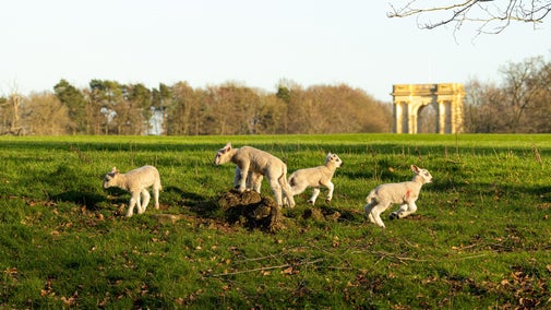
Originally owned by the Scrope family from the late 16th century, Wormsley Park is the former home of the philanthropist Sir Paul Getty who moved to Wormsley in 1986. It is now the home of Mark Getty and his family, and the site of the cricket field known as Sir Paul Getty's Ground. After he acquired the 18th-century house, Paul Getty spent much time on restoring the house and estate back to its former glory. Getty also had a library added to the house to accommodate his book collection, and a theatre where performances were held for invited guests. In the summer months, Garsington Opera's annual festival is held on the grounds of the park. Wormsley Park operates as an organic farm and you may encounter sheep or other livestock. The area is also known as the location of the first successful reintroduction of a population of red kites to the Chiltern Hills in 1989. The birds are now a common site in the surrounding area.

9
Continue along the track ahead, which follows the bottom of the valley. Where the path splits, keep right, following the narrow path along the valley bottom. Pass through a narrow area of woodland and then continue on the path, with a fence on your left and a hedge on your right, until you reach a crossing path, which is part of The Chiltern Way.

10
Turn right, through a wooden gate next to a metal field gate, onto the Chiltern Way. Follow the path across a field to another gate that leads to a lane. Cross the lane to a further gate and then continue half left across another field towards a gate in the corner. Go through the gate onto another lane. Turn right onto the lane then, after about 30 metres, turn left onto footpath SH4, which is also the Chiltern Way. (There is a way-marker, and a painted arrow, on a telegraph pole on your left as you enter the footpath.) Follow this footpath, with a flint and brick wall on your right. After 200 metres, bear right at a Y-junction, leaving the Chiltern Way and following path SH4 across a rough lawn and past an ornamental urn on a plinth. Continue on this path gently uphill ignoring crossing paths for 1.8 km, through the mature beech woodland of Shotridge Wood, until the gradient flattens out at a crossing track.

11
Here turn right on path SH4, and then, after 80m, left onto path PY3. The pockmarked ground to your left is the remains of old chalk pits. You emerge onto a wider track. Turn left towards a house and pass it to the right of a wattle (hurdle) fence. Follow the path round to the right to join a path from the left, putting you between a fence on your left and a hedge on your right. At the next junction, turn left and follow the path between some paddocks to reach a road by a junction.

12
(If you wish to visit the Fox and Hound Public Houses, cross the road and then turn left into Christmas Common Road. The pub is 100m on your right.) To continue the walk, turn right, following Christmas Common Road for 120m and then turn left into a lane signposted to Watlington. Follow Hill Lane for 420m, ignoring the first footpath sign on your left, until you reach a second footpath sign. Turn left and then immediately right to return to the National Trust carpark at Watlington Hill where you started the walk.
End:
End at the National Trust car park at Watlington Hill. Grid. Ref. SU709935.