The Journey of Discovery Trail
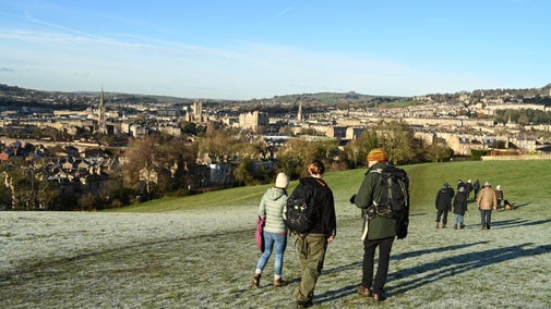
Enjoy a ramble through the past on this family-friendly trail through Dyrham's parkland. This is a landscape that's steeped in history and each way point of this walk reveals a different clue from days gone by. For younger walkers, there are carved wooden animals to spot along the way, before the walk finishes at Old Lodge.

Start:
Visitor reception, Dyrham Park
1
After walking through visitor reception, follow the main path a short distance to the tree stump carved with a compass. The compass is based on those pictured on William Blathwayt's maps. Follow the arrow pointing in the direction of 'Journey of Discovery' trail, turning left into the entrance of the first lime tree avenue.
2
Enter the lime tree avenue and follow its path. After walking about 350 metres, bear right alongside the fence. Ahead are views of the Severn valley and Welsh hills; behind you and to your right are the remnants of the ancient ridge and furrow landscape of Dyrham.
Ridge and furrow
In this part of the parkland, the noticeable rows of humps in the ground show that this area was once ploughed resulting in a ridge and furrow landscape. Although it is now part of the larger deer park, the area was once known as 'upper field' and it would have been cultivated from Anglo-Saxon times onward. The fields would have been ploughed with a wide plough pulled by oxen. Continual ploughing in the same direction gradually increased the height of the ridge and the depth of the furrow. As they are still visible today, we know that the ground hasn't been cultivated in recent history; modern ploughing is much deeper and eradicates all evidence of ridge and furrow.
3
Carry on walking downhill, keeping to the path alongside the fence for about 450 metres. Continue on as the fence changes to become a dry-stone wall. To your left is Dyrham’s environmentally friendly central heating plant.
Dry-stone walls
This wall, like most of the other boundary walls around the parkland, is a typical Cotswold dry stone wall. The stone used to create the walls would have been quarried from the local area. In fact, there is even evidence of a small quarry at the bottom of the hill, to the right of this path. With the stone readily available, and labour cheap, dry stone walling was commonly used throughout the Cotswolds from as early as 2000 BC through to the present day. The wall to your left was built, possibly in the 17th century, to contain livestock in the park. Dry stone walls support a vast array of wildlife, lichens and mosses.
4
At the bottom of the hill, follow the curve of the path around to the right for another 450 metres, walk through Hollow Ways to the cattle grid on the driveway in front of the house.
Hollow ways
Hollow ways are sites of ancient tracks that have been worn away by centuries of use. Also known as sunken lanes, they map a route that is incised below the general level of the surrounding land, often by several metres and are formed by the passage of people, vehicles and animals. These substantial earthworks around you represent the old course of Sands Hill; a road that now runs around the outside of the park. This route would have once led to the old manor house and village, perhaps forming one of several parallel courses of the road. A map created in 1689, shows that these hollow ways fell within the park before 1689.

5
At this point, you can either go through the gate by the cattle grid to visit the house and West Garden, or to have some well-earned refreshments from the kiosk or tea-room (when open). If you'd like to continue you on, cross the driveway and pick up the grassy path leading to the valley to your right.
A lost water garden
The Johannes Kip engraving of Dyrham Park (1710) at its peak, has East at the top, and shows water cascading down the hill from the Statue of Neptune, alongside elaborate gardens in front of the East front of the house and Greenhouse. These gardens were difficult to maintain, and reverted to parkland in the later 1700s. Today, the water from the many springs across the park is channeled into an underground culvert, flowing beneath the Greenhouse and house to feed the lakes in the West Garden.

6
With the house behind you and the driveway on your right, head diagonally across the grass, walking between the hill on your left and Neptune Hill to your right.
Routes to Dyrham Park
Roads in the local area were still little more than tracks when William Blathwayt built the house around 1700; access for visitors would have been from Sands Lane and then through the west entrance. The main road from London to Bath was improved in the early 1700s when Queen Anne popularised the benefits of the spa town. Turnpikes were introduced in the area in the mid 1700s, ensuring that roads such as the Bath - Stroud road (now the A46) were passable in most weather conditions. In the Victorian era visitors arrived at the east front of the house via the new driveway that was built around 1800.

7
Follow the path as it curves round between the two hills, and head towards the stone buildings that come into view. Note that the final part of this track still shows traces of its medieval origins.
8
At the top of the hill turn left towards Old Lodge.
Pond wood
To the right, at the top of the slope, there is a small area known as Pond Wood. As it is an important site for nature conservation, Pond Wood is not accessible to the public. However, within this area are the remains of stone features, a well and the reservoir for the lost water gardens of the 17th century. .
9
Well done, you've reached your destination. You should now see Old Lodge on your left. Stop here for a picnic, or carry on exploring the parkland.
Old Lodge
Once the site a park lodge in the medieval period, today Old Lodge is a small collection of Victorian farm buildings. Whilst historically these buildings would have once housed farm animals in the winter, today Old Lodge is an enclosed picnic area with some play equipment. However, some remnants of farming life in the past still remain, including a wagon, tractors and farm machinery.
End:
Old Lodge, Dyrham Park