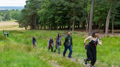
Views of the Hughenden Manor estate
This is a 5.6 mile walk which gives you ten different views of Hughenden Manor and the surrounding Chilterns countryside.
How to follow the walk
This walk is not waymarked however, you can follow it on a hand-held device or print out a copy to use as you walk.


Start:
National Trust carpark at St Michael and All Angels Church
1
Start from the National Trust information board by the car park at St. Michael and All Angels Church [or see alternative start from main Hughenden Manor Car Park, Step 13]. Keeping the church on your right, take the path up through the Church yard and out through a gate, then straight on up the hill. Just before you reach another gate, turn left, following the boundary of the park, passing several wooden benches, until you reach brick wall (a ha-ha) on your right, above which you will see the east side of Hughenden Manor through a broad gap in the trees. When you reach the ha-ha, turn around for your first view.
Hughenden Park View
Hughenden Park is largely pasture, which is grazed by cattle in the summer months. The grassland is broken by with clumps and single trees of various mature exotic and native species. In the far left (northeast) corner of the park is the largest known horse chestnut tree in the country. The 300 year old tree has a girth measurement of 7.33 metres (just over 24 feet). You may be able to spot a small chalk stream winding through the park at the bottom of the valley; it is dammed in several places to make it wider. The spring-fed stream is not permanent and completely dries up at times. The parkland was created in the early 19th century but Disraeli added the southern half of the park (to the right of the fence) in the 1870s.

2
From the ha-ha, continue in the same direction to a metal kissing-gate. Go through the gate. Keeping Hughenden Manor’s woodland garden on your right, walk past an ornamental green gate on your right and continue uphill towards a fenced-off area around some of Hughenden Manor’s beehives. On your right you will soon see the South Façade and the Parterre Garden of Hughenden Manor across a low wrought-iron fence.
South Façade and Parterre Garden
Hughenden Manor is a Grade I listed building. Benjamin Disraeli purchased the original stuccoed Georgian house and once he had the resources, he had the building completely remodelled in 1860-63 by Edward Buckton Lamb. The remodelling was undertaken with a view to updating it in a Gothic Revival style. The result was criticised at the time for being “sharp, angular and aggressive”. However, the gardens that Mary Anne Disraeli created help to soften its appearance. Mary Anne left diaries about her management of Hughenden, including the parterre garden. Her design shows an Italian influence, incorporating a pergola stretching the length of the house, enriched with classical statuary and urns from Florence and Venice. The National Trust has restored the gardens to reflect the taste and vision of its former owners, though sadly the iron pergola was lost to salvage during the war.

3
Bear left then head gently downhill away from Hughenden Manor on a wide grassy path along the top of the slope, parallel to a line of trees on your right. To your left you will see further views across Hughenden Park. After 150 metres you will pass some gravestones on your right. These were erected by Coningsby, Disraeli's nephew, for his pet dogs. Head towards a wide metal gate at the right-hand corner of the park. Go through (or around) the wide gate, then follow the wide track on the other side of the wide gate as it curves right, away from Middle Lodge. Continue downhill until you meet a gate leading onto Coates Lane.
4
Go through the metal gate on to Coates Lane. Take care here as this road can be busy. Turn left then almost immediately right through the kissing gate. Follow the public footpath through fields beside a fence. Go through another kissing gate into Little Tinker’s Wood and take the path immediately on the left. Climb up the hill until reaching a metal gate to the left through which you should see the Monument. Go through the gate towards the Monument.
Views from the D’Israeli Monument
The Monument, designed by E B Lamb 1862, is an elaborate, 15 ft high Bath stone pillar erected by Mary Anne Disraeli in memory of her father-in-law, the literary critic and historian Isaac D'Israeli. The Monument is an outlying feature designed to draw the eye from various parts of the garden and park across the valley to the west to the wider landscape to the west and south-west. Equally, the views from the monument towards Hughenden Manor and Manor Farm are amongst the finest on the Estate. It is not unusual to see red kites and buzzards soaring above this peaceful vantage point.

5
When you are ready to continue, return to the kissing gate then take the path ahead, left of the path on which you arrived. Continue along this fairly straight, level path through Little Tinkers wood. Ignore a downhill path on the right. Continue until the path narrows and eventually emerges into a small cul-de-sac. The path continues straight ahead for a few more metres to reach Littleworth Road. (This short section of path can become overgrown in the summer, so you may wish to turn left to reach Littleworth Road via the cul-de-sac.)
6
Turn right along Littleworth Road, following the roadside path for 250 metres until it meets Coates Lane. Cross Coates Lane. Take care here as this road can be busy. Enter a narrow footpath following the public footpath sign between hedges, walls and fences until you reach a National Trust sign in Common Wood announcing the Hughenden Estate; the path widens here. Follow the path downhill to a junction of paths at the bottom of Echo Valley where there is a view of the west wing of Hughenden Manor above the distant trees.

7
Turn left away from Echo Valley, heading gently uphill along the bottom of the wooded valley until you reach another junction of paths. Go straight ahead for 10m past the sign post and then bear right taking the uphill path towards Downley Common to the left of a ditch. Part way up the slope, take the left fork (where the right fork bends sharply right to follow the edge of the ditch). On leaving the wood, continue straight ahead following the footpath way-markers through a clearing and some scrubland. Take the left fork at a footpath marker where you see some wooden posts with a house behind until you reach the cricket pitch on Downley Common. Head across the outfield towards a set of benches on the other side of the pitch. (If the grass on the edge of the common is overgrown, or if a cricket match is in progress, you can circumnavigate the cricket pitch in an anticlockwise direction via a track and a lane.)
Downley Common
In Anglo-Saxon times Downley meant a clearing on the hill (down meaning ‘hill’ and ley ‘clearing’). It is now one of the few Chiltern commons that has not become completely wooded. The common was once part of an Anglo-Saxon ‘tithing’: a group of ten dwellings. For many centuries, clay chalk and flint have been extracted from many places on the common. This has left behind pits, called dells, some very large and deep. The clay was probably extracted to make bricks and tiles. During The Second World War, the Army used the common to test and repair Churchill tanks, which were assembled at Broom and Wade’s factory in Bellfield Road, High Wycombe. At the top of the common, next to the cricket pavilion, there is a small blacksmiths forge that was in use up until the early 1990s.

8
At the benches turn left on the road for about 40 metres then turn right onto a footpath just before the wooden Downley Sports Pavilion. Go through a metal kissing gate by the driveway to Blacksmiths Cottage. Keeping right, cross the paddock to another gate leading into the West Wycombe Estate. Follow a broad field-side path with a hedge on your right. About 50 metres after a wide gap in the hedge on your right, you will see a fine view across the valley to West Wycombe Church and the Dashwood Mausoleum.
West Wycombe View
The spectacular 18th century design of St Lawrence's Church, West Wycombe was completed by the mid 1760’s. The tower was raised to make it more visible from afar, and it was crowned with the wooden golden ball that was reputed to be a meeting place for the Hellfire Club. The golden ball could seat 10, and was described by the author John Wilkes as “the best globe tavern I was ever in”. The interior of the Church is equally magnificent. To the left of the church is the Dashwood Mausoleum. The Mausoleum is an unroofed hexagonal structure, formed by a series of linked triumphal arches, which was built from local flint in 1765 by John Bastard the Younger of Blandford. The Mausoleum contains urns and plaques dedicated to members of the Dashwood family and their associates.

9
Continue along the same path, which enters an area of woodland in the corner of the field. Continue downhill through the woodland until you reach a crossing path in the valley. Here turn right, heading uphill through woodland until you reach a kissing-gate. Follow the path across a field to another gate. After the gate, turn right and follow the path for 100 metres till you reach a pond on your left. Turn left just before the pond, and follow the path for a further 100 metres you will reach a small parking area at the end of Hunts Hill Lane. Head down Hunts Hill Lane for just under 300 metres until, near the bottom of a steep hill, you reach a sign-posted footpath on your right into Oaks Wood. Follow this path parallel with the boundary of the wood until you reach a crossing path. Here turn left, following the path about 40 metres to a metal kissing gate. Go through the gate to a view over a grass meadow in a dry valley, with a circular copse in front of you.
Jimmy Harding’s Dale
The view is of a typical Chiltern dry valley that was carved from the chalk during the Ice Age. The valley would have formed during the glacials (long cold periods) of the Ice Age, from about half a million years ago. During these times the ground would have been frozen like modern-day Arctic permafrost: the pores within the chalk, which normally allow water to drain down through the rock, were blocked with ice, so the water from spring snowmelt and summer rain would have run over the surface carving the valley. 14,000 years ago there would have been no grass or trees, just foaming grey-brown water thundering along the valley floor in the summer months. Tundra scrub and lichens would have covered the hills, with herds of mammoths and woolly rhinos grazing on the slopes.

10
From the gate bear right towards another gate leading into woodland. Enter Flagmore Wood and follow the path, which merges with another path from the left, until it reaches a dip. Here turn left following a clear path directly downhill. The path curves to the right towards the bottom of the slope. On reaching a T-junction, turn right along the bottom of the valley. At a crossing path, just before you reach another gate into a field, turn left up a short climb. At the T-junction at top of the slope turn right, following the signpost to Hughenden Manor & Tea Room. Follow this path along the edge of Echo Valley.
Echo Valley View
There are several benches along the footpath at Echo Valley, each of which offers views towards the outskirts of High Wycombe and back at some of the route you have followed. You should be able to see the D’Israeli Monument, Little Tinkers Wood and Common Wood as well as Manor Farm. Alongside the path you will find a bank that is carefully managed to allow an abundance of wildflowers to flourish. These vary throughout the year and include wild strawberries, milkwort, dog violets, marjoram, buttercups and large clumps of primroses: Disraeli's favourite flower. The flowers attract many species of butterfly and bee.

11
Continue along the edge of Echo Valley and then straight ahead through woodland until you reach a short, steep slope. At the top continue ahead between two brick and flint walls taking you to the Stableyard on your left and Hughenden Manor on the right.
Hughenden Manor north façade
Hughenden Manor is best known as the former home of the great Victorian statesman and author Benjamin Disraeli, but it also has a secret wartime history as ‘Operation Hillside’, in which the Manor played a key role in the RAF bombing offensive. Around 100 personnel were based here, drawing up the maps used for bombing missions during the war including the Dam Busters raids, and a planned hit on Hitler’s secret bunker at Berchtesgaden. Skilled cartographers produced leading-edge maps of Germany and other parts of Europe from aerial photography. If you would like to find out more, entry to the house is free to National Trust members. Non-members can buy tickets at the ticket office.

12
When you are ready to continue, cross the Stableyard and take the road that curves uphill, passing the buildings on your right and, later, the apple orchard picnic area on your left. On reaching the visitor welcome kiosk, bear left following the woodland path up towards the main Hughenden Manor Car Park at the top of the hill. At the T-junction of paths by the Dew Pond, just below the National Trust car park, turn right.
13
[If starting from the main Hughenden Manor Car Park, follow the track a few metres down from the information board, then turn left by the Dew Pond.]
Keep the pond on your left, and follow the path until you reach a road. Cross the road and head left for 20 metres. Opposite the entrance to the main Hughenden Manor Car Park, turn right onto a path indicated by a set of coloured National Trust way-markers, with a small plantation of young trees on your left. Continue downhill into Woodcock Wood, then straight ahead. At the next set of way-markers, turn left in the direction indicated by the arrows. Follow the woodland path past the next set of coloured arrows, but when it descends to a crossing path in a district dip don’t follow the arrows any further. Instead, turn right, following the path downhill to a gate. Go through the gate to see a fine view over Hughenden Valley and Church Farm.
Church Farm and Hughenden Valley View
The late eighteenth century buildings at Church Farm including most of the barns and outbuildings, have been converted into modern houses, although they still retain their flint with brick walls, tile roofs, and brick chimneys. The fine view of part of the Hughenden Valley typifies the landscape of the Chiltern Hills, with woodland on the hilltops and smooth, rounded valley slopes divided by hedgerows into fields used for arable and pastoral farming. This is an excellent location to enjoy the view with sheep or cattle grazing the fields below.

14
From the viewpoint, head directly downhill towards Church Farm, turning right when you reach a fence at the bottom of the incline. Follow the path through a gate into an adjacent field. Keeping the field boundary on your left, head for another metal gate, which takes you back to the National Trust car park at St Michael and All Angels Church.
St Michael and All Angels Church
At first glance the church appears to be a Victorian Gothic building, but the church dates to the 12th century. The church was restored and extended between 1874 and 1875 by Sir Arthur Blomfield. The oldest part of the church is the chancel, which was formed from the original mediaeval body of the church. Immediately behind the pulpit, on the north wall of the chancel, is the monument erected by Queen Victoria to Disraeli; the only known example of a memorial by a reigning English monarch to a subject. Benjamin and Mary Anne Disraeli’s grave can be found at the east wall of the church. Royal protocol did not permit the monarch to attend the private funeral, but Victoria visited the tomb a few days later to pay her respects.

End:
National Trust carpark at St Michael and All Angels Church