Wagonway walk at Seaton Delaval Hall
North East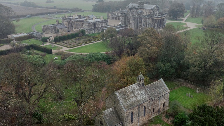
This gentle trail starts from Seaton Delaval Hall and takes in much of the wider estate, incorporating local points of interest and historical facts about the Delaval family. Part of the route follows a centuries-old wagonway that was used to carry the coal from the local mines to Seaton Sluice, where it would be loaded onto waiting ships for export. Stop by the old harbour to get an idea of this industrial history, and look out for other landmarks, including the remains of Starlight Castle (a folly built on a wager) and the Mausoleum.
Near to
Seaton Delaval HallStart point
Seaton Delaval Hall main gates, grid ref: NZ321766Trail information
More near here
Holywell Dene and Old Hartley walk
An easy self-guided walk taking in the points of interest around Holywell Dene and Old Hartley, including the history of the local area and Seaton Delaval Hall.

Holywell and Sluice walk at Seaton Delaval Hall
Explore Seaton Delaval Hall's estate on a circular walk in Northumberland, and discover a Norman church, a ruined castle, a nature reserve and Sluice Harbour.

Get in touch
The Avenue, Seaton Sluice, Northumberland, NE26 4QR
Our partners

We’ve partnered with Cotswold Outdoor to help everyone make the most of their time outdoors in the places we care for.
You might also be interested in
Walking
Explore some of the finest landscapes in our care on coastal paths, accessible trails, woodland walks and everything in between. Find the best places to walk near you.

Explore the garden at Seaton Delaval Hall
Find out what you’ll discover this season in the varied garden at Seaton Delaval Hall, one of Northumberland's top gardens. From a Parterre to a centuries-old weeping ash and woodland waiting to be explored.
Eating at Seaton Delaval Hall
During your visit to Seaton Delaval Hall, stop by the Brewhouse Café. Housed in a 17th-century building, it offers a wide range of drinks and snacks, as well as indoor and outdoor seating.

The history of Seaton Delaval Hall
Learn the story of this baroque Northumberland manor house and the individuals who shaped it, including architect Sir John Vanbrugh and the notorious 18th-century Delaval family.

Walking in the North East
Explore some of the best walking routes in North East England with the National Trust. From scenic coastal walks and historic countryside trails to family-friendly and dog-friendly paths, discover unforgettable walks across Northumberland, Tyne & Wear, and County Durham.
Staying safe at National Trust places
The special places in National Trust care sometimes come with a few risks for visitors, be it coastline or countryside. Find out how to keep safe throughout your visits.

Follow the Countryside Code
Help to look after National Trust places by observing a few simple guidelines during your visit and following the Countryside Code.

Cotswold Outdoor: our exclusive walking partner
Learn about the National Trust’s ongoing partnership with Cotswold Outdoor. Find out how they help us care for precious places and the exclusive discount available for National Trust supporters.

