Skip to content
Orlock Coastal Walk, County Down
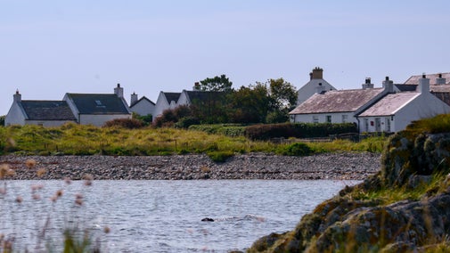
Stunning coastal walk at Orlock Point, Strangford Lough | © National Trust Images/David Armstrong
Northern Ireland

Orlock Point Walk

With evidence of Vikings and smugglers, a walk at Orlock on the North Down Coast is steeped in archaeology and history. The rocky outcrops of Orlock Point contain a mosaic of semi-natural habitats, which support a rich diversity of plants and animals. The walk affords stunning views of the Copeland Islands and out across the Irish Sea towards Scotland.

Total steps: 5

Total steps: 5

Start point

Orlock Point car park, BT19 6YU

Step 1

From the car park, the walk begins through the stile bearing the National Trust emblem. Walk along the path until you encounter a stony sheltered bay, crossing over the small stream (the Portavo River) with the standing stone to your left.

Step 2

A flight of steps leads up onto the headland and a large expanse of open farmland. While catching your breath, enjoy the views of the Copelands with the Galloway coast, Mull of Kintyre and Ailsa Craig providing a hazy backdrop.

Step 3

Continue on this path, along the top of the slope, through a stone stile. After another 200 yards, the path divides in two. The lower route will take you down towards the sea and onto the 19th-century Orlock Coach Road for a short section. If you want flatter terrain, remain on the top path until they merge again a little further along. The path will then lead you down some more steps before passing under an archway, which was hewn out of the rock by hand as part of the Coach Road. Chisel marks are still evident in places.

Step 4

The path leads past some open shingle bays and sheltered coves. The Second World War lookout hut makes a good vantage point for watching passing seabirds and boat traffic.

Step 5

The walk ends at Sandeel Bay. At this point you can retrace your steps or continue up Sandeel Lane to the main road and back to the start point (this is the route shown on the map).

End point

Orlock Point car park, BT19 6YU

Trail map

Map of Orlock walking trail
Orlock Point Walk Map, County Down | © National Trust Images/David Armstrong

You made it

Share your experience

More near here

House on the Kearney coast, Strangford Lough, Northern Ireland
Trail
Trail

Kearney coastal walk at Strangford Lough 

On this short coastal walk from Kearney, look out for quaint, whitewashed cottages and an abundance of wildlife.
Activities
Walking
DistanceMiles: 2.7 (km: 4.32)
View of waves crashing against the Giant's Causeway in County Antrim, Northern Ireland.
Trail
Trail

Giant's Causeway Red Trail 

With many unique viewing points along the way, this bracing clifftop trail boasts spectacular vistas of the world-famous Causeway Coast that are off the beaten track.

Activities
Walking
DistanceMiles: 0.8 (km: 1.28) to miles: 2 (km: 3.2)
Lake Walk in winter at Mount Stewart, County Down
Trail
Trail

Mount Stewart winter walk 

Treat yourself to a gentle winter stroll around the world-class gardens and lake at Mount Stewart, with a wide variety of flora and fauna and unique views of the house to enjoy.

Activities
Walking
DistanceMiles: 2.0 (km: 3.2)

Get in touch

Our partners

Cotswold Outdoor

We’ve partnered with Cotswold Outdoor to help everyone make the most of their time outdoors in the places we care for.

Visit website 

You might also be interested in

Worn steps winding up the side of a hill overlooking the coast at Orlock Point, County Down.
Article
Article

Things to do at Strangford Lough and beyond 

Explore the largest sea lough in the British Isles, home to a variety of rare wildlife. Head out for walk, discover the local towns and villages and soak up dramatic views.

Bluebells at Castle Ward

Walking in Northern Ireland 

Embrace the vibrant spirit of spring by stepping into the legendary landscapes of Northern Ireland. From the heights of Slieve Donard to the tranquil Lake Trail at Mount Stewart, our curated walking trails cater to all abilities, inviting you to immerse yourself in nature's blossoming beauty. Strap on your hiking boots and explore iconic sites like the Giant's Causeway, where coastal paths invite the adventurous, and ancient bogs tell tales of history on winding boardwalks. Let our trails guide you on an exploration of nature's renewal, beauty, and historical richness this season.

An aerial view of an adult and baby walking a dog along a path at Baggy Point, Devon
Article
Article

Staying safe at National Trust places 

The special places in National Trust care sometimes come with a few risks for visitors, be it coastline or countryside. Find out how to keep safe throughout your visits.

A visitor carrying a backpack and walking along a footpath at Divis and the Black Mountain with stone walls either side, the countryside visible in the background.
Article
Article

Follow the Countryside Code 

Help to look after National Trust places by observing a few simple guidelines during your visit and following the Countryside Code.

Walkers climbing rocks against a bright blue sky with the mountains in the distance at Sugarloaf, Monmouthshire

Walking 

Explore some of the finest landscapes in our care on coastal paths, accessible trails, woodland walks and everything in between. Find the best places to walk near you.

A group of people in a hiking group are being guided on a hike by rangers at Marsden Moor, West Yorkshire
Article
Article

Cotswold Outdoor: our exclusive walking partner 

Find out more about the National Trust’s ongoing partnership with Cotswold Outdoor as our exclusive walking partner.