Skip to content
Cornwall

Gunwalloe Cliff Castle walk

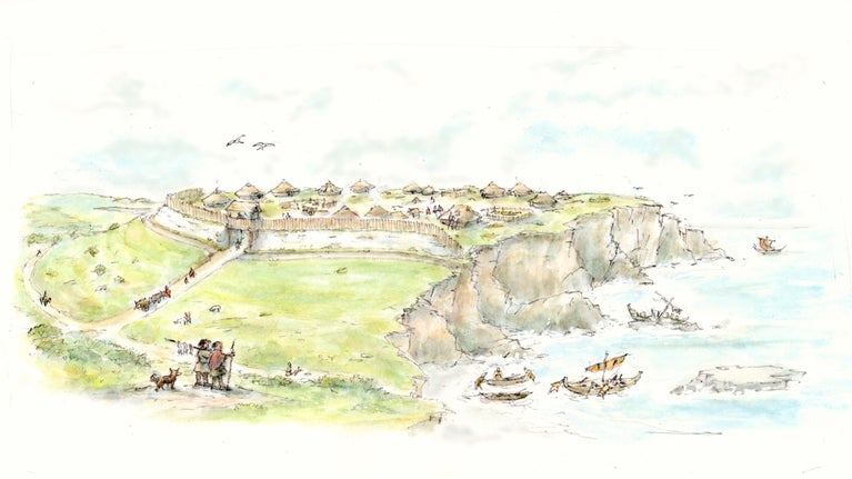
Illustration of a representation of what Gunwalloe Cliff Castle would have looked like. a collection of huts on a prominent cliff, surrounded by a wooden wall.
Illustration by Cornwall National Landscape Monumental Improvements Project for Gunwalloe Cliff Castle | © Cornwall National Landscape Monumental Improvements Project

Discover the history behind Gunwalloe. This 2 mile (3.2 km) walk themed around the archaeology of the area, will help illuminate the past; passing the site of Bronze Age settlements, an Iron Age fort, round barrows dating from 1110BC and a church built in the 13th-century.

Start point

Gunwalloe National Trust Car Park, TR12 7QE.

Trail information

Difficulty*

Full trail

DistanceMiles: 2 (km: 3.2)
Duration1 hour
Dog friendly**
  1. *Steep climb, uneven paths, may be muddy

  2. **Church Cove council enforced seasonal ban 10am - 6pm, 1 July - 31 August. Dollar Cove dog friendly all year. Keep dogs under close control. Be aware of cliff edges when on the coast path. 

Cliff edges and metal detecting

Stay away from the edge of cliff tops. Metal detecting is not permitted.

  • Total stages: 7

    Total stages: 7

    Start point

    Gunwalloe National Trust Car Park, TR12 7QE.

    Stage 1

    Leave the car park and turn left down the road past Winnianton Farm

    Stage 2

    At this point you may want to explore Jangy e-ryn (Dollar Cove), if not, move on to stage 3.

    Cove of turquoise blue water from a grassy cliff edge with a clump of pink sea thrift
    View overlooking Dollar Cove | © National Trust Images

    Stage 3

    On the left side, by the entrance to Dollar Cove, a path winds up onto Castle Mound. Follow this path to the top, on your left you will spot a way marker post with a QR code to find out more about the Cornwall National Landscape Monumental Improvements Project at Gunwalloe.

    A narrow earth path leading up a grassy slope, with a wooden post on the left, displaying a small rectangular way marker and information sign
    Path up to Castle Mound, Gunwalloe. Showing the Cornwall National Landscape Monumental Improvements project sign. | © National Trust Images

    Stage 4

    You can return down the mound the way you came (recommended) or follow a path around the mound and descend a steep slope and some steep uneven steps behind the church.

    Looking down from a height on a grey stone church in front of a sandy beach surrounded by cliffs
    Gunwalloe Church and Church Cove seen from Castle Mound | © National Trust Images

    Stage 5

    As you enter Church Cove, follow the path to the left and over the bridge.

    Stage 6

    Follow the path to climb the coast path to Carrag-a-pilaz, pass through the car park and follow the path down to Poldhu Cove.

    Stage 7

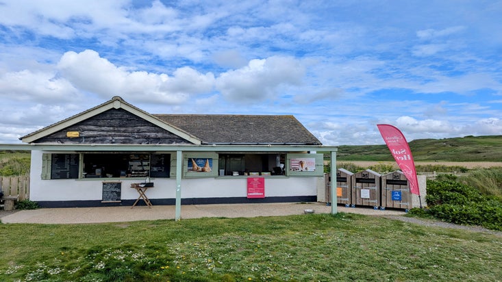
    Once you have explored Poldhu Cove, return to Gunwalloe by the same route. You can skip Castle Mound and walk directly from Church Cove to the car park (via Gunwalloe Kiosk – seasonally open).

    End point

    Gunwalloe National Trust Car Park, TR12 7QE.

    Trail map

    Numbered map of Gunwalloe Cliff Castle walk on an OS map
    Numbered map of Gunwalloe Cliff Castle walk | © © Crown copyright and database rights 2013 ordinance survey

    You made it

    Share your experience

More near here

Bar Lodge, Cornwall
Trail
Trail

Gunwalloe kiosk to The Stables cafe 

This long leisurely out & back walk follows the wild coastline from Gunwalloe to the heaped shingle beach at Loe Bar and through the woodland at Penrose to The Stables cafe, and back again.

Activities
Walking
DistanceMiles: 8.5 (km: 13.6)

Get in touch

Gunwalloe, near Helston, Cornwall, TR12 7QE

A small building with a veranda and two shuttered windows open, with signs and a table in front.
Article
Article

Eating at Gunwalloe 

Gunwalloe Kiosk is open from 1 April. Find out where you can grab a hot drink and tasty treat while exploring at Gunwalloe.