Skip to content
Shropshire & Staffordshire

Lime Kiln Walk

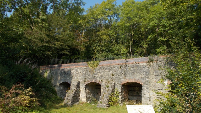
Lime Kiln viewed from walk.
Lime Kiln | © Bank of four restored limekilns, evidence of Wenlock Edge’s industrial past.

Enjoy this woodland walk passing quarries and limekilns.

Start point

Presthope Car Park, TF13 6DQ

Trail information

Difficulty

Accessibility*

Full trail

DistanceMiles: 0.6 (km: 0.96)
Duration 25 mins to 30 mins
Dog friendly
  1. *This walk contains steps.

  • Total stages: 4

    Total stages: 4

    Start point

    Presthope Car Park, TF13 6DQ

    Stage 1

    Follow the orange waymarkers along the Lime kiln walk. Starting at the rear right-hand corner of the car park, take the surfaced path past the viewpoint overlooking Ape Dale. Continue straight on through the woods, along the crest up and down a short flight of steps. Keep following the path through the woods.

    Stage 2

    When you come to a junction turn right and follow the path as it winds through the woods.

    Stage 3

    Within 100m you come to another junction where the path to the left leads to a bank of four restored limekilns, evidence of Wenlock Edge’s industrial past.

    Stage 4

    Retrace your steps back to the main path and take the left path, passing the bird hide and into Knowle Quarry: the exposed limestone rock face is composed of 425-million-year-old fossilised sea creatures. Climb the steps out of the quarry and follow the woodland path back to the car park.

    End point

    Presthope Car Park, TF13 6DQ

    Trail map

    Map of Presthope
    Presthope Walk Map | © National Trust

    You made it

    Share your experience

Get in touch

Longville, Much Wenlock, Shropshire, TF13 6EG