Skip to content
Project

Restoring Chyngton Brooks

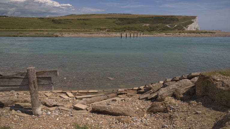
Salt marsh is already starting to form along the banks of the river Cuckmere
Saltmarsh is already established along the river banks | © National Trust Images/ Laurence Perry

This project aims to restore 42 hectares (100 acres) of National Trust land at Chyngton Brooks to saltmarsh and mudflat, habitats that are now in decline across the UK. The work forms a key part of the ambition for nature recovery, reinforcing our commitment to protecting nature, beauty and history – for everyone, for ever.

About the project area 

Chyngton Brooks was historically made up of intertidal habitat. In 1846 the Cuckmere River was straightened and embanked to aid navigation up to Milton Lock and beyond. A network of channels was excavated to drain the land, making it suitable for agricultural use but leading to the loss of the coastal habitat.

Our coastlines have been shaped by the action of waves, tides and weather for centuries; however climate change is accelerating these forces and the pace of change is increasing. We must now manage this area in a different way, moving away from maintaining expensive, man-made barriers and taking a more natural approach to caring for our coast. 

Project aims for Chyngton Brooks

The project has three main aims, each complementing and supporting the others.

Restoring nature
This project will restore 42 hectares (100 acres) of land at Chyngton Brooks to its historic state of saltmarsh and mudflat. These habitats are crucial for a variety of wildlife, providing key breeding and feeding grounds for a range of birds, many of which are migratory, as well as nursery sites for various fish and marine invertebrate species.
Nature based solutions
The work at Chyngton Brooks is an example of a nature-based solution. This term is used when we carry out work focused on conserving, restoring, and sustainably managing a variety of habitats. These kinds of solutions play a crucial role in sustainable development as they involve enhancing biodiversity and restoring degraded land and soil whilst delivering additional benefits to the wider population.    The very first managed realignment in the UK took place on National Trust land in 1991 at Northey Island, Essex. Since then, over 3,700ha (9,143 acres) of intertidal habitat have been created across the UK with this method. 
Adapting access in a changing landscape 
We understand that this landscape is deeply valued by many people, both locally and beyond. Within the project site is the embankment footpath, which is a popular route offering access to the beauty and wildlife of Cuckmere Haven.   As sea levels rise and storm surges become more frequent, the existing path is increasingly prone to erosion. This mean that it is difficult and more costly to maintain the footpath in a safe condition.  As part of the project, we are planning to adapt access in a way that works with the changing environment while still allowing people to enjoy the area. This will involve the following;  The existing embankment footpath will be closed.  The Vanguard Way / King Charles III England Coast Path will remain. A new inland path on higher ground will provide an alternative walking route offering views across the restored estuary.
Changes to public rights of way at Chyngton Brooks
Changes to public rights of way at Chyngton Brooks | © National Trust/ Dan Fagan

Public rights of way map

This map outlines the changes to public rights of way. Click on the image to zoom.

What will happen?

The proposal seeks to return the western floodpain of Chyngton Brooks to a naturally functioning estuary habitat. Lowering, or removing, sections of the bank along the Cuckmere River in several locations will allow the tide to flow in and out once more and gradually recreating a mosaic of saltmarsh and mudflat. This is a process called managed realignment. These restored wetlands will capture carbon, support wildlife, and help the coastline adapt to a changing climate.

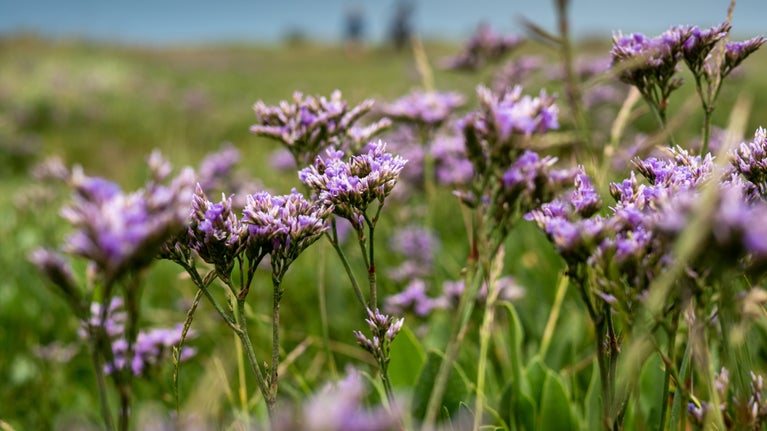
Sea lavender on a saltmarsh coast
Sea lavender growing on a coastal salt marsh | © Rob Coleman

A considered plan 

In partnership with the Environment Agency the National Trust have progressed the project through several stages: gathering information, exploring ideas, shaping a shared vision, developing concepts and finally creating detailed plans. Based on expert advice from industry-leading engineering consultancy, Haskoning, we have carefully considered the project design and how best it should be implemented. This includes the number, location, and size of breaches to the flood embankmemt.  

Each stage of project design has: 

  • Been informed by evidence-based outputs from studies and surveys; 
  • Incorporated recommendations from relevant management plans and environmental assessments; 
  • Addressed issues arising from consultation with stakeholders. 
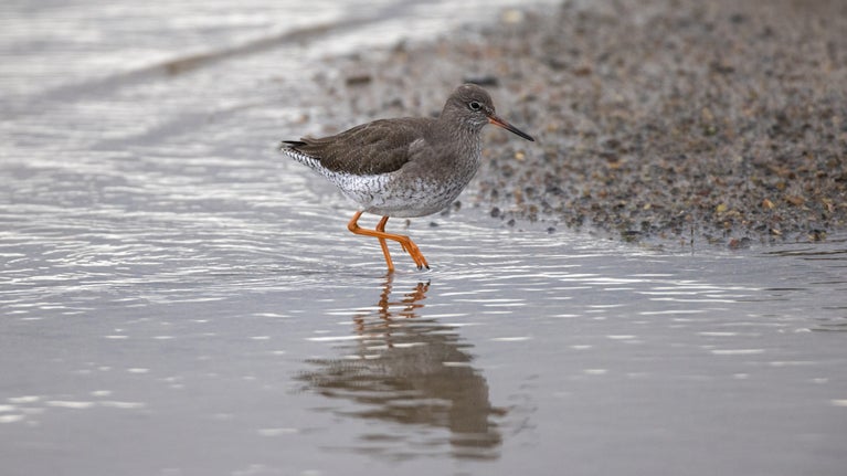
A redshank bird wades on a coastal shoreline
A redshank wades in the shallows of a coastal spot | © Justin Minns

Timeline of the work so far

2022 - 2025

2022 - 2025

After years of discussions with local stakeholders, observing changes to the landscape, and preparing initial concept reports, the project entered the design and planning stage for intertidal restoration in 2022. As part of this stage, modelling and detailed surveys and environmental assessments to refine the project design were carried out. The National Trust engaged with the South Downs National Park Authority, statutory bodies, stakeholders and the local community. Their feedback has influenced the project design now being promoted by the Trust. 
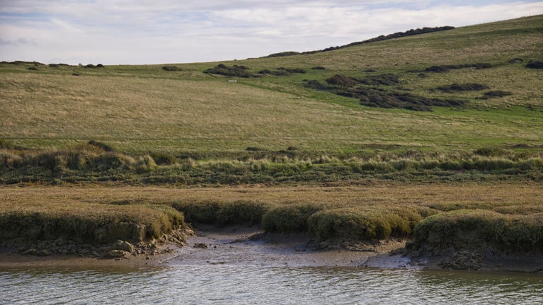
 

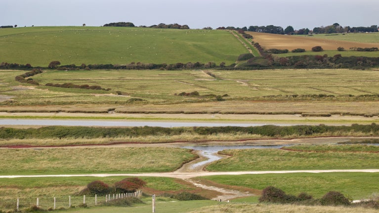
Looking west across Chyngton Brooks from the eastern South Downs Way
Looking west across Chyngton Brooks from the eastern South Downs Way | © National Trust Images/ Laurence Perry

Frequently asked questions

A high tide nears the top of the river Cuckmere bank
The river Cuckmere at Chyngton Brooks close to high tide | © National Trust Images/ Laurence Perry
Cuckmere Valley after heavy rain, East Sussex

Have your say

If you would like to make a comment on the proposal, please visit the South Downs National Park Authority planning portal.

You may also be interested in:

Living with change: Our shifting shores 

We’re tackling the threats of a changing coastline to safeguard the places you love. Find out how our teams are adapting their approach to our shifting shores.

Thorncombe Beacon, Dorset

Shifting shores at Birling Gap and the Seven Sisters 

Read about the changing coastline at Birling Gap and the Seven Sisters and discover how the National Trust is planning for the future in this changing landscape.

White chalk cliffs and the beach at Birling Gap, East Sussex

Creating wetlands at Cotehele 

Learn about how we're creating wetlands at Cotehele, Cornwall, which is helping control flood waters while providing a wildlife-rich environment.

Numbers of protected birds soar to new record after overhead power lines are removed on remote Essex island 

National Trust rangers at Northey Island in Essex, with support from volunteers, have recorded record numbers of two protected bird species following the re-routing of the island’s power infrastructure.

A flock of dark-bellied brent geese on Northey Island, Essex