West Runton circular walk, near Sheringham and Cromer, Norfolk
This walk details points of interest around beautiful West Runton and Beeston Regis Heaths and woodland. Get great views of the sea and the surrounding countryside, on this circular walk.
Walk West Runton
The perfect place for a breezy walk along, or up and down the hills of Norfolk. Open all year from dawn to dusk. Suitable for experienced walkers. Not suitable for buggies and/or wheelchairs.


Start:
National Trust car park off Sandy Lane, grid ref: TG184414
1
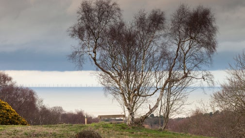
Start at the car park, walk directly behind the car park and head towards a viewing area (with seats).
Views
On a good day you can enjoy views from here right across to the Bittern Line Railway, West Runton Village and the North Sea.

2
Now return to the car park and turn right along the gravelled path looking out for another viewing area to the right (again with 2 seats). This area (at Beacon Hill) is known as Roman Camp.
Beacon Hill and Roman Camp
'Roman Camp' area is a series of earthworks on Beacon Hill, the name appearing in the late 19th-century. One theory for the origins of the name is that it was invented by carriage drivers from Cromer to encourage people to hire them for trips. No actual evidence of Roman occupation has ever been found but in medieval times it is certain that iron ore was dug from the ground accounting for the many pits which can be seen around.

3
Return to the track, turn right, and continue along until you reach a path 'cross road' junction. You will see a cairn on your right. Turn right past the cairn and then shortly afterwards turn left onto another path, leading on to West Runton Heath.
Heather
In order to keep scrub, gorse, bracken and brambles down to a minimum, in recent years the areas to your right have had the humus removed by 'scraping', thus allowing the heather to return and become the 'dominant' plant.

4
Continue along this path (in the direction shown by a red arrow on a post) until you reach an area known as Pine Heath. When you reach a 'T' junction near to a seat and to a post marked 9 and 10, turn left, and go downhill down a steep 'stepped path'.
Going downhill
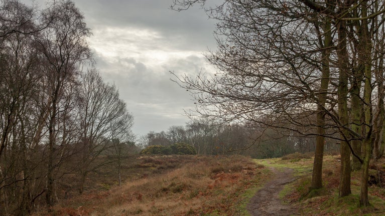
On West Runton Heath, pause for a while and take in this stunning vista before continuing down the path...

5
At the bottom of the steps turn right to walk to 'Calves Well Lane'. This is a 'green' lane and can be quite muddy in places. Now turn left here and continue on alongside 'Hillside' animal sanctuary.
Calves Well Lane/Hillside Animal Sanctuary
Hillside Animal Sanctuary was founded in 1995 to help and campaign for animals in need' and most importantly, to bring public awareness to the millions of animals suffering every day in the intensive factory farming industry.

6
Look out for the second signpost marking the Norfolk Coast Path junction. Turn left. You are now entering a wooded area called Beeston Regis Heath. Head up this path until reaching a marker post marked 12 and turn right, keeping the post on your left . Continue on this path until reaching a branch in the path and take the left hand fork and look out for another post marked 13.
Woodland
The woodland on the heath consists of a mixture of silver birch, rowan, oak, beech, sweet chestnut, holly and sycamore. These woodlands provide cover for roe and red deer, but probably muntjac are more common. The woodland edges are attractive to insects and birds. Great spotted woodpeckers may be seen in the trees; great, blue, coal and long-tailed tits are common.

7
Keep to the left and after a short way at another branch in the path take the right hand fork. You are now approaching Stone Hill.

8
Keeping to the left (avoiding another right hand branch) walk up to the viewing area and the cairn. On a fine day sit on the seat here and enjoy the wonderful views across to Sheringham and the coast. Now very carefully, keeping to the right of the cairn, head down a very steep path until again reaching Calves Well Lane, for the homeward leg of the walk. Turn right, and (passing points 6 and 5 again), continue for approximately 1 mile (1.5km) along the lane which can be very muddy. Look out for Calves Well Pond on the right which can appear stagnant.
Stone Hill and the cairn
The cairn was put at the top of Stone Hill by the National Trust in 1971, so you are looking at a piece of National Trust history. Stone Hill was one of the earliest heaths to be cleared of scrub, but due to a thick layer of humus, no heather has appeared. Unfortunately this humus cannot be 'scraped' due to potential damage to archaeological remains of medieval ironworking and Second World War slit trenches.

9
Then avoid any paths to the right until reaching Heath Farm on the right, and turn right following the signed path running alongside the Renwick Park housing estate, which will be on your left.
Heath Farm
You have just passed Heath Farm in this picture. Look out for the signed path to your right.

10
Avoiding the first, second and third paths that will be found on the right, take the fourth path (signed MP1) which climbs quite steeply uphill, until reaching the car park and the end of your walk.
End:
National Trust car park off Sandy Lane, grid ref: TG184414