Skip to content
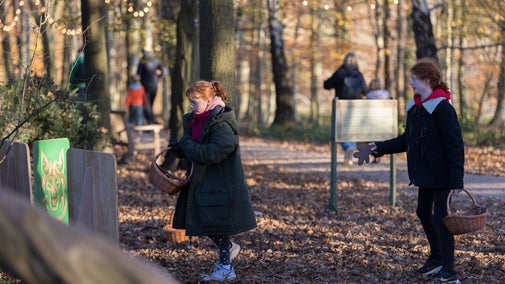
A woodland path at Witley and Milford Commons , Surrey
A woodland path at Witley and Milford Commons , Surrey | © National Trust/Chris Worsley
Surrey

Circular walk around Witley and Milford Commons

Take a gentle stroll around the calm and tranquil Witley and Milford Commons, along dry sandy paths that weave through a variety of different habitats across the two commons. There are lots of things to see and do as you stroll. This route goes clockwise from the Webb Road car park, although you can also have fun following the markers in the opposite direction.

Total steps: 10

Total steps: 10

Start point

National Trust Witley car park, Haslemere Road, Witley, Surrey, GU8 5QA. Grid ref: SU934406.

Step 1

From the car park, walk back towards the road and take the path to your right, signposted Witley Outdoor Learning Centre. The path goes through a woodland of Scots pine. At the forked junction, take the path bearing off to the left through the woods, signposted to the Witley Centre. You will come to an open area – walk around to the left-hand side and then straight ahead, following the pink signs.

Step 2

At the Witley Centre the path turns to the right and continues through mixed woodland. Follow the path marked by the pink signs and at the T-junction turn to your left. You will notice that the woodland on your right thins out. There is a lot of young birch here with some conifers.

Step 3

As you turn left you will see how the environment changes. The area to your right is now full of young birch and conifers. This is part of the heathland and the ground is rather boggy. At the T-junction turn left, leaving the nature trail as it goes off to the right. After about 120 yards (110 metres) turn right. You are at the edge of the woodland here with more birch and young oak. The ground to your left slopes upwards and is full of bracken and trees and is a great place for hide and seek. Listen out for woodland birds, such as the nuthatch, woodpecker or tiny firecrest.

Step 4

At the next junction follow the trail marker up the slope. You then turn right along a bridle path with conifers and heather on your left-hand side. At the bottom there is an area of grasses and a junction where you turn left to climb up to the ridge. Here you are at one of the highest points of the common and you have a great view across the heathland. Follow the path to the right along the ridge.

Step 5

The path descends slightly. Around here you will find some large dead trees which are wonderful for climbing over, and it's also a great place for fungi. Carry on along the path, crossing a bridle path and then going through quite thick woodland with lots of hazel and birch and oak. At the junction the path goes to the right.

Step 6

The path comes to a wide open area. On your right side is a fenced-off area. This is the parade ground used by soldiers in both the First and Second World Wars. You can see how it is very flat and the soil is compacted from all those marching boots. From here the path goes back into woodland away from the parade ground. It bears to the left and then right and then left again to come out on a long straight bridle path, which was possibly an old military track.

Step 7

This is a lovely straight stretch of lane to stroll along. You will come to a crossroads with Webb Street. To continue the trail turn left and then right to enter Milford Common. The land here is flatter with some open areas. There are trees here covered in wonderful lichen. You may also see red berries on the hawthorns and wild roses, which are a valuable food source for birds in winter.

Step 8

You will come to a junction with a bridle path. Take the path bearing right at the 2 o'clock position, going up a small slope through woodland. At the top is a lovely view across Milford Common. Turn right at the crossroads down the slope. On your left-hand side is a mass of gorse which flowers through most of the year.

Step 9

At the bottom of the slope is a crossroads with a sandstone memorial commemorating the Canadian soldiers who were based here in the First and Second World Wars. Carry on straight ahead from here and continue to follow the pink markers. The path wends its way through bushy areas and open spaces. You will bear to the left across a large open area, before passing again through open woodland.

Step 10

As you come out of the woodland follow the markers taking a sharp right and then left to go past the baseball ground on your right-hand side. Follow the path here back to the car park.

End point

National Trust Witley car park, Haslemere Road, Witley, Surrey, GU8 5QA. Grid ref: SU934406.

Trail map

Route map for the Winter wander around Witley and Milford Commons
Route map for the Winter wander around Witley and Milford Commons | © Crown copyright and database rights 2013 Ordnance Survey

You made it

Share your experience

More near here

View south from the Temple of the Winds at Black Down, West Sussex
Trail
Trail

Black Down Temple of the Winds trail 

Sussex

Find one of the best views of the South Downs National Park at the Temple of the Winds. This little-known spot has a secret feel and a charming curved stone seat to rest on.

Activities
Walking
DistanceMiles: 2 (km: 3.2)
Two women in warm clothing walking dog along woodland path with bluebells to either side
Trail
Trail

The Wix Wood walk at Hatchlands Park 

This circular walk cuts across the centre of the estate through woodland and open parkland, passing our children's adventure area and the cobbled courtyard. Follow the purple arrows on our waymarker posts.

Activities
Walking
DistanceMiles: 1.8 (km: 2.88)
Two small weirs with a red brick house on the right bank and blue skies above
Trail
Trail

Papercourt Lock to Triggs Lock walk 

An attractive and easy countryside walk in Send, where the River Wey Navigations has its workshops.

Activities
Walking
DistanceMiles: 6 (km: 9.6)
Purple Emperor butterfly
Trail
Trail

Bookham Common butterfly walk 

This walking trail takes you through one of the best woods in England for sighting the elusive purple emperor butterfly, which thrives here thanks to decades of work by National Trust rangers to protect the specialist habitats it needs.

Activities
Walking
DistanceMiles: 1.5 (km: 2.4)

Get in touch

Haslemere Road, Witley, Surrey, GU8 5QA

Our partners

Cotswold Outdoor

We’ve partnered with Cotswold Outdoor to help everyone make the most of their time outdoors in the places we care for.

Visit website 

You might also be interested in

Footpath in spring across Witley Common, south west of Guildford, Surrey
Article
Article

Things to see and do at Witley and Milford Commons   

The Commons’ dry, sandy soil makes it ideal for visits in all weathers. Follow the trails, or go wherever you want, and explore the woods, grasslands and heathland areas.

Visitor at the view point looking across towards the South Downs on a frosty winter's morning

Walking in Surrey 

From hilltop hikes with some of the finest views of the Surrey Hills to gentle wanders through ancient woodlands, these are some of the best walks in Surrey.

An aerial view of an adult and baby walking a dog along a path at Baggy Point, Devon
Article
Article

Staying safe at National Trust places 

The special places in National Trust care sometimes come with a few risks for visitors, be it coastline or countryside. Find out how to keep safe throughout your visits.

A visitor carrying a backpack and walking along a footpath at Divis and the Black Mountain with stone walls either side, the countryside visible in the background.
Article
Article

Follow the Countryside Code 

Help to look after National Trust places by observing a few simple guidelines during your visit and following the Countryside Code.

Walkers climbing rocks against a bright blue sky with the mountains in the distance at Sugarloaf, Monmouthshire

Walking 

Explore some of the finest landscapes in our care on coastal paths, accessible trails, woodland walks and everything in between. Find the best places to walk near you.
A group of people in a hiking group are being guided on a hike by rangers at Marsden Moor, West Yorkshire
Article
Article

Cotswold Outdoor: our exclusive walking partner 

Find out more about the National Trust’s ongoing partnership with Cotswold Outdoor as our exclusive walking partner.

Visitors exploring the rocks in the Owler Tor area of Longshaw, Burbage and the Eastern Moors, Derbyshire

Outdoor activities 

Searching for a new outdoor activity to try? Discover the best places in our care for outdoor activities, including off-road cycle tracks, walking trails and lakes and coastlines for water sports.

Family exploring a tree hollow at Hatchlands Park, Surrey

Family-friendly places to visit in Surrey 

Enjoy a spring day out in Surrey with your family. Explore natural play areas, gardens, cafés and plenty of wide open spaces waiting to be discovered.