Avebury Ridgeway walk
Wiltshire
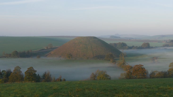
Starting at the heart of the World Heritage Site, this walk takes you through the remains of the largest stone circle in the world and along the West Kennet Avenue into beautiful rolling chalk downland. You'll catch glimpses of the prehistoric Silbury Hill, pass Bronze Age burial mounds and walk along ancient roads with far-reaching views across the landscape.
Near to
AveburyStart point
National Trust car park, Avebury. Grid reference: SU 09960 69654Trail information
*Uneven terrain with gently sloping downs. For further details, please see Terrain section.
**This trail isn't suitable for wheelchairs or those with limited mobility. For further details, please see section marked Access.
***Dog on leads are welcome across the site. For further details, please see section marked Facilities.
Avebury Stone Circle and Henge
The bank and ditch of the Neolithic Avebury Henge are almost a mile in circumference, and the ditch was originally 9 metres deep. The outer stone circle is the largest prehistoric circle of standing stones in the world and has the remains of two other smaller stone circles within it.
More near here
Around Silbury Hill
This walk circles the base of Silbury Hill, affording a real sense of scale of this important prehistoric structure, part of the World Heritage Site of Avebury.

Get in touch
Our partners

We’ve partnered with Cotswold Outdoor to help everyone make the most of their time outdoors in the places we care for.
You might also be interested in
Walking
Explore some of the finest landscapes in our care on coastal paths, accessible trails, woodland walks and everything in between. Find the best places to walk near you.

Exploring the stone circles at Avebury
Visiting Avebury and the surrounding landscape is a unique experience. The area contains multiple Neolithic and Bronze Age features including the largest stone circle in the world which you can enter and explore.

Visiting the museum and Old Farmyard
Discover artefacts from archaeological excavations in the museum. Step inside the large threshing barn and see the 16th-century dovecote near the wildlife pond.

Eating and Shopping at Avebury
The Circles Café serves lunches, cakes, snacks and drinks. Visit the National Trust shop for sustainable products and gifts, or browse Cobblestones second-hand bookshop.

Follow the Countryside Code
Help to look after National Trust places by observing a few simple guidelines during your visit and following the Countryside Code.

