Burnham Overy Staithe walk
Norfolk
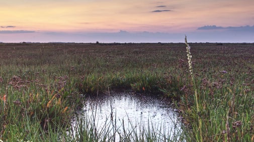
Wander through Burnham Overy Staithe near Brancaster, and enjoy beautiful sights of the North Norfolk coast and its wildlife. This circular route follows part of the Norfolk Coast Path and passes through Holkham National Nature Reserve. There's the opportunity to visit Burnham Overy Town, St. Clement church with its Norman tower, and catch sight of the Tower Windmill along the way.
Near to
Brancaster EstateStart point
The Hero Bar and Restaurant, Burnham Overy StaitheTrail information
Visit Scolt Head Island
From the harbour at Burnham Overy Staithe, you can go on a boat trip to Scolt Head Island National Nature Reserve.
More near here
Brancaster Staithe wildlife walk
Wander through Brancaster Staithe and enjoy the sights of the coast and its wildlife. There are views from Barrow Common and the chance to visit the site of Branodunum Roman Fort along the way.

Blakeney to Stiffkey coastal walk
Enjoy views across Norfolk's open landscape on this coastal walk, starting at Blakeney Nature Reserve and taking in Morston and Stiffkey salt marshes.

Blakeney Freshes coastal wildlife walk
This family-friendly circular walk through Blakeney village and around Blakeney Freshes offers impressive coastal views and is ideal for spotting birds and wildlife.

Get in touch
Brancaster Beach, Beach Road, Brancaster, Norfolk, PE31 8AX
Our partners

We’ve partnered with Cotswold Outdoor to help everyone make the most of their time outdoors in the places we care for.
You might also be interested in
Walking
Explore some of the finest landscapes in our care on coastal paths, accessible trails, woodland walks and everything in between. Find the best places to walk near you.

Discover Brancaster Estate
Brancaster Estate, with its wide expanse of golden sands, is perfect for summer sunbathing or winter wanders. Here’s everything you need to know when planning your visit.

Family days out at Brancaster beach
Plan a fun-filled day out at Brancaster beach. With its wide expanse of golden sands, it is perfect for sandcastles, wanders, picnics and paddling.

Bringing your dog to Brancaster Estate
Brancaster Beach is a two pawprint rated place. Dogs and responsible owners are very much welcome here. We know your pets will enjoy it as much as you.

Kite sports at Brancaster Beach
Find out where the safe zones are for kitesurfing and other kite sports, plus tips and advice to keep everyone safe when you visit.

Cotswold Outdoor: our exclusive walking partner
Learn about the National Trust’s ongoing partnership with Cotswold Outdoor. Find out how they help us care for precious places and the exclusive discount available for National Trust supporters.

Follow the Countryside Code
Help to look after National Trust places by observing a few simple guidelines during your visit and following the Countryside Code.

Top tips for coastal walks
Get safety tips for walking by the coast, including the essential clothing and equipment to take with you and what to do before you set out.


