East Soar to Bolt Head Walk
Devon
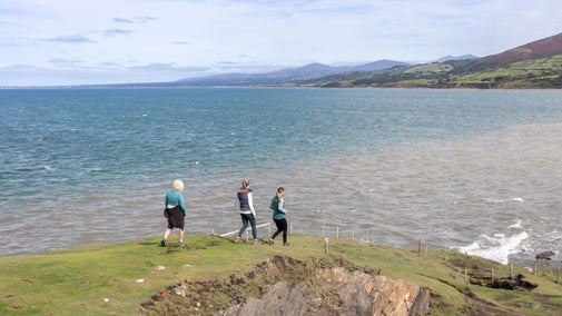
From shipwrecks to wildlife-spotting, discover the dramatic coast around Salcombe on this circular walk via the South West Coast Path. After the jagged rocks at Bolt Head, wander down to the impossibly blue waters of Starehole Bay, then return past Overbeck's, with views of the Salcombe Estuary.
Near to
East SoarStart point
East Soar National Trust car park, grid ref: SX713375Trail information
Please be aware of livestock
Be aware that you may encounter livestock, which can include sheep and cattle, on this route. Please follow the guidance of onsite signage and take any dog waste away with you.
More near here
East Soar to Overbeck's Garden walk
A linear walk from East Soar to Overbeck's Garden. Follow the trail along the runway of what used to be RAF Bolt Head, taking in panoramic views of the South Hams coast and countryside.

Bolberry Down and Soar Mill Cove walk
Discover a circular walk that takes in some of the most scenic coastline of South Devon. Find out more about the history of the area and enjoy far-reaching views out to sea and along the coast.

Get in touch
Our partners

We’ve partnered with Cotswold Outdoor to help everyone make the most of their time outdoors in the places we care for.
You might also be interested in
Top coastal walks
Explore some of the UK's most famous natural landmarks on a coastal walk. With a variety of walking trails offering clifftop views, golden sands and local wildlife, there's a walk for everyone.

Cotswold Outdoor: our exclusive walking partner
Learn about the National Trust’s ongoing partnership with Cotswold Outdoor. Find out how they help us care for precious places and the exclusive discount available for National Trust supporters.

Staying safe at National Trust places
The special places in National Trust care sometimes come with a few risks for visitors, be it coastline or countryside. Find out how to keep safe throughout your visits.

Follow the Countryside Code
Help to look after National Trust places by observing a few simple guidelines during your visit and following the Countryside Code.

Things to see and do at East Soar
With a variety of walks and views, East Soar has plenty to see. Discover seascapes, secret coves and rugged clifftop walks along the way. You could even try out some outdoor activities.

Top tips for coastal walks
Get safety tips for walking by the coast, including the essential clothing and equipment to take with you and what to do before you set out.

Walking in Devon
From rugged coastline with captivating views to gentle woodland strolls, these are some of the best walks in Devon this winter.

Walking
Explore some of the finest landscapes in our care on coastal paths, accessible trails, woodland walks and everything in between. Find the best places to walk near you.


