Erddig riverside walk
Wales
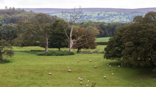
Enjoy a short circular walk taking you round the green waymarked route on the 1,200-acre estate with an array of natural and archaeological features. Take in Erddig’s famous 18th-century Cup and Saucer water feature, designed by William Emes, and follow the River Clywedog along the bottom of Wat’s Dyke and Court Wood into the historic village of Felin Puleston.
Near to
Erddig Hall and GardenStart point
Erddig car park, grid ref: SJ326481Trail information
More near here
Erddig Hall and Garden
Explore a much-loved home, garden and estate filled with the stories of a family and their servants.

Erddig Big Wood trail
Explore a gentle stroll around the parkland at Erddig on this circular walk. Wander through woodland and discover the ancient remains of a Norman motte and bailey castle as you join the historic and mysterious Wat’s Dyke way.

Erddig Bryn-y-Cabanau and Lewis Wood walk
Enjoy the eastern reaches of Erddig's 1,200-acre estate in Wrexham on a waymarked trail through two woods.

Erddig French meadow walk through Emes' pleasure park
Enjoy a waymarked trail through Erddig's 1,200-acre estate in Wrexham, taking you past the historic Cup and Saucer water feature.

Get in touch
Our partners

We’ve partnered with Cotswold Outdoor to help everyone make the most of their time outdoors in the places we care for.
You might also be interested in
Walking in Wales
Explore wide open landscapes, gentler coastal strolls or energetic hikes for something a little more challenging. We've rounded up some of the best places to walk in Wales.

Exploring Erddig's parkland
Discover the top things to see and do when you visit the parkland. From meandering rivers and an 18th-century water feature to the dramatic escarpment leading to Wat’s Dyke.

Outdoor activities at Erddig
Free outdoor activities to help you make the most of the garden and parkland, from Nordic walking to weekly parkruns.

Eating and shopping at Erddig
Check out the places to eat and shop at Erddig. Most are set within historic outbuildings and every purchase helps us to look after Erddig for future generations to enjoy.

Walking
Explore some of the finest landscapes in our care on coastal paths, accessible trails, woodland walks and everything in between. Find the best places to walk near you.

Cotswold Outdoor: our exclusive walking partner
Learn about the National Trust’s ongoing partnership with Cotswold Outdoor. Find out how they help us care for precious places and the exclusive discount available for National Trust supporters.

Follow the Countryside Code
Help to look after National Trust places by observing a few simple guidelines during your visit and following the Countryside Code.


