Discover more at Golden Cap
Find out how to get to Golden Cap, where to park, the things to see and do and more.

No matter what time of year you visit, there’s plenty to see and do at Golden Cap. From orienteering to swimming, angling to running, there’s something for the whole family to enjoy.
We have a fantastic Smugglers Trail designed to take you on a mini adventure around the routes smugglers would have walked. Follow the tab titled 'Family-friendly things to do at Golden Cap' for more information and copies of the maps and audible guides.
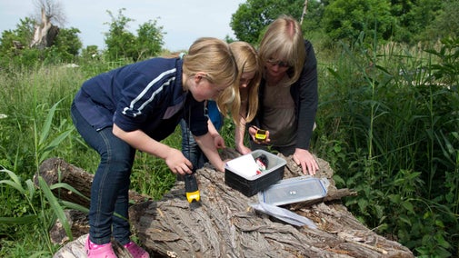
Like treasure hunting for the digital generation, geocaching is an exciting outdoor adventure that the whole family can take part in. The premise is simple: ‘treasures’ are hidden in secret locations, which can be found using co-ordinates shared on the internet. All you need is a handheld GPS and a sense of fun. Most caches have a log book for you to leave a message in.
Start your geocaching adventure
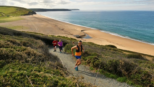
Why sweat it out on a treadmill when you can run in the fresh air at Golden Cap? For an easy workout, do a circuit or two of Langdon Hill. For a more challenging training session, the undulating South West Coast Path awaits. We also have the a Trust 10k route mapped out on the estate, it is waymarked with pink discs allowing it to be followed at any time, but between March and October we meet once a month, on the 4th Sunday of the month, for a offical Trust 10 run event. Meet at the Old Radar Station on Stonebarrow Hill at 8.45am.
Being based on the Jurassic Coast we have some of the most stunning sea views for you to enjoy. A walk from either of our car parks (Langdon or Stonebarrow) will quickly bring you in sight of the sea. There are shingle beaches at Charmouth, Seatown and Eype’s Mouth which are great for fossil hunting and paddling. We would advise caution before swimming due to the shelving nature of the beaches along the coast and care should, especially, be taken at Seatown and Eype’s Mouth, where currents can be strong near the shore. Please note that all three locations have their own (i.e. not National Trust) car parks.

Whether you want to spend some quality time with loved ones or enjoy a bit of solitude, walking is a fun and rewarding pastime. There are a number of trails across the Golden Cap estate, so you can get some fresh air and exercise while exploring this special coastal site.
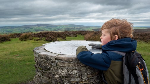
As you’d expect from the highest point on the South Coast, the views in all directions are spectacular on a clear day. Park at Langdon Hill car park and climb up the east side, or approach from the west if you’re parked at Stonebarrow. Either way, the stiff climb will be amply rewarded by the views and sense of achievement.
Langdon Hill car park is a good starting point for a walk up to Golden Cap or a stroll along a stretch of coast path. The woodland offers a small play trail and a scenic circuit along level paths, popular with dog walkers and those looking for a less challenging walk. A great place to seek shade on a hot summer’s day, it’s also rich in wildlife, with carpets of bluebells in spring and unusual varieties of fungi in the autumn.
While you're in the woods, look out for the sculpture by Zac Greening, an award-winning artist who takes his inspiration from nature and his surroundings. Created from Portland stone in 2015, it was commissioned to celebrate the 50th anniversary of Enterprise Neptune, the Trust's coast fundraising campaign.
There’s been a settlement at St Gabriel’s since Saxon times. All that remains of the thriving hamlet is a ruined medieval chapel and an 18th-century manor house that’s now divided into four National Trust holiday cottages. The ancient landscape of this secluded valley has been formed by centuries of farming. Wildlife thrives in the meadows and hedges, and the tiny streams support frogs, newts and dragonflies.
Stonebarrow is an excellent starting point for exploring the Golden Cap estate. From the car park, there are numerous short walks along the hilltop, or you can enjoy a longer coastal walk to Golden Cap and beyond, returning via an inland route across wildlife-rich meadows.
Thorncombe Beacon stands to the east of Golden Cap on the Jurassic Coast. Like its taller neighbour, it gets its distinctive colour from a green mineral in the rock that turns rusty gold in sunlight. There’s been a signal station here from at least the 16th century, built to warn of invasion.

Find out how to get to Golden Cap, where to park, the things to see and do and more.

We’ve partnered with Cotswold Outdoor to help everyone make the most of their time outdoors in the places we care for.
From a woodlands to hilltops and the Jurassic Coast, Golden Cap is full of variety. Discover the best parts of the estate and look out for rare orchids and dragonflies.

From surveying moth populations to managing rare orchids, the National Trust team at Golden Cap works tirelessly to maintain this special coastal site in Dorset. Find out more.

Geocaching is like a digital treasure hunt using a handheld GPS, and you can try it for free at many places we look after.

Choose one of our favourite coastal running spots and see where it takes you – miles of coastal trails, wooded valleys and havens for nature await.

Climbing a huge hill is no. 28 of our ‘50 things to do before you’re 11¾’. It might seem tiring, but once you've reached the top, think about how much fun you'll have coming down.

Swimming in the sea, no. 42 of our ‘50 things to do before you’re 11¾’, is a brilliant experience. Follow our tips to help you have the best time.

Searching for a new outdoor activity to try? Discover the best places in our care for outdoor activities, including off-road cycle tracks, walking trails and coastlines for watersports.

Explore some of the finest landscapes in our care on coastal paths, accessible trails, woodland walks and everything in between. Find the best places to walk near you.
