Stonebarrow walk on the Golden Cap Estate
Dorset
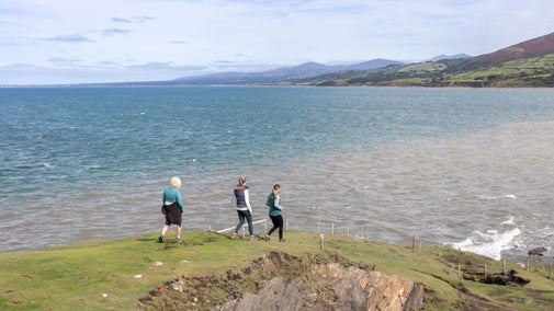
The Golden Cap Estate is made up of rolling hills, pastoral fields, sunken lanes, ancient hedgerows and dramatic coastline, and lies within the Dorset Area of Outstanding Natural Beauty. This walk includes a section of the South West Coast Path along the Jurassic Coast World Heritage Site.
Near to
Golden CapStart point
Stonebarrow car park, grid ref: SY382933Trail information
More near here
Langdon Hill walk
Enjoy a circular woodland walk with spectacular views at Langdon Hill, where you'll discover year-round wildlife highlights.

Get in touch
Our partners

We’ve partnered with Cotswold Outdoor to help everyone make the most of their time outdoors in the places we care for.
You might also be interested in
Outdoor activities at Golden Cap
From bracing walks with breathtaking views to angling and geocaching, there's lots to do around the Golden Cap estate.

Exploring nature at Golden Cap
From a woodlands to hilltops and the Jurassic Coast, Golden Cap is full of variety. Discover the best parts of the estate and look out for rare orchids and dragonflies.

Cotswold Outdoor: our exclusive walking partner
Learn about the National Trust’s ongoing partnership with Cotswold Outdoor. Find out how they help us care for precious places and the exclusive discount available for National Trust supporters.

Staying safe at National Trust places
The special places in National Trust care sometimes come with a few risks for visitors, be it coastline or countryside. Find out how to keep safe throughout your visits.

Top coastal walks
Explore some of the UK's most famous natural landmarks on a coastal walk. With a variety of walking trails offering clifftop views, golden sands and local wildlife, there's a walk for everyone.

Walking in Dorset
From strolls along the coastline by the sea to spectacular views over three counties at the top of Hambledon Hill, these are some of the best walks in Dorset this winter season.


