Polruan coast and creek walk
Cornwall
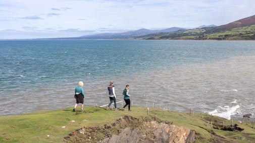
Travelling high above Lantic Bay, with spectacular views over its wide beaches and clear turquoise waters to Gribbin Head, this energetic circular walk circles the mouth of the Fowey Estuary. It takes in some of Polruan's many historic features before looping around above the tranquil Pont Pill creek to the quay at Pont Pill, returning to the car park via Lanteglos Church.
Near to
Lantic BayStart point
Lantic Bay car park, Bodinnick Heights, Bodinnick, Lanteglos, Polruan, Cornwall PL23 1LX. Grid ref: SX149513Trail information
Cliff edges
Be aware of cliff edges and unstable cliffs. Keep children supervised at all times.
More near here
Covington walk in the Fowey estuary
A circular walk around the Cornish harbour town of Fowey on this National Trust trail taking in heritage highlights and views across the estuary. It's the perfect place for a stroll with plenty of places to stop for a picnic too.

Gribbin Head walk at Fowey Estuary
Follow in the footsteps of author Daphne du Maurier on this relaxing trail which visits the coastal landscapes west of Fowey Estuary that inspired her much of her work.

Polperro to Looe coast walk
Discover the fascinating history of this area, and a biblical connection, on this moderate coastal walk from Polperro to Looe, Cornwall.

Fowey Hall Walk
Savour the coastal Cornwall views on this scenic walk through woodland and creek at Fowey Estuary, on a circular route which includes two ferry rides.

Get in touch
Our partners

We’ve partnered with Cotswold Outdoor to help everyone make the most of their time outdoors in the places we care for.
You might also be interested in
Things to do at Lantic Bay
Explore the beach, go fishing, take in the clifftop views and walks around Lantic Bay and Pencarrow Head.

Lantivet Bay
Coastal walks, wide open views and hidden coves

Top coastal walks
Explore some of the UK's most famous natural landmarks on a coastal walk. With a variety of walking trails offering clifftop views, golden sands and local wildlife, there's a walk for everyone.

Walking
Explore some of the finest landscapes in our care on coastal paths, accessible trails, woodland walks and everything in between. Find the best places to walk near you.

Walking in Cornwall
From strolls that reward you with stunning views of the South West coast to gentle inland meanders, these are some of the best walks in Cornwall.

Follow the Countryside Code
Help to look after National Trust places by observing a few simple guidelines during your visit and following the Countryside Code.

Staying safe at National Trust places
The special places in National Trust care sometimes come with a few risks for visitors, be it coastline or countryside. Find out how to keep safe throughout your visits.

Cotswold Outdoor: our exclusive walking partner
Learn about the National Trust’s ongoing partnership with Cotswold Outdoor. Find out how they help us care for precious places and the exclusive discount available for National Trust supporters.


