Mottisfont estate walk
This walk can experience high visitor numbers, and parking is limited. Please park responsibly, and if the area is too busy on your arrival please come back another time.
Discover our beautiful and diverse estate on a varied walk through ancient woodlands, historic farmland and along the crystal-clear River Test. This walk takes in part of the Test Way and showcases some of the best of Hampshire countryside. The route is best walked anti-clockwise. Look out for the stone markers with the bear crest on them, as some of these have numbers which relate to points on this walking trail - but please note that we are currently revising the route. There may be livestock grazing at certain points on the route - please keep dogs on leads while walking through fields.

Start:
Spearywell car park, grid ref: SU316275
1
Starting from Spearywell carpark, take the gravel path to the left of the sign board. This part of the walk takes in much of the woodland. Follow the bear stone markers until you exit the woods and emerge by farmland.
Mottisfont estate
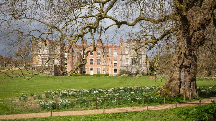
We acquired Mottisfont estate in 1957 from Mrs Maud Russell, which includes the mansion house, gardens, woodlands, rivers and farmlands - over 648 hectares (1645 acres). The land has been managed as a traditional working estate since 1500; now, the countryside team here at Mottisfont manage it carefully to maintain access, enhance wildlife habitats and preserve the landscape.
2
Take the left turning at a T junction, following the path and signs down through the wood. You'll go under a railway bridge.
Wild wildlife
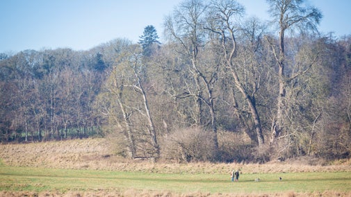
We actively manage the woods for nature conservation. Much of our work has been to restore the historic rides within the woodland to a width that favours plants and insects. Wide rides allow plenty of light and sun into the woods and this offers the perfect habitat for butterflies such as silver-washed fritillary, white admiral and meadow brown.
3
Continue on the same path once you've passed under the railway bridge, turning left through a kissing gate and across the wet meadows of Dunbridge springs.
Dunbridge springs
The three freshwater springs here feed into the surrounding ditch systems and the River Dun. The adjacent fields are managed as traditional hay and grazing meadows without intensive fertilisers, herbicides or pesticides. Such management will protect local habitats. Dragonflies, damselflies and water voles can be found here.
4
Cross over the level crossing. When you reach the road, cross over onto the footpath, following the signs. Be aware that at certain times of year, this field may be grazed with cattle.
Historic farmland
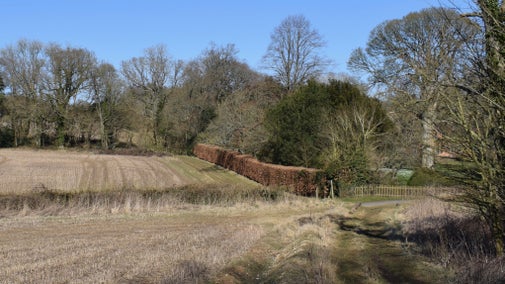
Much of the land here is farmed, either growing arable crops such as barley and wheat, or for grazing cattle. We work closely with our tenant farmers to improve the wildlife habitat, and although there is much to do, many hedges have been replanted where they once existed, and buffer strips of natural vegetation have been left uncultivated to protect rivers and woods and provide habitats for plants, insects and small mammals. These areas also offer fine hunting opportunities for kestrels and barn owls.
5
Cross Hatt Lane to go through a gate on the opposite side. Follow the path through the field, which is often grazed with sheep - please keep dogs on leads here.
The Mottisfont estate
We own 64 houses within the estate, mostly in the village of Mottisfont. One of the oldest properties is the Fox, which you will pass once you cross Hatt Lane. This was one of many pubs in the village until the estate owner Mrs Vaudrey Barker-Mill closed them down around 1920. The church dates from 1150, and it is said that a tunnel connected the church with the main Abbey. The oldest houses in the village date from the 1500s.
6
Walk along Oakley Road tracing the west boundary of Mottisfont's grounds - the famous rose gardens lie beyond these red brick walls. Turn right off the road by the marker, and follow the field across the parkland. Go through the gate at the far side and turn left onto Oakley Lane.
Queensmeadow Copse
Like all of the estate woods, this copse was once managed as an oak woodland with an understorey of hazel. It takes upwards of 80 years for an oak to mature for timber. Hazel, if cut regularly, provides fuel, fencing and thatching materials on average every 10 years. This regular cutting is called coppicing and benefits wildlife, but the practice is dying out as the demand for hazel products has diminished. However, we have reintroduced coppicing in this copse.
7
Turn right off the road at the marker. Follow the track through Queensmeadow Copse and along the field boundary. Cross the road at the marker point and follow the track along the boundary to Clapgate Copse, and across fields to Great Copse.
Ancient woodland
All of the woods on the estate have been in place for more than 400 years, which means they are classified as ancient woodlands. They are in a semi-natural state due to management over time. Great Copse is one of the best examples of the semi-natural ancient woods on our estate. Look out for plants such as Solomon's seal, wood surge, herb Paris and bluebells: the presence of these plants indicates that the woodlands are very old.
8
Walk through Great Copse and come out onto Spearywell Road. Turn left and walk up the road for a short way, turning right along the field boundary and into Spearywell Wood. Follow the pathway back through the woodland to the car park start point.
Woodland management
You are now entering the northern-most point of our estate. Commercial trees such as Douglas fir, Norway spruce and larch were planted in the 1960s. These are felled and some of the timber is used on the estate for fencing, gates and stiles. They are then replaced with British broadleaf trees to encourage local plant and wildlife. The variety of trees makes the wood an enchanting place to find fungi during the autumn. Look out for the characteristic fly agaric and the musky smelling stinkhorn.
End:
Spearywell car park, grid ref: SU316275