Walk to the Huff Duff
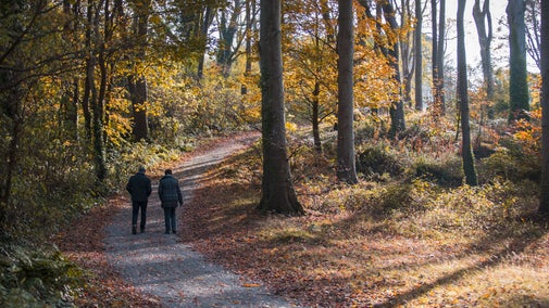
Take in breathtaking views from Ibsley Common, an area steeped in military history, and visit the Huff Duff (an old directional station) and associated bunker. The heathland is awash with autumn colour: huge expanse of purple heather and the rich golden foliage of oak and beech trees contrast with evergreen hollies and pine. Fungi litter the edges of woodland with a myriad colours and amazing shapes.
Dogs need to be kept on a lead or under close control during ground nesting bird season (March – July). Livestock present - Take care, and keep your distance - Avoid getting between animals and their young - Please keep your dog on a short lead - If cattle or ponies approach please let your dog off the lead Walk through carpets of purple heather in early autumn and stands of yellow flowering gorse.If you take your binoculars you may catch a glimpse of heathland-loving birds such as the tiny Dartford warbler, the stonechat and woodlark. Descend to a tranquil wooded valley at Dockens Water before crossing the stream to Rockford Common. Wet heath and gleaming bogs reveal carnivorous sundews and many mysterious mosses. In autumn the deer rutting season begins. Lsten out for the fierce crack of antlers as the roaring bucks (male deer) spar for the attention of the females.

Start:
SU164082
1
Walk back towards the road, under the limbs of ancient English oaks, and cross over the Dockens Water using the footbridge. Continue up the road ahead with Moyles Court School on your left. Before reaching the riding stables, turn right onto the Avon Valley Path (AVP) leading you uphill through horse paddocks towards the tree line of Newlands Plantation.
2
Turn left as you reach the tree line to continue following the AVP, with the tree line on your right. Go through the gate ahead and enter Ibsley Common. Follow the trodden path that skirts along the edge of the common, keeping the fence line on your left. Look through the many ancient oak trees marking the boundary, across the plateau, to see Blashford Lakes nature reserve. Follow this path for about 1/3 mile, cross the ditch via the boardwalk and footbridge, go straight across Mockbeggar Lane and up the other side of the bank, following the AVP.
Read more
Keep an eye out for buzzards perching atop an oak branch, and foxes slinking into the hedgerows.
3
Follow the contour of the land, keeping the houses on your left, and continue straight on as you reach a track ending in a large junction. Turn right through a wooden barrier gate back onto Ibsley Common. Walk onto Summerlug Hill, keeping the banks of the old gravel works on your right.
Read More
This woodland edge is great for wildflowers and woodland minibeasts. Take the time to carefully turn over rotten logs, take photos of colourful flowers and relax beneath the dappled shade.
4
Bear left on a well-trodden grassy path, heading in a north-easterly direction. The path will take you slightly uphill, past a wooden bench and across the tops of two valleys to your left, known as Little Chibden Bottom and Chibden Bottom (if you find yourself heading towards a clump of pine trees on the horizon, called Whitefield Plantation, you are heading in the wrong direction, you want this on your right). The path becomes gravelly after a while and passes between birch trees. Continue onwards.
Read more
The yellow flowering gorse that surrounds you is fantastic habitat for nesting birds. Stonechats, dartford warblers and dunnocks may pop out from the protection of the gorse to inspect you. Woodlarks may fly up into nearby trees. Remember to keep to well trodden paths and tracks.
5
After about half a mile, you'll be able to see a cluster of pine trees in the distance to your left, known as Robin Hood’s Clump. Ahead, you will see an octagonal brick building. This is the Huff Duff, a direction finding station during World War Two. Head east, to the right of the Huff Duff, towards a scrub covered mound to find the nearby air raid bunker.
The air-raid shelter was built for the crew of the nearby Direction Finding Station. All that remains is the octagonal brick blast wall. Their job was to assist in the tracking of Allied aircraft on their way to intercept enemy raids. They could also transmit homing signals to help Allied aircraft find their way back to base.
6
Continue on and turn right, heading south on a gravel path, keeping right of the Whitefield Plantation. Passing the plantation, you reach a white-stone trig point. Stop here to take in the view.
Looking west to south from this viewpoint, you can seen Martin Down, Cranborne Chase, and Somerly House further south, its cream coloured stone standing out from the green woodland. Looking due south you can see Ringwood church above the tree line and, on a clear day, the chalk ridgeways of Purbeck, Dorset.
7
Continue heading south on the path bearing left, and turn left at the track crossroads, heading east towards a horizon of trees.
Read more.
8
This track will take you slowly downhill through open heathland. Go straight on at the crossroads, down towards the Dockens Water stream. Pass the National Trust sign on your left and cross over the footbridge (great for pooh sticks!) into the cover of pine trees, known as Newlands Plantation.
In the past, local people would come to the Dockens Water stream here, to bathe in the many pools.
9
Cross the road ahead onto Rockford Common and ascend the gravel path. When the path levels out you will reach a crossroads: turn right and follow the gravel path south for 2/3 mile. Finally, go down through the sunken lane downhill, around the barrier, and back into the car park.
Read more.
Where the map notes "Pillow Mounds" look out for rectangular mounds on your left, these can be difficult to see when the vegetation is high but preserver! These mounds were built up as rabbit warrens during medieval times. Rabbits were so highly prised for their meat and pelts that these mounds probably had 24hr security guards.
End:
SU164082