Ty'n y Coed Uchaf and Cwm Eidda walk
A walk through the history of upland Wales, taking in rivers, open farmland and the remains of ancient woodland.
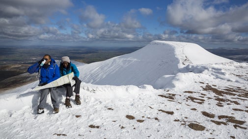
See fine views towards Snowdon and Moel Siabod
There's a huge range of plants and wildlife which is being sustained by using the right farming methods.

Start:
Ty'n y Coed lay-by on the B4406, grid ref: SH80519
1
Park in the lay-by on the B4406 (SH80519) opposite Plas Eldon. Taking care, walk along the verge, approximately 150 yds back towards the A5, until you reach the Ty’n y Coed and Dugoed farm track on the right hand side.
2
Cross the road and go through the small gate directly opposite. Walk up to the upper left-hand corner of the field and go through the gate onto the farm track. Turn right and then left, following the track uphill. Turn right again, following the way-marked route uphill until the end of the double-walled section of the path.
3
Walk up to the fence, bear right and follow this fence along the slope till you come to a small gateway in a stone wall. Go across the next field and through the right-hand gap in the stone wall. Keep walking uphill through a small section of woodland, bearing right till you come to a stream and stone wall. Cross the stile in the fence and head for the stone slab bridge.
4
Cross over the bridge and follow the way-marker up the field past the ruin of Carreg yr Ast Isaf and on to the next cottage, Carreg yr Ast Uchaf. Head to the lower left-hand corner of the field below the cottage, go over the stile and follow the earth bank down to the stream. Cross the stone bridge and keep straight on until you reach a rough track. Follow this left, aiming for the top left-hand corner of the field. Go over the stile to the ruin of Ffriddwen.
5
Walk on, along the front of the ruined farmhouse and past the remains of the outbuilding, till you reach a stream. Cross this and follow it up to the brow of the hill. Cross the stile and walk uphill for about 440yd (400m), keeping the stream on your right. Cross the next stile, in a fence alongside a dilapidated wall, then leave the stream to bear slightly left uphill to another waymarker by a gap in a stone wall.
Fine views
Point 5 is the highest spot on the walk, about 1148 feet (350m) above sea level. It's is a good place to get your breath back and admire the great views towards Snowdon and Dyffryn Conwy.
6
Head downhill past a small disused quarry on the right towards the ruins of Hwylfa Cottage. Keep to the path that runs parallel with the front of the house, following this over the stile in the fence. Keep the high stone wall to your left and go downhill till you come to a wooden ladder stile.
Hwylfa Cottage
The cottage was once the home of two brothers who were cobblers. They picked up all of their work for the week while visiting the chapel at Padog on a Sunday, returning it the following week. There wouldn't have been much passing trade here.
7
Cross over the stile and follow the waymarkers down the hill. Climb over the next stile and bear slightly right till you come to a track. Go through the gate, turn right through a second gate then follow the faint track alongside the wall till you get to the main track.
Bog myrtle
The long moorland grass is not the only thing that grows here. Look out for bog myrtle, a strongly scented upland plant that used to be stuffed into horsehair mattresses to deter fleas!
8
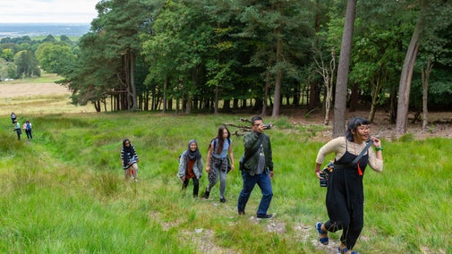
Turn left and follow this track to a wooden gate leading into Coed Maen Bleddyn, a mixed conifer and broadleaf woodland. These trees were planted in the 1960s and have been thinned twice since then to encourage a variety of wildlife.
9
About 22yd (20m) into the wood, follow the left-hand track. At the heart of the wood is a magnificent beech tree. This is all that's left of a forest that once grew here - the other trees were felled in the 1940s as part of the war effort.
10
Cross the ladder stile out of the wood and curve slightly left to a gate leading onto open farmland. Bear left again, heading towards a stone wall, and go through the small opening in its right-hand side. Head towards Bryn Eithin, take the track through the farmyard and follow this for about ½ mile (0.8km).
11
Follow a waymarker to a stile and stream, then bear slightly left across the field to a small gate in the stone wall. The rocky hillock on your left is called Tomen Castell Castle Mound. Go through the gate and walk straight ahead, then bear slightly right and downhill till you reach a stile at the junction of three fences. Go over the stile and follow the stone wall down the field to the large gate. Go through, turn left and follow the faint path down the bracken-covered slope. Cross the wet area at the bottom of the slope and bear right towards the stile.
12
Cross over the stile onto the single-track road. Turn left down the lane, which comes out on the B4406. Please take care when crossing the road. Go through the private car park and follow the path, through the gates. Carry on along this path, through the hay meadows, until you reach the gate by the B4406. Turn right and carry on along the verge until you reach the lay-by.
End:
Ty'n y Coed lay-by, grid ref: SH80519