Horse Head Moor and Deepdale walk
Yorkshire
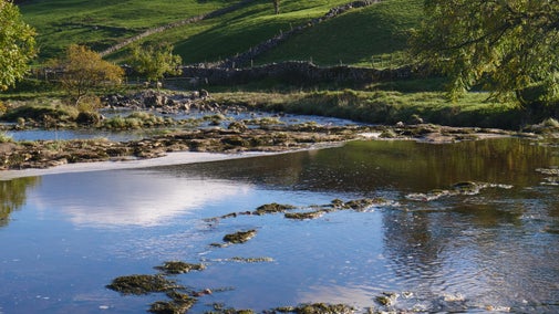
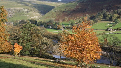
Challenge yourself to the Horse Head Moor and Deepdale walk, which explores the remote moorland ridge and rewards visitors with views across the Three Peaks. This invigorating circular trail tackles steep climbs to cross moorland and fellside before descending for a stroll alongside the River Wharfe. It offers the chance to discover colourful fauna, woodland restoration as well as kingfishers and other water wildlife.
Near to
Yorkshire DalesStart point
Yockenthwaite, Skipton, BD23. Grid ref: SD904790Trail information
More near here
Buckden to Kettlewell walk
Explore the Yorkshire Dales and spot kingfishers and other water wildlife on this easy linear walk, which follows the River Wharfe through fields, farmland, and along historic dry-stone walls.

Old Cote Moor from Kettlewell trail
Discover the exposed Old Cote Moor summit ridge on this challenging circular trail, which offers sweeping views across the Yorkshire Dales and the chance to spot otters and kingfishers by the riverside.

Buckden to Starbotton hillside and river walk
Discover a 5-mile circular walk on the fellside at the National Trust's Buckden and Starbottom including a return along the River Wharfe path.

Malham Tarn upland farm circular walk
Discover England's highest lime-rich lake, home to a unique community of rare plants and animals.

Get in touch
Malham Tarn Estate Office, North Wing, Malham Tarn House, Settle, North Yorkshire, BD24 9PU
Our partners

We’ve partnered with Cotswold Outdoor to help everyone make the most of their time outdoors in the places we care for.
You might also be interested in
Walking
Explore some of the finest landscapes in our care on coastal paths, accessible trails, woodland walks and everything in between. Find the best places to walk near you.

Walking in Yorkshire
Discover some of the best walks in Yorkshire, from rugged Pennine beauty spots, views over the coast, to parkland and meadows perfect for a family stroll. Most are dog friendly and many can be enjoyed as part of your day out to the nearest National Trust property.

Cotswold Outdoor: our exclusive walking partner
Learn about the National Trust’s ongoing partnership with Cotswold Outdoor. Find out how they help us care for precious places and the exclusive discount available for National Trust supporters.

Staying safe at National Trust places
The special places in National Trust care sometimes come with a few risks for visitors, be it coastline or countryside. Find out how to keep safe throughout your visits.

Follow the Countryside Code
Help to look after National Trust places by observing a few simple guidelines during your visit and following the Countryside Code.

Outdoor activities in Yorkshire
Whether you fancy a cycling, climbing or running adventure in the Yorkshire Dales, prefer the excitement of orienteering in the countryside, or would like to try fossil hunting on the coast, there's plenty of ways to get outside in Yorkshire.

Things to look out for in the Yorkshire Dales
Discover the Yorkshire Dales with their rolling countryside, steep-sided valleys, heather-covered moorland and a patchwork of dry stone walls and barns.

Outdoor activities in the Yorkshire Dales
Discover the best walking, running and cycling routes around the Yorkshire Dales.

