Skip to content
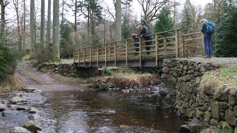
A river walk and train ride with spectacular scenery of the Eskdale valley
A river walk and train ride with spectacular scenery of the Eskdale valley | © National Trust Images / Paul Harris
Lake District

River Esk: Steam, ride and ramble walk

This classic river walk along the River Esk, with its intimate scenery of crags, woods, fields and the river itself, provides the perfect excuse to leave the car behind and travel along one of Cumbria's favourite and most memorable steam railways.

Total steps: 10

Total steps: 10

Start point

Dalegarth Station (nr Boot) pay and display car park, grid ref: NY173007

Step 1

Leave the station and turn left along the road towards Boot. At the crossroads next to the pub turn right and head south down the track.

Step 2

After passing through Esk View Farm and the farm buildings you can see linear stone walls that are remains of the railway line for the quarries.

Step 3

The track passes St Catherine's Church and the stepping stones across the River Esk. From the church, follow the river upstream along a pitched surface.

Step 4

Continue along the path until you reach a gate. At this point there are two paths that are close together and run parallel. A well-defined lower path thatcrosses the Esk, and an upper path that is not well-defined and can easily be mistaken for a grass strip. Take the lower path to the old railway bridge.

Step 5

At the bridge you can see Gill Force Waterfall in the Esk. From here, go back along the path until you reach the point where the path splits. Take the path leading to the right heading up a slight gradient following the river upstream. Follow along this path through various gates and thin woody areas until you reach a small humpback bridge locally known as Doctor's Bridge.

Step 6

Cross the Esk at Doctor's Bridge and follow the river downstream, heading away from Penny Hill Farm. At Low Birker Farm follow the bridleway through the property and continue along a well-defined walled track. This track eventually leads to a small footbridge over a ford and through a gate.

Step 7

Continue through the gate and towards Gill Force along a path through open ground lined by gorse and bracken. Follow the earthen path through a wood until you get to a gate exiting the woodland. Continue out of the wood till you reach corner in a dry-stone wall where the path bends to the left across a ford. Continue along the track until you reach a gate and enter a plantation.

Step 8

Through the gate you drop into a plantation and cross the beck with a ford and footbridge. At this point you can visit Stanley Force Waterfall or continue on the route.

Step 9

Head towards the gate, exit the plantation and follow the bridleway cross the field. Upon exiting the field turn right on to the track and follow towards the B road. On your way you pass an alternative car park and bridge.

Step 10

At the road junction, turn right by the old school and war memorial, and head towards the station and the car park.

End point

Dalegarth Station (nr Boot) pay and display car park, grid ref: NY173007

Trail map

Map route for steam, ride and ramble walk
Map route for steam, ride and ramble walk on the River Esk | © Crown copyright and database rights 2013 Ordnance Survey

You made it

Share your experience

More near here

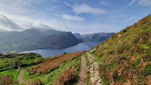
A birds-eye view of Ullswater in Autumn at Aira Force and Gowbarrow Park, Cumbria
Trail
Trail

Aira Force and Gowbarrow Park trail 

Explore Aira Force and Gowbarrow Park on a circular walk passing through woodland and open glades all accompanied with the roaring sounds from the waterfall in the gorge. Enjoy expansive views over Ullswater from the summit of Gowbarrow.
Activities
Walking
DistanceMiles: 4.5 (km: 7.2)
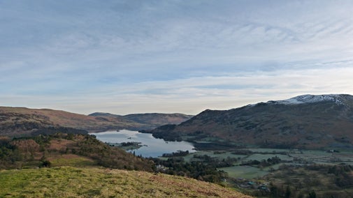
An old ash tree, leafless winter, with high fells behind it, stands on a sloping hillside covered in grass and dead bracken
Trail
Trail

Patterdale and Glenamara Park trail 

Patterdale, near Ullswater, is home to Glenamara Park – a former deer park and site of several stately ancient and veteran trees. Explore them on this easy circular walk.
Activities
Walking
DistanceMiles: 2 (km: 3.2)
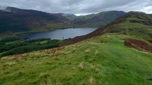
View down to Crummock water and surrounding mountains on a clear spring day
Trail
Trail

Buttermere to Rannerdale walk 

This scenic and invigorating Lakeland ridge walk takes you from the Buttermere Valley up to the summit of Rannerdale Knotts, offering impressive views over lakes and high peaks.
Activities
Walking
DistanceMiles: 3 (km: 4.8)
A bumblebee visits the bright yellow gorse flowers on the Whitehaven Coast in spring.
Trail
Trail

Whitehaven colourful coastal walk 

Experience wild, secluded beaches on this dramatic cliff-top walk at Whitehaven's historic 17th-century harbour, passing the town’s industrial archaeology to join Wainwright’s Coast to Coast path.

Activities
Walking
DistanceMiles: 7 (km: 11.2)

Our partners

Cotswold Outdoor

We’ve partnered with Cotswold Outdoor to help everyone make the most of their time outdoors in the places we care for.

Visit website 

You might also be interested in

View over Derwent Water looking towards Skiddaw in the Lake District in spring

Walking in the Lake District 

From gentle ambles to more challenging hikes, these are some of the best walks to explore the heart of the Lake District.

An aerial view of an adult and baby walking a dog along a path at Baggy Point, Devon
Article
Article

Staying safe at National Trust places 

The special places in National Trust care sometimes come with a few risks for visitors, be it coastline or countryside. Find out how to keep safe throughout your visits.

A visitor carrying a backpack and walking along a footpath at Divis and the Black Mountain with stone walls either side, the countryside visible in the background.
Article
Article

Follow the Countryside Code 

Help to look after National Trust places by observing a few simple guidelines during your visit and following the Countryside Code.

A group of people in a hiking group are being guided on a hike by rangers at Marsden Moor, West Yorkshire
Article
Article

Cotswold Outdoor: our exclusive walking partner 

Find out more about the National Trust’s ongoing partnership with Cotswold Outdoor as our exclusive walking partner.

Walkers climbing rocks against a bright blue sky with the mountains in the distance at Sugarloaf, Monmouthshire

Walking 

Explore some of the finest landscapes in our care on coastal paths, accessible trails, woodland walks and everything in between. Find the best places to walk near you.

Visitors exploring the rocks in the Owler Tor area of Longshaw, Burbage and the Eastern Moors, Derbyshire

Outdoor activities 

Searching for a new outdoor activity to try? Discover the best places in our care for outdoor activities, including off-road cycle tracks, walking trails and lakes and coastlines for water sports.