Follies, Farms and Forts
Oxfordshire, Buckinghamshire & Berkshire
A long circular walk, connecting the nearby town of Faringdon to Coleshill, taking in much of the Buscot and Coleshill Estate. Cross many of the farms that make up the estate and see many features of this working landscape.
Near to
Buscot and Coleshill EstatesStart point
Park in Faringdon if driving to start point – What3Words of start point = ///spenders.bandwagon.hotdogTrail information
Total stages: 13
Total stages: 13
Start point
Park in Faringdon if driving to start point – What3Words of start point = ///spenders.bandwagon.hotdog
Stage 1
Note: Step 1 is off National Trust land. Make your way to the start of the trail. Here you will see the first waymarking sign pointing down a path shaded by trees. Once you get to the end of this track, follow the next waymarking sign towards the opposite left-hand side of the next field.
Stage 2
Continue straight across this field where you come to a wooded track within the left hand side of a fenced path. (This is off National Trust land). Continue up the slight hill and cross straight over the drive way leading to a private house which will be on your right. After crossing straight over the driveway, you will find a gate at the top of the hill taking you out onto a country lane.
Stage 3
Turn left onto the lane and continue to walk down here. Just before the end of the lane, you will see a waymarker directing you right, onto a path around the edge of a field heading towards Badbury Clump. (You are now back on National Trust land).
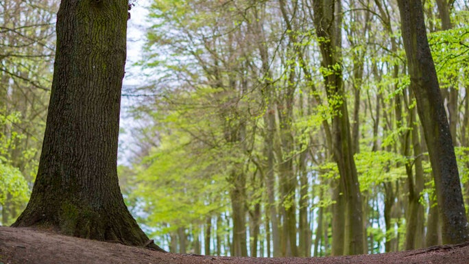
Trees at Badbury Clump | © National Trust Images/Chris Lacey Stage 4
Halfway along this field, there is a gap in the hedge to cross the main road. Do this then continue downhill along the marked footpath, this footpath has fences on either side of it.
Stage 5
Continue downhill, across a small section of board walk and turn left though a gate. Follow this field round to the left, where you will come to Great Coxwell Barn. Directly opposite the gate you have just come though, with the Great Barn on your left, go through the gate and turn right, joining Great Coxwell village’s main road.
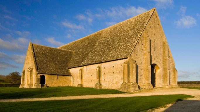
The 13th-century Great Coxwell Barn | © National Trust Images/Robert Morris Stage 6
Continue down the road through the village of Great Coxwell. After about 700m, turn right down the public footpath lane. Follow the next field straight across, keeping to the right-hand side of the hedgerow. Keep going straight along the marked path for the next 3 fields.
Stage 7
Follow the waymarkers through a small area of woodland, then cross the next field diagonally towards some farm buildings. Keep to the right around the edge of the farm buildings, the cross straight over the driveway and continue straight on, with Ashen Copse woodland on your left.
Stage 8
Keep following the path along the right hand side of the next 2 fields, then you have reached Coleshill Parkland. Carry on going straight across Coleshill Parkland, in the direction of the village. Continue straight on, with the café and carpark on your left, and cross the road with the village green on your right. Walk to the end of the lane and turn right through the kissing gate.
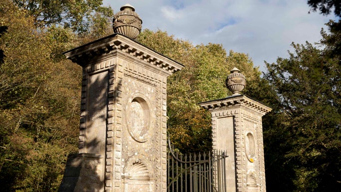
The gateposts at Coleshill Park | © National Trust Images/John Miller Stage 9
Having turned right, walk slightly up hill to the gate taking you out onto a road. Cross the road and take a slight left following the footpath onto a field. Continue to walk along the edge of the next 2 fields, coming to a section of woodland called Fern Copse. Follow the path through this woodland, crossing a bridge to bring you out the other side. Continue straight across the next 2 fields, then follow the arrows around to the left, taking you through a marked gap in the hedge.
Stage 10
Cross the next field diagonally to the right, towards a small area of trees and farm buildings. After going through the trees, turn immediately right, then left, passing through Brimstone Farm, with the house on your right. Follow the driveway down away from the farm for about half a kilometre.
Stage 11
Pass some more farm buildings on your right, then follow the track and arrows round to the right, towards Rowleaze Cottages. Pass with the cottages on your left, continuing through the next field, with beehives on your right.
Stage 12
Through the next gate, follow the path and arrows around the right-hand side of the field. Keep going until you come to a small bridge on your left. Cross the bridge and continue to follow the path adjacent to the woodland edge for approximately 1.5km.
Stage 13
Cross the next field diagonally to the right, following the waymarkers that take you down the right-hand side of a line of trees. Follow the arrows across the next 2 fields which will take you back to the tree lined path towards Faringdon, this is where you started the walk.
End point
What3Words Location: ///spenders.bandwagon.hotdog
Trail map
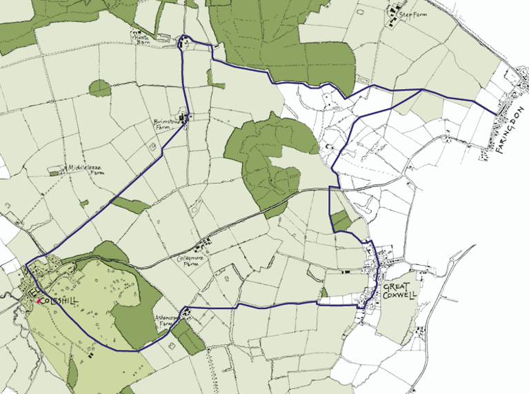
Follies, Forts and Farms Walks Map | © Bronwen Thomas


