Skip to content
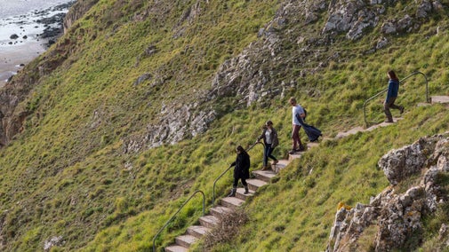
View across the Bristol Channel to Wales
Experience wildlife, archaeology and great views across the Bristol Channel to Wales | © National Trust/Jim Elliott
Somerset

Sand Point circular coast walk

On this circular walking trail, enjoy great views across the Bristol Channel to Wales, and up the Bristol Channel to the Severn bridges. An extension of the Mendip Hills, Sand Point is made of limestone with unusual volcanic intrusions and juts out into the Bristol Channel.

Total steps: 6

Total steps: 6

Start point

Sand Point car park, grid ref: ST330659

Step 1

Head out the front of the car park and bear sharply right, following a surfaced road gently uphill. Turn left before a metal barrier gate to head uphill through trees. At the top of the slope, go through the gate and turn right, keeping the fence on your right. Pass through a ruined stone wall. Head diagonally left across the grassland crossing several low banks toward a gate in the wall ahead. Go through this and the sheep fold, bearing slightly left to climb up onto a narrow ridge. Follow this until it rejoins the main track, with a surfaced access road ahead of you.

Step 2

Carry on along the track (wall on your right). Cross the surfaced access road leading down to the farm, Woodspring Priory Barn and the Priory (no access to them from this point) and bear right, slightly downhill, now with a fence to your right. Continue following this fence line to a gate and opening in the hedge on your right. Turn right through this and continue, now with trees to your left, to pass through another hedgerow and continue on to a gate in the corner of the next field, leading onto a path overhung by trees and shrubs. Follow this to emerge in Hucker’s Bow car park, next to a large concrete sluice gate.

Step 3

Take the steps to the top of the sluice structure, turning back in the direction you have just come from to pass through a metal pedestrian gate onto a raised bank. Continue along the top of the bank toward a pool on the salt marsh. There is a creek on your right. Bear left of the pool, passing through another metal pedestrian gate on your left. From here, bear right uphill, keeping the shrubs and scrub to your right, to again meet the surfaced track the served the Ministry of Defence establishment at St Thomas’s Head. Cross over this road at the end of an overgrown wall to follow another tumbledown boundary. Keep this wall on your right as you cross over the down, gradually descending toward the water. The worn track now turns left, with views over the Channel on your right.

Step 4

Follow the track, continuing straight ahead when it bears left uphill, taking you through scrub and across a grassy plateau above a secluded cove. Continue on, keeping the cliffs on your right until the path rises again, rejoining your earlier route and returning you to the sheep fold you passed near the start. Cross the wooden steps over the wall to the right of the fold, bearing right ahead of you, walking around the top of another bay following a gently sloping path (though steep in places).

Step 5

Continue past the beach, following the cliffs on your right and passing a curious conical hill to your left. If you are lucky you may spot a seal. Down to the right is a ruined shrimping hut, used up until the 1930s to boil up the catch of shrimps ready to be taken to Weston-super-Mare. The way soon opens out onto a large flat raised beach platform. Continue following the coast until it swings left, eventually bringing you to a stile at the end of a stone wall.

Step 6

Go over the stile and follow the path bearing right, very soon turning left uphill along a track. Arrive at another conical hill, a lookout during the Second World War and possibly a beacon site. Down to the right is an unusual earth bank, thought to date back to the Iron Age. Follow the path across the grass, with Sand Bay down to the right, passing two Bronze Age burial sites. Keeping the slope of the hill on your right, follow a well-worn track bearing slightly right downhill, descending into scrubby trees to a wooden gate. Continue on down the hard track, descending steps back to the car park.

End point

Sand Point car park, grid ref: ST330659

Trail map

Map showing the steps and route of the Sand Point circular coastal walk
Map showing the steps and route of the Sand Point circular coastal walk | © Crown copyright and database rights 2013 Ordnance Survey

You made it

Share your experience

Our partners

Cotswold Outdoor

We’ve partnered with Cotswold Outdoor to help everyone make the most of their time outdoors in the places we care for.

Visit website 

An aerial view of an adult and baby walking a dog along a path at Baggy Point, Devon
Article
Article

Staying safe at National Trust places 

The special places in National Trust care sometimes come with a few risks for visitors, be it coastline or countryside. Find out how to keep safe throughout your visits.

A group of people in a hiking group are being guided on a hike by rangers at Marsden Moor, West Yorkshire
Article
Article

Cotswold Outdoor: our exclusive walking partner 

Find out more about the National Trust’s ongoing partnership with Cotswold Outdoor as our exclusive walking partner.

Sunny view of a carpet of bluebells on a clifftop with a tree and the sea in the distance

Walking in Somerset 

From the majestic crags of Cheddar Gorge and the sea views at Bossington to gentle strolls through Tudor parkland at Montacute House, these are some of the best walks in Somerset.
Walkers climbing rocks against a bright blue sky with the mountains in the distance at Sugarloaf, Monmouthshire

Walking 

Explore some of the finest landscapes in our care on coastal paths, accessible trails, woodland walks and everything in between. Find the best places to walk near you.