Skip to content
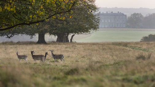
View East from Bignor Hill at dawn
View East from Bignor Hill at dawn | © National Trust/Bob Epsom
Sussex

Bridle Road to Bignor walk

Slindon is the largest traditional estate cared for by the National Trust on the South Downs and this circular walk captures its scale, depth and variety. Remaining firm underfoot and opening up new vistas through the bare trees this is a perfect winter walk.

Total steps: 12

Total steps: 12

Start point

Opposite Slindon College (five-bar gate at bottom of Butt Lane), grid ref: SU959086

Step 1

From the five-bar gate at the beginning of Butt Lane, walk steadily up towards Bignor Hill. Ignore the many left-hand tracks and turnings and either keep level, or go up-slope, and go straight or go to the right. There will be trees or a hedge to your left, while to your right the view will frequently open out over fields and downs.

Step 2

Around 2 miles (3.2 km) into the walk, the way re-enters rough woodland, opening up to your right again for the last few hundred yards up to Gumber Corner.

Step 3

You'll see the sweep of 'The Gallops' to your right. At the top you'll meet an east–west bridleway at Gumber Corner (grid ref: SU969125). Turn left here, slightly downwards, on this track into mixed woodland.

Step 4

Continue for about 55yd (50m) along the path until you see, to your left, the fence, farm gate and walkers' stile (with a dog stile) at the top of Stane Street. Mature ash and beech trees cast welcome shade in summer over a bench and grassy banks; a great picnic spot. You'll probably need to keep your dog on a lead down Stane Street – for much of the year it, and the neighbouring grassland, is grazed by sheep.

Step 5

Continue South along Stane Street, mostly downhill, for about 1 mile (1.8km), heading for Eartham Woods. As you approach the woods, Stane Street is criss-crossed with old roots.

Step 6

Through mature beeches you reach a clearing at the 'Six-Ways' signpost (where eight ways now meet). Take the way to your left, with a 'No horses' sign to its right and a waymark post to its left.

Step 7

About 270yd (270m) after a Forestry Commission barrier partially crosses the way, turn right at a signpost to your right. The increasingly chalky way goes through a dip – which in summer has a splendid show of the chalk-loving pyramidal orchid – then up the northern flank of Nore Hill.

Step 8

Turn left and uphill at the next signpost. Follow the way up Nore Hill where it becomes a forestry track across its top.

Step 9

As you come into the open, take a moment to savour the view to your east, downwards and over the rich valley of Courthill Farm.

Step 10

Keep the woods to your right for 220yd (200m) until Nore Hill Folly – there's a well-sited bench here to enjoy the panoramic views, way down to the sea.

Step 11

Take the farm track downhill, then at the T-junction adjacent Row's Barn turn away from it, down to your left.

Step 12

Just past the farmyard to your left, turn right onto Nore Hill Lane. This takes you out onto Top Road, a few metres down from your starting point.

End point

Junction of Nore Wood Lane and Top Road, near to where you started, grid ref: SU959086

Trail map

Map route for Bridle Road to Bignor walk
Map route for Bridle Road to Bignor walk | © Crown copyright and database rights 2013 Ordnance Survey

You made it

Share your experience

More near here

Sheep in the parkland at Slindon Estate, West Sussex
Trail
Trail

Slindon medieval park pale and village walk 

Discover this circular walk at the Slindon Estate in West Sussex and wander through a medieval deer park and enjoy village views.

Activities
Walking
DistanceMiles: 1.8 (km: 2.88)
Slindon folly, built in 1814 for the Countess of Newburgh's picnic parties
Trail
Trail

Nore Hill Folly walk at Slindon 

This walk around Nore Hill Folly from The George Inn at Eartham is ideal for warm days in spring, summer and autumn, with much of the route shaded by trees.

Activities
Walking
DistanceMiles: 3.8 (km: 6.08)
Enjoy the open views along the track to Littlewood
Trail
Trail

The Rise of Northwood Ramble at Slindon 

Take a walk to see the fields under the plough since the First World War, soon to be restored to woodland as part of our project 'The Rise of Northwood'.

Activities
Walking
DistanceMiles: 3.3 (km: 5.28)
Sunrise over Pillbox pond at Sheffield Park, East Sussex
Trail
Trail

Estate walk at Sheffield Park 

Explore the wider Sheffield Park estate and discover the historic and natural importance of this piece of Sussex countryside.

Activities
Walking
DistanceMiles: 3 (km: 4.8) to miles: 3 (km: 4.8)

Get in touch

Slindon, near Arundel, West Sussex

Our partners

Cotswold Outdoor

We’ve partnered with Cotswold Outdoor to help everyone make the most of their time outdoors in the places we care for.

Visit website 

Tree and fungi on Nore Hill on the Slindon Estate, South Downs, West Sussex
Article
Article

Things to do on the Slindon Estate 

Explore 3,500 acres of countryside on the Slindon Estate. From the historic village to ancient parkland and walking routes for all, there's lots to see and do.

Winter sun in the woods at Petworth House and Park, West Sussex

Walking in Sussex 

Explore coastal paths, open parkland and countryside teeming with wildlife on these top walks in Sussex.
An aerial view of an adult and baby walking a dog along a path at Baggy Point, Devon
Article
Article

Staying safe at National Trust places 

The special places in National Trust care sometimes come with a few risks for visitors, be it coastline or countryside. Find out how to keep safe throughout your visits.

A visitor carrying a backpack and walking along a footpath at Divis and the Black Mountain with stone walls either side, the countryside visible in the background.
Article
Article

Follow the Countryside Code 

Help to look after National Trust places by observing a few simple guidelines during your visit and following the Countryside Code.

Walkers climbing rocks against a bright blue sky with the mountains in the distance at Sugarloaf, Monmouthshire

Walking 

Explore some of the finest landscapes in our care on coastal paths, accessible trails, woodland walks and everything in between. Find the best places to walk near you.

A group of people in a hiking group are being guided on a hike by rangers at Marsden Moor, West Yorkshire
Article
Article

Cotswold Outdoor: our exclusive walking partner 

Find out more about the National Trust’s ongoing partnership with Cotswold Outdoor as our exclusive walking partner.

Project
Project

The Rise of Northwood 

Discover how we’ve been returning Northwood to a wooded landscape over the past decade, reconnecting woods cut off from each other after the First World War.

Visitors exploring the rocks in the Owler Tor area of Longshaw, Burbage and the Eastern Moors, Derbyshire

Outdoor activities 

Searching for a new outdoor activity to try? Discover the best places in our care for outdoor activities, including off-road cycle tracks, walking trails and lakes and coastlines for water sports.