Discovering Gayles Farm
Stride out on a walk across this iconic landscape, walking in the steps of our ancestors as you discover the fascinating history, wildlife and archaeology of this coastal site. Enjoy far reaching views towards the sea and across the Cuckmere Valley, and the wealth of wildlife that this rare chalk grassland offers.
All our houses, gardens, parks, toilets, cafes, shops and car parks are now closed to further restrict the spread of coronavirus. We urgently request people to stay local and observe social distancing - please do not travel.

Start:
Crowlink car park (TV549978)
1
After arriving at Crowlink Car Park walk over the cattle grid and down the concrete track. Walk over another cattle grid and carry on through Crowlink hamlet. At the end of the hamlet go through a gate and enter grassland. Keeping the fence on your right continue on and a little further on go through another gate. Turn right at the dew pond heading up the hill, keeping the fence on the right. Once you reach the top of the hill head towards the sea for 100m. Look for a gap on the hedge in the right, turn into the gap and go through the gate.
Crowlink hamlet as seen from the dew pond.

2
You have now arrived at Gayles Farm, keep the fence on your right (there will be an electric fence if the Exmoor ponies are grazing. When the electric fence is in place go through the temporary gates keeping the fence on your right).
Nature's lawnmowers
Exmoor ponies are an endangered native horse breed that is very hardy and suited to rough conditions and poor grazing. They are grazing here at Gayles temporarily to try and manage the tor grass, which is a rough and invasive grass that prevents the more delicate and important chalk grassland species from growing. Sheep and cattle do not like to eat tor grass but the ponies are quite happy to munch on it.

3
After a couple of ups and downs over chalk grassland you reach the bottom of the slope, follow path up the hill (heading slightly diagonally towards the sea) and keep the fence on your right. Enjoy the views out to sea on your left and towards Friston Forest on your right.
Flower rich views
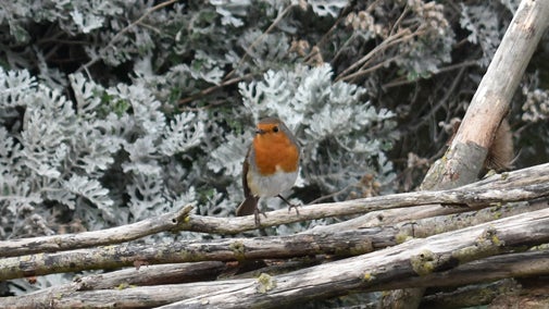
Chalk grassland is rich in plants and wildlife. On Gayles Farm there is a mixture of different habitats. To the north there is a hay meadow whilst the coastal strip is a fantastic example of undisturbed chalk grassland which is very rare. There are patches of scrub made up of gorse, elder and hawthorn which are used by birds such as linnets and stonechats for nesting places. Skylark and meadow pipits are birds that prefer to nest on the ground, and can be found in great numbers on the more open inland grassy areas. The characteristic liquid song of the skylark can be heard overhead from spring through to late summer.

4
Go through the pedestrian gate and this time keep the fence on your left. You enter an arable field through a gate - walk the field margin keeping the fence to your left. As you go through the gate the view opens up with the Cuckmere Valley in front of you. Turn right once you are in the grassland and have the fence on your right.
Wetland wonders
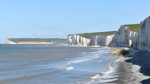
The western side of Gayles Farm provides wide reaching views over the Cuckmere valley and Seaford, and across the Seven Sisters Country Park and Chyngton Farm. On the valley floor the famous meanders stand out and you can follow the traces of old salt marsh creek and ditches. Pools and ponds have been dug and are great for wetland birds and the wet fields have large gull roosts during the winter and spring.

5
After admiring the view follow the fence around the edge of the field until you come to the corner, and then turn right. Keep the fence on your right as the field bends around. Here you will be walking the edge of the RAF Friston airfiled. Go through the wooden pedestrian gate and enter the arable field again.
RAF Friston
Walking along the northern edge of the farm you walk beside the main runway and emergency landing strip of RAF Friston and the associated hanger complex. 72 years ago you could have had the sight of a Lancaster bomber low on fuel making an emergency landing along the runway. It is now part of a large arable field which is managed with farmland birds in mind by leaving field margins and sowing bird seed plants along trackways which are used by flocks of finches in late summer and autumn feeding on the seeds.

6
At the junction of tracks, turn left taking the 2nd track towards the memorial stone with the fence on your left. As the fence line turns to the right you follow it and head towards the stile which is 75m in front off you. Go over the stile and walk towards the sea with the fence on your left. This is part of a permissive footpath that runs from the South Downs Way to Friston Forest. After a while go over the next stile heading straight on towards the sea. Then over another stile turning left to join the South Downs Way. You are now on part of the Seven Sisters Country Park, go up and down Rough Brow.
Memorial stone
RAF Friston – Along the permissive path is a memorial stone commemorating the history of RAF Friston which was operational 1940-1946. At the start of the Second World War Gayles Farm was requisitioned as an emergency landing ground for aircraft. As the war progressed aircraft hangers, gun emplacements and accommodation were built on site. From 1943-1944 RAF Friston’s position on the coast made it ideal to receive various bombers that were either damaged or low on fuel. In January 1944 alone, 68 bombers ‘belly flopped’ at Friston according to the camp log. At the same time it became a fully operational air field with its own squadron of Spitfires and up to 1400 personnel were stationed there. It supported the D-Day landings and intercepted dozens of VI flying bombs.

7
As you continue through gate you re-enter National Trust land, walk down the hill past the site of the coast guard cottages and up the next slope, then at Flagstaff Brow turn inland. Follow the track through the large kissing gate in the fence, over the top of the field and then head back to the car park. And you're back where you started....
Genuine Crowlink - a coastguard's story
Crowlink cottages; On the ground the low earth works and scattering of bluebells are all that remain visible of the coastguard cottages that occupied the site, over the years coastal erosion has removed the evidence of the gap that provided access to the beach. An engraving of 1748 showing the shipwreck Nympha Americana suggests that horses were able to access the beach. As this was a relatively undisturbed stretch of coast line, smuggling goods from the continent was regularly undertaken at Crowlink eventually giving rise to ‘genuine Crowlink’ being a benchmark for high quality brandy smuggled inland. With the risk of shipwrecks on the Seven Sisters cliff and the smuggling occurring here, a coast guard station including a watch house and cottages where built. Constructed in 1832 the station was occupied until the station was closed in 1921 when it was rented by local farm workers till it was requisitioned in 1939 by the War Office. The buildings survived up to1941 when the remains of the cottages were used for training purposes by the Canadian army.

End:
Crowlink car park (TV549978)