Skip to content
Burway Long Mynd Shropshire Rick Greswell
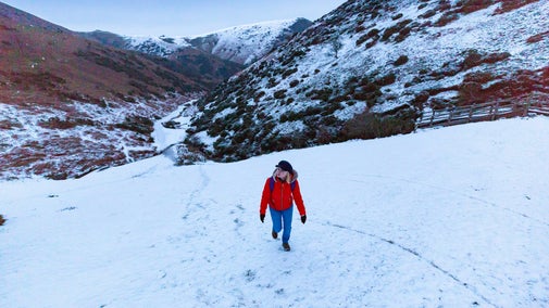
Take in the views across Shropshire and beyond from the Burway | © National Trust Rick Greswell
Shropshire & Staffordshire

The Burway Loop: a walk to the top of the Long Mynd

This challenging circular walk takes you to the head of Carding Mill Valley and up to the highest point of the Long Mynd. From the top you can take in impressive views across Shropshire and beyond.

Total steps: 10

Total steps: 10

Start point

Carding Mill Valley, grid ref: SO445945

Step 1

If you're starting from the Chalet Pavilion, follow the stream uphill to the former top car park. Continue straight ahead, on the stony track alongside the stream to the head of Carding Mill Valley.

Step 2

Where the valley forks, go right. Follow Mott's Road uphill.

Step 3

As you make your way along the path, Calf Ridge will be high up on your left. Soon you'll emerge onto the top of the hill.

Step 4

The path runs on across the moor to join a broader stony track. Go left and, almost immediately, left again, onto the ancient Portway.

Step 5

When the main track bends left, 440yd (400m) later, turn off to the right and go straight ahead on a narrower continuation of the Portway.

Step 6

Cross the road and take the path straight ahead, uphill, through the rolling heather. Half a mile on, beyond side paths to Priory Cottage and Medlicott, is Pole Bank.

View of Long Mynd from Haddon Hill at Carding Mill Valley, Shropshire
Heather on the Long Mynd | © National Trust Images/PJ Howsam

Step 7

From Pole Bank, retrace the path for 275yd (250m) to its junction with the Medlicott track and turn right, to join the tarmacked Burway Road below, beside the spring at Boiling Well.

Step 8

Go straight on along the path road. Within 110yd (100m), on the right, is a wayarked path to 'Townbrook'. Turn right here, on a grassy path, running roughly parallel with The Burway.

Step 9

Continue downhill around a low ridge, to the lip of the dramatic Townbrook Hollow.

Step 10

Follow the narrow path down the valley. Beyond the Victorian reservoir at the foot of the valley, bear left along the top of Old Rectory Wood to emerge on the Burway. Cross the road and descend the 'Burway Track' back into Carding Mill Valley.

End point

Carding Mill Valley, grid ref: SO445945

Trail map

Map of the Burway Loop walking trail, Shropshire
Map of the Burway Loop | © Crown copyright and database rights 2013 Ordnance Survey

You made it

Share your experience

More near here

A view looking across Bodbury Hill to Church Stretton in the distance, Carding Mill, Shropshire.
Trail
Trail

The Pipe Walk at Carding Mill Valley 

This walk is a great way to see some beautiful views and also to really get to the heart of 'those blue remembered hills', as mentioned in the poem by A E Housman.

Activities
Walking
DistanceMiles: 1.5 (km: 2.4)
View toward Caer Caradoc at Carding Mill Valley and the Long Mynd, Shropshire
Trail
Trail

The Long Mynd and Ratlinghope walk 

A challenging 10-mile circular walk taking in both sides of the Long Mynd, with impressive views over Shropshire and a halfway stop at the pub for refreshments.

Activities
Walking
DistanceMiles: 10 (km: 16)
View of the Lightspout Waterfall in the Carding Mill Valley and the Long Mynd, Shropshire
Trail
Trail

Lightspout Waterfall walk 

Starting at Carding Mill Valley at the heart of the Long Mynd enjoy a sometimes challenging walk along a stream to the 4-metre cascade at the picturesque Lightspout Waterfall, taking in impressive geology and wildlife along the way.

Activities
Walking
DistanceMiles: 2.8 (km: 4.48)
The Burway and Bodbury Hill at Carding Mill Valley and the Long Mynd, Shropshire
Trail
Trail

New Pool Hollow walk 

This shorter walk through the valley ends with beautiful views of the reservoir and beyond.

Activities
Walking
DistanceMiles: 0.5 (km: 0.8)

Get in touch

Our partners

Cotswold Outdoor

We’ve partnered with Cotswold Outdoor to help everyone make the most of their time outdoors in the places we care for.

Visit website 

You might also be interested in

A group of people in a hiking group are being guided on a hike by rangers at Marsden Moor, West Yorkshire
Article
Article

Cotswold Outdoor: our exclusive walking partner 

Find out more about the National Trust’s ongoing partnership with Cotswold Outdoor as our exclusive walking partner.

An aerial view of an adult and baby walking a dog along a path at Baggy Point, Devon
Article
Article

Staying safe at National Trust places 

The special places in National Trust care sometimes come with a few risks for visitors, be it coastline or countryside. Find out how to keep safe throughout your visits.

Walkers climbing rocks against a bright blue sky with the mountains in the distance at Sugarloaf, Monmouthshire

Walking 

Explore some of the finest landscapes in our care on coastal paths, accessible trails, woodland walks and everything in between. Find the best places to walk near you.

Winter dog walking at Attingham Park, Shropshire

Walking in Shropshire and Staffordshire 

Find out about the best walking routes around Shropshire and Staffordshire, including gardens, parkland and estates, ideal for family walks.