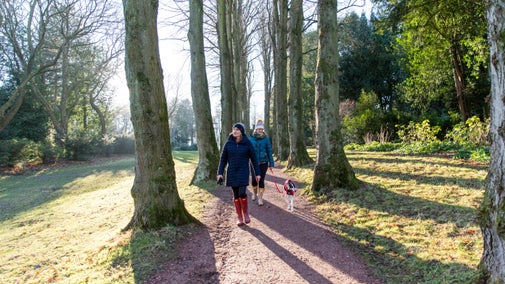
The Purbeck Ridgeway walk: Corfe Castle to the coast
Visit Corfe Castle and walk the ridge towards Old Harry Rocks. Enjoy vistas over Poole Harbour, Swanage and over the bay towards the Isle of Wight. Listen out for the whistle of the steam train and picnic amongst the tumuli on Nine Barrow Down. Walk along the beach at Swanage and return to Corfe by bus or on the Swanage Railway (when operating).

Start:
Castle View visitor centre, Corfe Castle, SY959825
1
Standing in front of the Castle View National Trust visitors centre and car park, cross the road near the bus stop and take the path ahead signposted Village Centre and Castle. Go through the gate and continue on the track with the castle to your left. Pass the remains of West Mill on your left. At the junction, follow the signs to Corfe Castle and cross the footbridge over the stream. Cross the road and go ahead along the asphalt path, keeping the castle to your left. Arrive at the entrance to Corfe Castle and the National Trust Tea Rooms and Shop. Toilets are available next to the castle ticket office.
Corfe Castle
The Norman stronghold of Corfe Castle has dominated the gateway to the Isle of Purbeck for 1,000 years. Its partial destruction during the English Civil War created a dramatic skyline which has inspired artists ever since. The castle is open daily - see website for details.

2
Leave the village Square going uphill along East Street towards Swanage, passing a pelican crossing and keeping the church on your right. Cross at the zebra crossing by Corfe Castle Primary School and continue in the same direction. Just before the Castle Inn, turn left on the public footpath down St Edwards Close. At the car park, go ahead across the grass open space towards the railway and train sign. Enter a short path and pass through the kissing gate onto the railway track - extreme caution is required as the crossing is unmanned. After crossing the railway, pass through a kissing gate. Looking over to your left you can see the railway goods yard and Corfe Castle. Go ahead down the field and exit through a gate to cross the footbridge over a stream. Bear left up the steps and continue left around the field boundary. After passing to the rear of houses the path exits onto a narrow road. Turn left and continue 100m down the road in front of houses. Immediately after passing a duck pond on your right, turn right and pass through a five bar gate.
3
Go ahead on a rising path up the side of the ridge, ignoring the fork to the right. A mobile phone mast comes into view ahead at the top of the ridge. At the mast, follow the path through the small gate in the direction marked Ulwell Ridge Path. Continue along the ridge. At the end of the field views towards Poole Harbour and Bournemouth appear on the left. Exit the field through the gate and continue along the ridge. Ignore the sign to Woolgarston and continue towards Ulwell. The path runs parallel to a field boundary on your left. Exit the field through a gate into a cattle pen and a second gate. Continue along the ridge through a gorse-covered landscape. At the fork in the path, follow the sign to Swanage, Studland along the ridge. Pass a cluster of tumuli on your left (a good spot for lunch).
Views of Poole Harbour
Poole Harbour is claimed to be the second largest natural harbour in the world and contains five islands including Brownsea, which is owned by the National Trust and open to visitors for much of the year.

4
Exit Ailwood Down (NT) through the gate. Continue ahead ignoring the sign to Studland Road. After 100m continue ahead along the ridge signposted Ulwell. At the end of the field, exit through the gate marked Purbeck Way and continue up the ridge on a track between fences. The track starts to bear right and descend. At the gate go ahead downhill through a small side gate in the direction marked Purbeck Way. On a clear day the Needles on the Isle of Wight are visible ahead. At the junction 50m after going under electric cables, go ahead down the track signposted Purbeck Way Studland Road. Two hundred metres later fork left on a path across the field to a kissing gate. Cross a short section of field and pass through second kissing gate onto a busy road. Cross the road with care and turn left, then, after 20m turn right onto a footpath by a bus stop following the signs for the Purbeck Way.
5
Go through the kissing gate and follow the path along the base of the ridge, signposted towards Old Harry. At the water works continue ahead through the kissing gate made from reclaimed City of London bollards. After 10m turn left at the cross junction up the steps signposted obelisk. Climb approximately 210 steps and cross the style to arrive at the obelisk.
The obelisk
The Victorian obelisk was originally erected to commemorate the introduction of a fresh water supply to Swanage. During World War Two it was feared it would provide a landmark for enemy aircraft and the obelisk was removed. It was returned to its former site in 1952.

6
Turn right along the ridge signposted Old Harry. Exit the fenced track onto the open ridge and continue ahead along Ballard Down. Good views of Poole Harbour and Studland to the left, the Isle of Wight ahead and Swanage to the right. At the path junction, near a stone seat, continue ahead signposted Swanage via Coast Path and Old Harry. At the five bar gate go ahead towards Old Harry along a broad track. Soon after passing an old trig point go through a gate and turn immediately right along the fence line for 25m and then right again to join the cliff path back towards Swanage. Alternatively, continue down the hill to the cliff for views of Old Harry and The Pinnacle chalk stack before doubling back. On returning, exit the path through a kissing gate and turn left down the side of the ridge towards Swanage. At this point you can see the state of the tide which will influence the later stages of the route. Follow the path down the side of the ridge and after a flight of steps, pass through a kissing gate in the direction of the Coast Path and continue to descend. Go ahead along the winding path beside field boundaries until you pass a National Trust Sign for Whitecliffe by the steps leading down to a stream. (At this point if the tide is out turn left down the path the stream to reach the beach and then turn right along the shore towards Swanage.)
Old Harry
Old Harry is the most famous of a series of stacks formed as the chalk of Ballard Down has been eroded away by the sea. Some say he was named after the Devil, others after a notorious Dorset pirate.

7
If the tide is in cross the bridge and climb the steps in the direction marked Coast Path to Swanage. At the top of the steps follow the signs across the grassy open space marked Coast Path to Swanage. Exit the open space through an alleyway between houses. At the end of the alleyway turn left along the road. Stay on this road, passing the Old Post Office, and go through the barrier gate at the end of the Ballard Estate onto a wide road. At the end of this road by Ballard Down Shop turn left onto Redcliffe Road one way system, signposted sea and town centre, Continue along this road down to the sea. Walk along the seafront, past the jetty with a clock tower, towards the Mowlem Theatre and amusement arcades.
8
Turn right up the main shopping street towards Swanage Railway Station. Trains or the number 40 bus will take you back to Corfe. The bus stop at Corfe is outside the Castle View National Trust Visitors centre.
End:
Swanage Railway Station, SZ029789