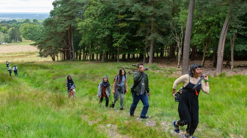
Bishopston Valley walk
Wales
A challenging walk through a hidden valley. Discover a secret world of limestone caves, underground rivers and ancient woodland and emerge from beneath the canopy onto one of Gower's most beautiful but secluded beaches. Those with keen eyes may be able to find trees such as the wild service tree.
Start point
Kittle Green, grid ref: SS573893Trail information
*A walk over stony ground with some steep climbs and descents. For further details please see the Terrain section.
**Uneven surface and muddy paths throughout the trail. For further details, please see section marked Access.
***Dogs welcome, but should be kept on leads around livestock. For further details, please see section marked Facilities.
More near here
Southgate, Hunts Bay and Pwll Du circular walk
Explore the clifftops and wooded valleys of the South Gower coast on this challenging walk, with highlights including an iron age fort and an abundance of rare plants.

Rhosili headland walk
Journey out along one of Wales's most famous cliffs with views of the golden sand of Rhosili and the rugged limestone rocks of the South Gower Coast.

Rhosili Ranger Run
Feel the wind in your hair and sand beneath your feet as you enjoy this scenic running route around Rhosili.

Get in touch
Our partners

We’ve partnered with Cotswold Outdoor to help everyone make the most of their time outdoors in the places we care for.
You might also be interested in
Walking in Wales
Explore wide open landscapes, gentler coastal strolls or energetic hikes for something a little more challenging. We've rounded up some of the best places to walk in Wales.

Staying safe at National Trust places
The special places in National Trust care sometimes come with a few risks for visitors, be it coastline or countryside. Find out how to keep safe throughout your visits.

Cotswold Outdoor: our exclusive walking partner
Learn about the National Trust’s ongoing partnership with Cotswold Outdoor. Find out how they help us care for precious places and the exclusive discount available for National Trust supporters.

Follow the Countryside Code
Help to look after National Trust places by observing a few simple guidelines during your visit and following the Countryside Code.

Visiting Rhosili and South Gower Coast
A scenic spot for coastal walks, water sports and wildlife. With 3 miles of sandy beach there’s plenty of space for the whole family to play in the sand or fly a kite.

Walking
Explore some of the finest landscapes in our care on coastal paths, accessible trails, woodland walks and everything in between. Find the best places to walk near you.

