Nare and back again
This double-loop walk offers far ranging views and a variety of beautiful scenery to enjoy. A host of highlights include Carne Beacon, a Bronze Age barrow with views across to St Agnes Beacon on the north coast; an Iron Age earthwork; a Second World War decoy bunker; a delightful wooded valley and breath-taking views from the tip of Nare Head and from the South West Coast Path. This trail weaves in and out of National Trust land. Livestock may be present at certain times of the year (points 7 - 9 and 9 - 14).

Start:
Carne car park, grid ref: SW906383
1
In the right-hand corner of the car park go over the wooden stile into a field, walking along the base of the valley away from the car park. Bear right up the hill (not over the footbridge).
2
At the brow of the hill you'll see a large, flat area, continue on from this, cross the stone stile and follow the hedgeline down the right-hand side of the field.
Ringarounds
This large flat oval area is a man-made earthwork, which probably enclosed an Iron Age homestead. Called Veryan Castle it is also locally known as Veryan Round or Ringarounds.
3
At the end of the field, go through the kissing gate, then turn right to follow a short section of minor road.
4
As the road bends to the right, cross the double stile in front of you, following the footpath across the field.
View over to Carne Beacon
The small but distinctive hill in the middle of the field is Carne Beacon.
5
Climb the short way to the top of the beacon.
Carne Beacon
There are fantastic paronamic views from this Bronze Age barrow, including St Agnes beacon on the north coast and the wide expanse of Gerrans Bay to the south. Legend has it that Gerent, King of Cornwall, was buried here about 590AD, his body having been carried across Gerrans Bay in a golden boat, powered by silver oars, which were buried with the king. An excavation in 1855 failed to verify this story of buried treasure, but a stone burial chest was discovered containing ashes and charcoal.

6
Exit the field via the stone step stile, coming out onto a minor road. Bear left along the road, towards the houses of Carne village.
7
Walk through Carne village, bearing right following the public footpath signs.
8
The road ends at an intersection of grassy footpaths; take the left hand path. Nare Head will soon come into view.
Nare Head
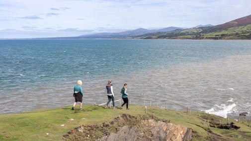
Nare Head juts into the sea, forming the eastern edge of Gerrans Bay.

9
Stay on the coast path, crossing the footbridge at the base of the valley, past the remains of Mallet's Cottage up to the right. Turn left opposite the cottage, heading inland through Paradoe Valley woods. Come out of the woods, through the kissing gate and bear left along edge of the field hedge line.
Mallet's Cottage
This stone and cob cottage was built by a fisherman called Mallet. He married a woman from Veryan but lived here at his cliff-side cottage, returning at weekends with his catch. He kept a boat in the inlet beneath his home, hauling it up clear of the waves when not in use. In the 1840s he emigrated to Australia leaving his wife behind. About 120 years later, his great grand-daughter, Tina Mallet, came to visit her roots. Hitch-hiking from Bristol, by coincidence, the driver who gave her a lift was the National Trust tenant farmer for Nare Head.

10
Go through a kissing gate, past Kiberick car park, cross the road and through the next kissing gate into a field. Follow the path down towards Kiberick cove, bear right keeping the sea on your left.
Kiberick Cove
You can see across to the Dodman, the highest point on the south coast of Cornwall.
11
Cross the wooden stile into the next field. The path is close to the cliff edge, so please keep children and dogs under close control. Continue along the path and over another wooden stile.
Gull Rock
This sparse, rocky island is uninhabited by people. But it provides a welcome home and breeding site to sea birds. Herring gulls, black backed gulls and shags can be seen regularly. During their breeding season, guillemot and razorbills can also be spotted (a good pair of binoculars helps). South of Gull Rock is a reef called the Whelps, a few pinnacles of which break the surface at low tide. Viewed from the right angle, and with imagination, the island looks like a sleeping dragon with a long tail trailing behind him.
12
Go through this field, which has a World War 2 decoy bunker and early-warning ROC observation post in it. Continue along, keeping the sea on your left, towards Nare Head.
Veryan ROC post
The underground Royal Observer Corps post was built in 1963. It was opened in July of that year with the role of taking observations of nuclear bursts and monitoring radioactive fallout, it was fully equipped with radiological equipment to do so. Above ground you can see the access hatch and ventilator turret. The Royal Observer Corps was stood down in 1991, making this and all ROC posts redundant. However, the 'bunker' is now opened a few times a year, giving a rare opportunity to see a fully-restored cold-war observation post.

13
At the waymarker turn left towards and on to Nare Head. Then follow the path down hill, back back past Mallet's Cottage and continue along towards Carne beach.
Lichen
Cast your eyes across the bay, towards Porthscatho and the eastern edge of the Lizard in the distance. But look beneath your feet to discover a microscopic world - the exposed rocks of this headland are a haven for lichen (23 species have been recorded here).
14
Stay on the South West Coast Path around Gerrans Bay. The path comes out onto the road above Carne beach, bear left downhill following the road back into Carne car park.
Carne Beach
Before returning to your car, why not kick off your shoes to feel the sand and sea between your toes.
End:
Carne car park, grid ref: SW906383