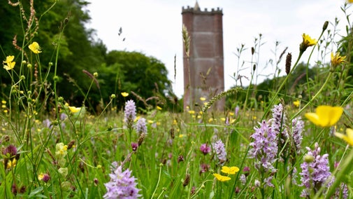
Stourhead Park Hill Camp walk
Wiltshire
This scenic circular walk takes in Park Hill Camp Iron Age hillfort and returns along Six Wells Valley. Make sure to look and listen out for nuthatches, tree creepers and long-tailed tits on the way, and enjoy the carpets of bluebells in the woodland in spring. This route may contain livestock, please follow the countryside code.
Near to
StourheadStart point
Stourhead visitor reception, grid ref: ST778340Trail information
More near here
Stourhead
Palladian house and world-famous landscape garden

Alfred's Tower walk at Stourhead
This historic circular walk takes in an Iron Age hillfort and a tower named for King Alfred the Great, with impressive views over three counties. Follow the blue way markers from visitor reception for this walk.

Bonham Wood walk at Stourhead
This gentle walk takes you behind the Temple of Apollo through the picturesque Bonham Wood, and returns along a WWII airfield. A springtime hotspot also for daffodils and bluebells. Follow the pink way markers from visitor reception for this livestock free walk.

Stourhead White Sheet Hill walk
Look out for an array of wildflowers & wildlife and take in the wide views of Stourhead estate on this challenging walk up White Sheet Hill, a site of great archaeological interest. Follow the orange way markers for this walk.

Get in touch
Our partners

We’ve partnered with Cotswold Outdoor to help everyone make the most of their time outdoors in the places we care for.
You might also be interested in
Cotswold Outdoor: our exclusive walking partner
Learn about the National Trust’s ongoing partnership with Cotswold Outdoor. Find out how they help us care for precious places and the exclusive discount available for National Trust supporters.

Staying safe at National Trust places
The special places in National Trust care sometimes come with a few risks for visitors, be it coastline or countryside. Find out how to keep safe throughout your visits.

Follow the Countryside Code
Help to look after National Trust places by observing a few simple guidelines during your visit and following the Countryside Code.

Explore the estate at Stourhead
Explore the wider countryside around the Stourhead estate. Discover an Iron Age hillfort, Alfred’s Tower and ancient woodland. Then rest a while and listen to the wide variety of birds and creatures that call this estate home.

Eating and shopping at Stourhead
Discover the best places to eat, drink, and buy gifts and souvenirs during your visit to Stourhead.

Walking
Explore some of the finest landscapes in our care on coastal paths, accessible trails, woodland walks and everything in between. Find the best places to walk near you.

Visiting Stourhead with your dog
Find out about visiting the Stourhead estate with your dog, from where you can and can't take them, to the facilities available to dog owners. Stourhead is a three pawprint rated place.

Walking in Wiltshire
From walking in the footsteps of King Alfred to exploring the county's mysterious ancient monuments, these are some of the best walks in Wiltshire.

