Skip to content

Sustainable travel in Bath and Bristol

People on mountain bicycles in Sizergh, Cumbria
People riding bicycles | © National Trust / Steve Barber

Whether you’re looking to travel by train, bus, bike or foot. Plan your day out in Bath and Bristol using greener travel options.

Travel by bus

  • Bath Assembly Rooms - The nearest bus stop is Alfred Street which stops on Belmont Road (north and south) and is a two-minute walk to the Assembly Rooms use FirstGroup buses 6, 6A or 7. Lansdown Park & Ride also stops here. All other bus routes stop in the city centre and walking takes 10 to 15 minutes from most stops.
  • Bath Skyline - Take the First Group bus services U1 from the Bath bus station/Dorchester Street towards the University of Bath. Alight at Cleveland Walk (on Bathwick Hill). Cross over Bathwick Hill to bus stop and National Trust signs.
  • Bathampton Meadows and Little Solsbury Hill - The number 3 and 13 buses run regularly from the city centre to either Morrisons where you can walk through Kensington Meadows to connect to Bathampton Meadows, or Batheaston. From Batheaston you can turn right for Bathampton Meadows or left to walk up to Little Solsbury Hill.
  • Blaise Hamlet - Bus service numbers 1, 2 and 76 run from Bristol city centre to Henbury. The bus stops on Avonmouth Way and Blaise Hamlet is approximately a 6 minute walk. Bus service numbers 3 and 4 stop at Blaise Castle, which is a 4 minute walk from Blaise Hamlet.
  • Cadbury Camp - First Bus service numbers X6 and X7 run from Bristol to Clevedon.
  • Leigh Woods - First Bus X4, between Bristol and Portishead, departs daily from Bristol Bus Station, or by the harbourside on Anchor Road. Alight at Beggar Bush Lane, from which it is a 10-minute level walk, via Valley Road, to Leigh Court.

City Sightseeing, March - October, daily. Departs from Broad Quay in the city centre, alight at Clifton Village.

  • Prior Park Landscape Garden - Buses run regularly from the city centre. Catch the FirstGroup number 2 bus from stop BK on Dorchester Street. The bus runs daily every 30 minutes. Alight the bus just in front of the Prior Park Landscape Garden entrance gate.

You can also catch the red City Sightseeing bus (Skyline route) from various locations in the city centre: Manvers St, Terrace Walk, North Parade and Great Pulteney St. Alight at Stop Q - Prior Park.

  • Tyntesfield - Bus number X6 (between Bristol and Clevedon) stops at the main entrance to Tyntesfield. Please be aware that bus numbers X9/X7 (between Bristol and Nailsea) stop at the bottom gate, which is not accessible and not recommended due to the lack of a safe footpath.

Nearby railway stations

  • Bath Assembly Rooms - The nearest station is Bath Spa (3/4 mile) and Bath Assembly Rooms is approximately a 15 minute walk. Cycle hire is available from Bath Spa and taxi services are available from the station entrance. Catch a bus from Manvers Street (opposite Bath Spa) routes 6, 6A and 7 drop-off at Alfred Street.
  • Bath Skyline - Bath Spa is the nearest station (0.8 mile) from the start of the walk (point 1 on the Skyline map). Cycle hire is available from PlusBike at Bath Spa. If travelling by bus, take the U1 or U18 from Bath Bus Station/Dorchester Street (at front of railway station), alight at Cleveland Walk (on Bathwick Hill) and cross over Bathwick Hill to find the start of the Bath Skyline Walk (behind the National Trust branded bus stop).
  • Bathampton Meadows - The closest station is Bath Spa (3.4 miles) from the Batheaston entrance. You can walk along the canal path to connect to Bathampton Meadows, hire a bike or take a bus.
  • Blaise Hamlet - The closest station is Bristol Temple Meads (4 miles). Cycle hire is available from Bristol Temple Meads and taxi services are available from the station forecourt. Bus service numbers 1, 2 and 76 run from Bristol city centre to Henbury. The bus stops on Avonmouth Way and Blaise Hamlet is approximatley a 6 minute walk. Bus service numbers 3 and 4 stop at Blaise Castle, which is a 4 minute walk from Blaise Hamlet.
  • Cadbury Camp - Nailsea and Backwell is the nearest station (2 miles). It's worth noting there are no taxi services available at the station.
  • Leigh Woods - The nearest station is Bristol Temple Meads (4 miles). From here take First Bus X4, alight at Beggar Bush Lane, from which it is a 10-minute level walk, via Valley Road, to Leigh Court. If arriving by bike, National Cycle Network Route 41 (cycle hire is available from the station). There are taxi services available from the station forecourt.
  • Prior Park Landscape Garden - Bath Spa is the closest station (1 mile). Cycle hire is available from the station, or you can walk uphill for 1 mile (very steep in parts) from the rear of Bath Spa railway station - cross the river, pass Widcombe shopping parade, turn right onto Prior Park Road at the White Hart pub and proceed uphill, following the brown signs with distance markers, you’ll find Prior Park on left.
  • Tyntesfield - Nailsea and Backwell is the nearest station (4 miles). It's worth noting there are no taxi services available at the station.

Cycle routes

The National Cycle Network (NCN) is a UK-wide network of signed paths and routes, ideal if you’re looking to reach places by bike.

  • Bath Assembly Rooms - NCN4 is within 1/4 mile.
  • Bath Skyline - NCN4 passes through Bath, follow the cycle route to the east side of the city where the cycle route joins/leaves the canal path, follow the canal path back towards the city (south) until you reach Bathwick Hill, follow Bathwick Hill uphill until you reach point 1 on the Skyline map (behind the National Trust branded bus stop on your right).
  • Bathampton Meadows - NCN4 is close to Bathampton Meadows.
  • Blaise Hamlet - NCN4 goes to Henbury.
  • Cadbury Camp - NCN41 is close, in the Gordano valley to the north. A bridleway runs across the northern edge of the site.
  • Dyrham Park - Accessible via the Avon and Wiltshire cycleways. It is worth noting the main entrance is on the A46 which is a fast and potentially dangerous road. Bicycles can be locked to railings in the car park (at your own risk). Bicycles cannot be taken into the park or garden.
  • Leigh Woods - NCN41, Bristol Pill runs to North Road, close to Leigh Woods.
  • Prior Park Landscape Garden - NCN4 is within 3/4 mile.
  • Tyntesfield - The main entrance to Tyntesfield is on the B3128, which is a major road with no cycle lanes. For the most accurate journey to the main entrance gates, please use the following postcode: BS48 1PA On arrival, please follow the signs for 'All visitors', dismounting when you reach the visitor welcome building. The Festival Way (Route 33) from Bristol to Nailsea will bring you part of the way to Tyntesfield. You can then follow the Clevedon Road or use the bridleway to enter the estate. Please note the bridle route does not have a paved surface and the bridle route is not in the care of the NT. We ask that cyclists dismount on their route through the estate from the B3130, following the signs for the visitor welcome building at Home Farm, where you'll find bike racks available.

Arriving by foot

  • Bath Assembly Rooms - Is in the centre of Bath.
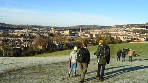
  • Bath Skyline - The closest part of the Bath Skyline to Bath city centre is at point 1 on the Skyline map, Bathwick Fields (0.9 miles from Bath Abbey). Follow Bathwick Hill uphill until you reach a National Trust branded bus stop on your right (opposite Cleveland Walk). You will see a marker for point 1. Cross the road and follow Cleveland Walk and the yellow 'Bath Skyline' arrows to start the walk. The Bath Skyline walk follows a circular path, so you can start at multiple points around the route.

Another option to reach the Bath Skyline from Bath city centre is to follow the ‘Walk to the view!’. This walk will lead you from Bath Abbey, through the city and along the Kennet and Avon Canal, and up into Bathwick Fields to join the walk at point 1 on the map. You can collect a ‘Walk to the view!’ leaflet from the Bath Ambassadors out and about in the city centre, or by emailing bathskyline@nationaltrust.org.uk. Little Solsbury Hill: from Bath follow the Kennet and Avon Canal east to Batheaston. From the village of Batheaston follow Solsbury Lane. Grid reference for the top of the hill is ST768 679.

  • Bathampton Meadows - To reach the closest entrance from Bath city centre, head east out of Bath, walk along London Road until you reach Morrisons, at the far side of the building in the car park there is an entrance to Kensington Meadows, walk through Kensington Meadows and cross over Grosvenor Bridge and the entrance to Bathampton Meadows will be on your left hand side before the railway bridge. You can also pick-up the canal path from the centre of Bath to connect to the meadows.
  • Blaise Hamlet - There are several paved roads and footpaths that lead to Blaise Hamlet.
  • Cadbury Camp - There are several footpaths from Tickenham village.
  • Dyrham Park - The Cotswold Way links Dyrham Park to Bath and various locations in Gloucestershire.
  • Leigh Woods - From the docks area of Bristol the River Avon Trail follows the river downstream, under the suspension bridge and up into Leigh Woods, via Nightingale Valley. Take the first tunnel past suspension bridge, route is then signposted.
  • Prior Park Landscape Garden - You can walk uphill for 1 mile (very steep in parts) from the rear of Bath Spa railway station - cross the river, pass Widcombe shopping parade, turn right onto Prior Park Road at the White Hart pub and proceed uphill, following the brown signs with distance markers, you’ll find Prior Park on left.
  • Tyntesfield - There are several public footpaths that connect, please see Ordnance Survey maps no. 154 or 155. Please follow the public footpath signs from the B3128 and B3130 and head to the visitor welcome building at Home Farm.
Tyntesfield House in Spring

Places to visit in Bath and Bristol

Magnificent houses, peaceful gardens, wooded trails and little-known treasures. See what the area around Bath and Bristol has to offer.