Skip to content
Weathered orthostats on the cliffs over the coast at Prawle Point, Devon.
You can find weathered orthostats at Prawle Point. | © National Trust Images/Eric McDonald
Devon

Prawle Point walk

This walk is full of drama: heart thumping clifftop climbs, with rocky raised beaches below. Look out for the sunken Demetrios below Signalhouse Point and don't miss the ancient boundary stones that dot the landscape. Call in at the Coastwatch visitor centre to find out more about this wild and beautiful landscape.

Total steps: 5

Total steps: 5

Start point

Prawle Point car park, grid ref: SX775354

Step 1

From the car park, join the South West Coast Path and turn right towards Gara Rock. Walk up the hill towards the look-out at Prawle Point, soon passing the row of coastguard houses. The Trust has been working with the local tenant to create flower rich pasture here, which is a key site for rare invertebrates including the Long-horned Bee and Mediterranean Oil Beetle which need nectar rich areas to survive.

Step 2

Continue west along the coast path, through a gate, and onto the clifftop of Prawle Point. This headland, the most southerly in Devon, has served on and off as a coastguard station and Lloyds signal station since the 1860s.

Step 3

Continue along the path as it climbs past cairns (built by walkers) and through the stone walls of ancient fields – these are protected scheduled monuments and are hundreds, if not thousands, of years old. At Signalhouse Point a late 18th-century admiralty semaphore station once stood on the summit, similar to that near Soar. Follow the path as it cuts through the rock and out over Elender Cove, with views to Gammon Head.

Step 4

Keep on the coast path, past a steep detour to Maceley Cove, and go through the gate and onto Gammon Head, taking the path up the incline.

Step 5

Continue along the cliffs to reach Pig's Nose. An unsuccessful iron mine operated here from 1857 to 1860, its cliff-face adit now hidden by gorse. Turn inland at the waymarker, up the path and through a gate. Ignore the next gate and instead turn right and head uphill, with the wall on your left. Pass through a gate into a green lane, and at the next junction of paths go straight ahead to eventually emerge onto the cliffs, alive in summer with orange tip, heath brown and red admiral butterflies, as well as crickets. Ignoring all paths down to the right, keep to the higher path until you reach a lane which leads up to the road. Turn right and back to the car park.

End point

Prawle Point car park, grid ref: SX775354

Trail map

Map route for Prawle Point, Devon walk
Map route for Prawle Point walk | © Crown copyright and database rights 2013 Ordnance Survey

You made it

Share your experience

More near here

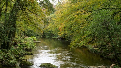
A view up the River Teign seen from the gorge walk at Castle Drogo, Devon in autumn
Trail
Trail

Teign Gorge classic circuit 

Follow the breathtaking Hunters Path high above the river Teign for chances to spot wildlife and stunning views. The path then drops down into the beautiful woodland as you follow the river back to Castle Drogo.
Activities
Walking
DistanceMiles: 4.1 (km: 6.56)
The sun shines over the ocean in the Heddon Valley
Trail
Trail

Heddon Valley to Woody Bay walk 

Take in spectacular views along the coast on this challenging walk along an historic 19th-century carriageway.

Activities
Walking
DistanceMiles: 6 (km: 9.6)
A walker in a U-shaped valley, with craggy cliff rocks up to the left, walks towards a sea with headland in the distance
Trail
Trail

East Soar to Bolt Head Walk 

Explore an easy circular walk on the South West Coast Path near Salcombe, taking in the views and beaches around Bolt Head, Starehole Bay, Overbeck's and Tor Woods.

Activities
Walking
DistanceMiles: 4.5 (km: 7.2)

Get in touch

Mill Bay car park, East Portlemouth, Devon, TQ8 8PU

Our partners

Cotswold Outdoor

We’ve partnered with Cotswold Outdoor to help everyone make the most of their time outdoors in the places we care for.

Visit website 

You might also be interested in

Visitors with a dog walking through the woodland in the summer

Walking in Devon 

From rugged coastline with captivating views to gentle woodland strolls, these are some of the best walks in Devon this winter.
A group of people in a hiking group are being guided on a hike by rangers at Marsden Moor, West Yorkshire
Article
Article

Cotswold Outdoor: our exclusive walking partner 

Find out more about the National Trust’s ongoing partnership with Cotswold Outdoor as our exclusive walking partner.

An aerial view of an adult and baby walking a dog along a path at Baggy Point, Devon
Article
Article

Staying safe at National Trust places 

The special places in National Trust care sometimes come with a few risks for visitors, be it coastline or countryside. Find out how to keep safe throughout your visits.

A visitor carrying a backpack and walking along a footpath at Divis and the Black Mountain with stone walls either side, the countryside visible in the background.
Article
Article

Follow the Countryside Code 

Help to look after National Trust places by observing a few simple guidelines during your visit and following the Countryside Code.

A person walking along the South West Coast Path at East Soar, South Devon

Walking 

Explore some of the finest landscapes in our care on coastal paths, accessible trails, woodland walks and everything in between. Find the best places to walk near you.