Skip to content
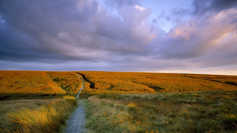
Close view of the Pennine Way path at Standedge on Marsden Moor, West Yorkshire
The Pennine Way path at Standedge on Marsden Moor | © National Trust Images/Joe Cornish
Yorkshire

Standedge circuit walk

This challenging circular walk, a large part of it on the Pennine Way, explores the varied landscapes of Marsden Moor. You'll discover valleys and reservoirs, head over open moorland with far-reaching views, and wind back to Marsden along the old packhorse route and Huddersfield narrow canal.

Watch out for livestock!

In the summer months, for your safety and to protect cattle and calves, please stay on the footpaths. Keep your dogs on a short lead at all times around livestock.

Total steps: 10

Total steps: 10

Start point

Marsden train station, grid ref: SE047117

Step 1

From Marsden train station go down Station Road turning right to cross the bridge over the river and on to Church Lane. Just after the church, before the road bends towards the main road, take the small lane opposite at the side of The Cottage. Follow this road through the tunnel under the A62 and turn right towards the roundabout with Marsden FC on the left. Go straight across at the roundabout to walk up Binn Road towards Butterley reservoir and spillway.

Step 2

Turn right off Binn Road at Butterley spillway onto the wide track marked with a public bridleway sign. Follow this track up the Wessenden valley passing Butterley and Blakeley reservoirs in turn on your right.

Step 3

At the Pennine Way fingerpost take a right to follow the Pennine Way downhill into the valley, across the footbridge and then up the steep slope on the other side.

Step 4

At the top of the slope turn right to continue along the Pennine Way along Blakeley Clough crossing the brook to walk up the steps that lead on to the moor. Continue along the Pennine way, crossing open moorland, with far-reaching views on a clear day, until you reach Swellands and Black Moss reservoirs.

Step 5

On reaching Black Moss reservoir go across the small footbridge and continue along the dam wall. Follow the flagged path around to the left (with fence line on right hand side). Continue along the flagged path, go through a wooden kissing gate and head downhill and through another gate to continue down to the meet the Pennine Way.

Step 6

At the junction with the Pennine Way, with Redbrook reservoir straight ahead, turn left along the bridleway until you reach Brun Clough car park.

Step 7

From the car park, cross over the road (A62) and follow the Pennine Way sign up the track ahead and turn left at the top. Continue until you reach the Pennine Way fingerpost and turn right through the kissing gate to follow the path uphill. Follow the Pennine Way north, passing through a field with kissing gates at either end. Please be aware that livestock graze in this field. Continue along Millstone Edge taking in views across the moors and west towards Manchester.

Step 8

At the stone waymarker, signed Oldham Way & Pennine Way, turn right to continue along Pennine Way with the fence line on your right-hand side. Follow the path towards Haigh Gutter and the A640.

Step 9

Just before reaching Haigh Gutter the road takes a sharp right across a ford and onto the footpath. This is the old Packhorse Road. Follow this path down and across the moorland with March Haigh reservoir and Buckstones to your left. At the fork with the Packhorse Road marker, continue downhill heading towards Easter Gate, taking in views of Pule Hill to your right.

Step 10

When you reach the valley bottom cross Easter Gate bridge, also known as Close Gate bridge and follow the footpath along the side of the river Colne to the road. You can follow the red waymarkers ‘Easter Gate return’ back to Marsden. Turn right off Waters Road through the gate into tunnel end nature reserve. On reaching Standedge tunnel car park head right to cross over the canal and follow the towpath alongside Huddersfield narrow canal back to Marsden train station.

End point

Marsden train station, grid ref: SE047117

Trail map

Map showing the route and steps of Standedge Circuit walk
Standedge Circuit walk | © Crown copyright and database rights 2013 Ordnance Survey

You made it

Share your experience

More near here

View of Eastergate bridge, Marsden Moor, Yorkshire
Trail
Trail

Eastergate return walk 

Take a short, linear walk along the Huddersfield narrow canal leading to a picturesque picnic spot at Eastergate packhorse bridge. It's an easy route under 3 miles that makes a great reason to get outdoors in nature.

Activities
Walking
DistanceMiles: 2.8 (km: 4.48)
View looking north from Wessenden Head towards Wessenden Reservoir on Marsden Moor Estate, West Yorkshire.
Trail
Trail

Marsden Moor heritage trail south 

Push yourself on this 8-mile circular trail which will take you above the Wessenden Valley and show you the moorland plants and birds that make the area internationally important.

Activities
Walking
DistanceMiles: 8 (km: 12.8)
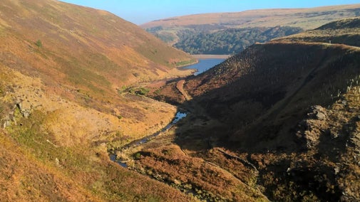
A winding path links a series of reservoirs in the Wessenden valley
Trail
Trail

Wessenden Valley walk 

Take a linear walk up the Wessenden Valley. Stride out along the track to explore this beautiful valley and discover four reservoirs along the route.
Activities
Walking
DistanceMiles: 8 (km: 12.8)
Close view of sunrise from Pule Hill, Marsden Moor, showing the mosses and grasses on the hill and the farmland and heather covered hills beyond, with the sun showing through light cloud.
Trail
Trail

Pule Hill walk 

A moderate circular walk that starts along the canal towpath before gently contouring around the sides of Pule Hill.

Activities
Walking
DistanceMiles: 4.5 (km: 7.2)

Get in touch

Marsden Moor Office and Information Room, The Old Goods Yard, Station Road, Marsden, West Yorkshire, HD7 6DH

Our partners

Cotswold Outdoor

We’ve partnered with Cotswold Outdoor to help everyone make the most of their time outdoors in the places we care for.

Visit website 

You might also be interested in

Two people walking uphill on the Marsden Moor Estate, West Yorkshire.

Walking in Yorkshire 

Discover some of the best walks in Yorkshire, from rugged Pennine beauty spots, views over the coast, to parkland and meadows perfect for a family stroll. Most are dog friendly and many can be enjoyed as part of your day out to the nearest National Trust property.
A person walking along the South West Coast Path at East Soar, South Devon

Walking 

Explore some of the finest landscapes in our care on coastal paths, accessible trails, woodland walks and everything in between. Find the best places to walk near you.

An aerial view of an adult and baby walking a dog along a path at Baggy Point, Devon
Article
Article

Staying safe at National Trust places 

The special places in National Trust care sometimes come with a few risks for visitors, be it coastline or countryside. Find out how to keep safe throughout your visits.

A group of people in a hiking group are being guided on a hike by rangers at Marsden Moor, West Yorkshire
Article
Article

Cotswold Outdoor: our exclusive walking partner 

Find out more about the National Trust’s ongoing partnership with Cotswold Outdoor as our exclusive walking partner.