Acorn Bank to Temple Sowerby walk
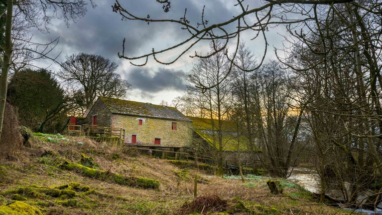
Enjoy this peaceful backwater and discover Acorn Bank’s surprising industrial heritage.
Enjoy river wildlife such as heron, salmon and crayfish
A great stopping off point close to the M6, the estate is a haven for wildlife, perhaps best known for its collection of more than 300 varieties of herbs and its traditional fruit orchards. Crowdundle Beck flows through the area, and panoramic views can be enjoyed across the Eden Valley to the Lakeland mountains.

Start:
Acorn Bank car park, grid ref: NY617282
1
Leave Acorn Bank car park and take the woodland footpath to the right downhill until you come to a wooden step style with a dog gate. Cross the stile into the field.
Acorn Bank House
Acorn Bank House nestles in the foothills of the Pennines, with the brooding mass of Cross Fell (the highest peak in the Pennine Range) rising up beyond.
2
Follow the river bank through the field. Pass through the empty gateway in the fence into the next field and continue on under the viaduct ahead, following the river on the left into another field.
Crowdundle Beck
Part of a Special Conservation Area, Crowdundle Beck is a tributary of the river Eden and forms the old county boundary between Westmorland and Cumberland. Look out for otters, crayfish, salmon, kingfishers, herons and dippers. Eden Rivers Trust (www.edenriverstrust.org.uk) is dedicated to conserving the river, its tributaries and surrounding countryside.
3
From this point you can see Great Dunfell in the distance with the Civil Aviation 'golf ball' on top. In spring there is an abundance of primroses in the woodland on the other side of the riverbank. Look out for an old walled garden on your left.
Settle to Carlisle railway
The Settle to Carlisle Line passes right through the walk and was the last railway to be built by hand, employing an enormous number of navigators. Hundreds of men died from smallpox or injury whilst constructing it. The railway passes over the impressive Crowdundle viaduct, which you will walk under just before point 3 of the walk. Built in 1873, it is 55 feet (17m) high and 86 yards (78m) long.
4
When you arrive at the old barn, go over a stile and turn right onto a tarmaced road. The church of St Edmund is on your left. The church stands in the grounds of a Pele Tower and includes later additions. Within the church you can find historical information about the De Newbiggin and Crackenthorpe families, who have lived here for more than 800 years. The village is just one of a number of Cumbrian hamlets called 'Newbiggin'.
5
Continue down the road into the centre of the village - you will see all the houses are built with local Crowdundle sandstone. At the crossroads turn right and walk towards Temple Sowerby. The farmhouse at the crossroads features a datestone from 1695.
6
Continue on the road under the railway bridge. Look out for modern industrial buildings at Kirkby Thore to the south-east. Further on, through the hedge, look out for the 'swallow holes' in the fields, where the ground has caved-in from the old mine workings. Next on your right, you will see the prefab building which used to be the engine house for the gypsum mines at Acorn Bank.
Kirby Thore gypsum mines
The modern industrial buildings you can see on your left are deep working gypsum mines. Set against the backdrop of the beautiful Pennine range, British Gypsum still operates mines at Kirkby Thore. The gypsum is used to make plaster board. The Acorn Bank estate and surrounding areas have a long history of gypsum mining and during the 19th and early-20th centuries the watermill at Acorn Bank was used to power the mines.
7
Cross the bridge over Birk Sike, a drainage ditch dug in the 18th century to drain the land for agriculture. The name Temple Sowerby means boggy or sour land belonging to the Templars. The Knights Templar owned the manor, now Acorn Bank, in the 13th century. After the road turns right, look out for a kissing gate on the left into Borough Fields.
8
Go through and follow the fence line on the right, through another kissing gate into the next field, which was once part of the old strip field system of farming. Look back now for the best view of the Pennines to the north-east. The conical hills are Dufton and Knock Pikes.
9
Go through the next kissing gate and down the alley with the walled garden to your left. This brings you straight into the village of Temple Sowerby, a traditional Westmorland village arranged around a village green. Often referred to as the 'Queen of Westmorland', it once belonged to the Lords of the Manor at Acorn Bank. The new A66 bypass has removed the heavy traffic that until recently passed through the village.
10
Turn right onto the tarmaced road. As you leave the village by Tanyard Lane (known locally as 'The Tanny'), you will see a newly-converted long building on your right, which is an old tannery. Temple Sowerby was a tanning village during the 18th century and would have been very smelly. The pigeon guano from the old dovecote (weather vane on top) was used in the process.
11
At the T-junction you will see Acorn Bank ahead, nestling under Cross Fell. Go straight ahead, through the kissing gate into the parkland and follow the old approach to the manor house. This would have been oak woodland back in 1600 and is how 'Acorn Bank' got its name. Later on, it became fashionable to create parkland featuring open views and vistas.
12
Cross Birk Sike again, passing through the kissing gate into another field you come to a metal gate beside the cattle grid. Cross the main drive into the property and go through the next gate back into the car park. You can finish off with a treat in our traditional tea-room.
End:
Acorn Bank car park, grid ref: NY617282