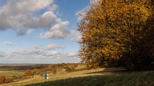
Chiltern Hills Three-in-One Walk
This is an 8.5 mile walk taking you between the fascinating historical village of West Wycombe, the unspoilt village of Bradenham and the estate of Hughenden Manor. It is also possible to use these instructions for a shorter 5.5 mile circular walk just between West Wycombe and Bradenham.
We strongly recommend using the local 1:25 000 Ordnance Survey map in addition to these instructions.


Start:
National Trust car park near St Lawrence’s Church on West Wycombe Hill at grid ref. SU827950
1
Walk away from the church to the far end of the car park, and then turn right down the lane that leads into the car park. After about 150m, and opposite a passing place and some steps, turn sharp left through a narrow gap in the hedge onto a sign-posted footpath that leads into a small area of woodland. After about 50m bear right under some yew trees until you emerge into a field, with views across the broad Saunderton Valley and the Chiltern Line railway track.
Bear left then continue straight ahead along the edge of the field with a hedge on your left. On reaching an area of woodland, continue straight ahead through the woodland for 20 minutes (1 km) until you reach a signposted T-junction. Turn right to pass a large old chalk pit on the right then continue following the track. Large areas of woodland to the right of the track have recently been clear felled and replanted, opening up very good views (for now) over Bradenham Valley and Village. About 12 minutes (600 metres) after the turn you reach the buildings at Nobles Farm.
2
Turn right opposite the entrance to Nobles Farm, following a path that heads steeply downhill through woodland. Just after a wooden gate, you will enter a field and you will see the village of Bradenham ahead of you. Continue downhill, following the edge of the field. On reaching the bottom corner of the field, the path turns right through a narrow, rather overgrown gap to a gate. After passing through the gate, turn right along the edge of a field and go through another gate. Turn immediately left, across the narrow field, to reach a track that heads under the railway line. As you reach a gate on the other side of the underpass, you will see a field gate ahead of you. Head towards this and go through a smaller metal gate on the right of the field gate that leads onto the A4010 main road. Take great care crossing this busy road and then turn right. At the Red Lion former public house, now a welcoming café, cross Bradenham Wood Lane towards an old-fashioned, red telephone kiosk that houses a defibrillator. Turn left into Bradenham Wood Lane, following the narrow roadside pavement until you reach the village green. Here take a footpath that heads across the green towards a track that runs along the right side of the green. At the corner of the green, just past the cricket pavilion, you will reach the National Trust car park for Bradenham Village (SU828970).
Bradenham Village
Bradenham is an unspoilt Chiltern village with cottages clustered around a village green and its notorious sloping cricket pitch. The village name is Anglo-Saxon and means 'broad enclosure', referring to the fact that the village sits in a broad valley among the surrounding Chiltern Hills. In the Domesday Book of 1086, the village was recorded as ‘Bradeham’. The majority of cottages are 18th century, and the area around the green has been designated a conservation area, with 18 listed buildings. The entire village of Bradenham is now in the care of the National Trust. The parish church of St. Botolph was restored in 1863 by G.E. Street, although the south door dates from the early Norman period and is reputedly the oldest church doorway in Buckinghamshire. The earliest part is the nave, dating from 1100. The remainder of the building dates from the fourteenth century onwards, the north chapel being added in 1542. In the medieval tower hang two of the oldest bells in England, which were cast in about 1300. The Church contains a tablet to Isaac D’Israeli and his wife, both of whom lie at rest here. The building stones are local, consisting of flint with some sarsen stones and Portland Limestone (from North Bucks).

3
From the National Trust carpark by the cricket pavilion, follow the track away from the village green that heads uphill to the right of the wall at the corner of Bradenham Manor. After the second corner, take the left fork and continue along the track alongside the wall to the Manor House. After 80 metres, follow the track as it curves to the right and head uphill through woodland. You will pass some houses on your right. 60m beyond a signboard about ‘The Clumps of Naphill Common’, leave the track (which curves to the right) and continue straight ahead on a narrow footpath until you reach a second signboard showing your location on the edge of Naphill Common.
Naphill Common
Naphill Common is a 71.1 hectare Site of Special Scientific Interest. It consists of common land, with commoners' rights to estovers (the right to collect constructional materials), grazing (for cattle and swine) and firebote (the right to collect firewood).This oak and beech wood is thought to be the most natural of all the Chilterns woodlands. It has a diverse range of trees and shrubs, areas of acid heath, wet rides and ponds. Many of the oaks and beech trees are ancient pollards, and they provide an important habitat for invertebrates and lichens. Heathland clearings have some species which are uncommon in the county, such as heath bedstraw and common heather.

4
Continue in the same direction on the path to the right of the signboard. On reaching a crossing path, turn right again to follow a path that runs parallel to the edge of a field. After 3 minutes (180 metres), just before a plantation of Christmas trees, turn left on a downhill fork and then turn right through a gate. Follow the path through Great Cookshall Wood for about 20 minutes (1 km), ignoring crossing tracks. On reaching the Cookshall Farm buildings, continue straight ahead on a track, keeping the buildings to your left. From here, you will see expansive views back towards West Wycombe Hill. When the track reaches a T-junction, head straight ahead through a gate into a wood to a footpath that curves immediately to the left, then heads downhill to meet a crossing track.
(If you wish to do the shorter walk of 5.5 miles (8.5 km) cutting out Hughenden Manor, turn right here, following the path downhill until you reach a narrow country lane. Turn left on the lane and follow it for 4 minutes (200 metres) until you reach a private car park on your right by some buildings. Now go straight to instruction 9.)
5
At the crossing track, turn left, heading gently uphill through woodland until you reach a kissing-gate. Follow the path across a field to another gate. After the gate, turn right for 2 minutes (100 metres) and then turn left passing a pond on your right. After a further 2 minutes (100 metres) you will reach a small parking area at the end of Hunt’s Hill Lane. Follow Hunt’s Hill Lane downhill.
6
After about 7 minutes (340 metres), turn right into a field, following the public footpath sign to Hughenden Manor. The path follows a dry valley downhill and, after passing through a gate, it continues into Flagmore Wood. Just before the path reaches another gate into a field, turn left up a short climb. At the T-junction at top of the slope turn right, following the signpost to Hughenden Manor & Tea Room. Follow this path along the edge of Echo Valley, with distant views towards High Wycombe town centre, and then straight ahead through woodland until you reach a short, steep slope and then a narrow road between two brick and flint walls taking you to Hughenden Manor.
Hughenden Manor
Hughenden Manor is a red brick Victorian mansion. In the 19th century, it was the country house of the Prime Minister, Benjamin Disraeli, 1st Earl of Beaconsfield. The Manor of Hughenden is first recorded in 1086, when formerly part of Queen Edith's lands it was held by William, son of Oger the Bishop of Bayeux. The estate exchanged hands may times and by 1816 the manor and lands were owned by John Norris, a distinguished antiquary and scholar. Disraeli bought Hughenden in 1848 and he had the house remodelled by local architect Edward Buckton Lamb. Today, Hughenden is owned by the National Trust and fully open to the public. There is a restaurant, a shop and toilets in the Stableyard, opposite the entrance to the Manor House. Entry to the house is free to National Trust members.

7
From the entrance gate to Hughenden Manor, facing the Stableyard, turn left to retrace your steps, following a narrow road between two brick and flint walls. At the end of the road, head straight ahead down a steep slope. At the next junction, fork left, following the signpost towards Downley. Follow the path downhill towards a set of gates and then along the bottom of Echo Valley. On reaching Common Wood, continue straight ahead until you reach a major junction of footpaths by a National Trust sign for Hughenden Estate Manor Farm. Turn right uphill to the left of a ditch, then bear left away from the ditch where the path forks. As you emerge from the woodland continue straight ahead until you reach the cricket pitch on Downley Common.
Downley Common
In Anglo-Saxon times Downley meant a clearing on the hill (down meaning ‘hill’ and ley ‘clearing’). It is now one of the few Chiltern commons that has not become completely wooded. The common was once part of an Anglo-Saxon ‘tithing’: a group of ten dwellings. For many centuries, clay chalk and flint have been extracted from many places on the common, this has left behind pits, called dells, some very large and deep. The clay was probably extracted to make bricks and tiles. During the Second World War, the Army used the common to test and repair Churchill tanks, which were assembled at Broom and Wade’s factory in Bellfield Road, High Wycombe. At the top of the common, next to the cricket pavilion, there is a small blacksmiths Forge that was in use up until the early 1990s. Downley Common also plays host to a number of sports clubs, including Downley Cricket Club and Downley Albion Football Club.

8
Either cross the common, or if a football match or cricket match is in progress, turn right to skirt around the northern edge of the common until you reach the Downley Sports Pavilion on the opposite side. Take a footpath to the right of the pavilion. Go through a gate to the left of Blacksmith’s Cottage and then follow the path with a hedge on your right. Head towards another metal gate, near the base of a wooden electricity pylon, and enter the West Wycombe Estate. Follow the path along the right edge of the field until it enters an area of woodland by another wooden electricity pylon. The path now heads downhill through the woodland to reach a crossing path in the bottom of a valley. Turn left and follow the path downhill until you reach a narrow country lane. Turn left on the lane and follow it for 4 minutes (200 metres) until you reach a private carpark on your right by some buildings.
9
Cross the carpark towards a green public footpath sign under a large tree to the left of the buildings. Follow the footpath downhill across a field until you reach a crossing track. Cross the track, taking the path opposite that heads briefly uphill through some scrub woodland and then along the right hand edge of a field. Follow the path towards and then under the railway line. On the other side of the railway, take the path that heads half left across a field towards the A4010 road. Taking great care, cross the road and go through the kissing gate opposite. Follow the right hand edge of the field to another kissing gate and then continue uphill along the left hand edge of the field until you reach a road. Turn left down Church Lane, keeping straight ahead when the main road bends right, until you pass beneath the Church Loft to reach the main A40 road.
West Wycombe Village
There has been a village at West Wycombe for at least 1000 years and many of the cottages date back to the 16th and 17th centuries. In the 18th Century, the High Street had up to 17 coaching inns, as it was the halfway stop off point for the London to Oxford stagecoaches. The Church Loft is the oldest building on the High Street, a part of which was used as a lockup. The remains of the old stocks are still underneath the clock today. The other part of the building was a pilgrim’s rest house. Whilst some buildings were altered in the 18th century, they still retain much of their original timber-framed structure. In 1929 the buildings were in extremely poor condition and were saved from demolition by the Royal Arts Society, which acquired the major part of the village, and undertook an extensive programme of repairs. The village was handed to the National Trust in 1934 and was the first village to be acquired by the organisation. If you would like to learn more about the historic buildings in West Wycombe, guidebooks are available in many of the local shops

10
Turn right and follow the pavement along the High Street. At the end of the High Street, you will be opposite the entrance to West Wycombe House.
11
Turn right into Chorley Road, then immediately right again into Church Lane. There is a paved path parallel with the narrow lane until you reach the far side of primary school. Continue up Church Lane until you reach the entrance to the Hell Fire Caves on your left.
Hellfire Caves
Francis Dashwood (2nd Baronet), had the caves built to relieve serious local unemployment caused by three successive harvest failures between 1748 and 1750, and to provide material for a new main road between West Wycombe and High Wycombe. Dashwood was co-founder of the notorious Hellfire Club, which held meetings in the caves. Members of the Club included William Hogarth, John Wilkes, Thomas Potter and John Montagu, 4th Earl of Sandwich. Benjamin Franklin, a close friend of Dashwood, visited the caves on more than one occasion. The caves consist of a long winding tunnel a quarter of a mile into the hill with all sorts of chambers and divided passages leading off it, including a huge Banqueting Hall, allegedly the largest man-made chalk cavern in the world. The design is clearly symbolic and is thought to have been influenced by the Eleusinian mysteries of ancient Greece, which Dashwood would have learned about on his Grand Tour. Since 1951 the Caves have been open to the public and some of the profits have benefitted various charities, including the National Trust, to help pay for restoration and maintenance work in West Wycombe.

12
From the small car park in front of the caves, take a path that heads steeply uphill to the right of the iron gates to the Hellfire Caves. After 50 metres, turn left onto a broader uphill path that heads towards the flint-built Dashwood Mausoleum. From the Mausoleum, you will see fine views of West Wycombe House and West Wycombe Park.
Dashwood Mausoleum
The Mausoleum is an unroofed hexagonal structure, formed by a series of linked triumphal arches, which was built from local flint in 1765 by John Basstard the younger of Blandford at a cost of £495 5s 3d. In the centre stands a pedestal and urn dedicated to Dashwood's wife, Ladyle Despenser (d.1769); a wall plaque commemorates his mother (d.1710) and stepmother (d.1719); and three inscriptions in the frieze refer to Dashwood himself, his friend, Dodington, and his uncle, the 7th Earl of Westmorland. There is also an urn containing the heart of the poet, Paul Whitehead, who was also steward of the Hellfire Club.

13
On reaching the Mausoleum, turn right, following a path towards the West Wycombe War Memorial on the edge of St Lawrence’s Church’s churchyard. Follow the concrete path through the churchyard. On your left is the entrance to St Lawrence’s Church, at the base of the church tower. Turn right, through a gate, to reach the car park where you started the walk.
West Wycombe Hill and St. Lawrence's Church
West Wycombe Hill has been continuously inhabited for many centuries. A Bronze Age settlement is thought to have existed here, and research suggests there was a pagan temple in a similar style to Stonehenge. A Roman settlement later occupied West Wycombe Hill. The site was also occupied by the Saxons, who established a settlement named Hæferingdune (Hill of Hæfer's people in Old English). The name later evolved into Haveringdon. A church is said to have been erected by St Birnius (who later became the bishop of the West Saxons in AD 635). A Norman watch tower is also said to have been built on top of the hill. By the 18th century the village had been re-sited in the valley along the Oxford Road, and renamed West Wycombe. By the mid-18th century Haveringdon had all but disappeared, and the village church was remodelled by Francis Dashwood and renamed Saint Lawrence's. The spectacular 18th century design was completed by the mid 1760s. The tower was raised to make it more visible from a distance, and it was crowned with the wooden golden ball that was reputed to be a meeting place for the Hellfire Club. The golden ball could seat 10 and was described by the author John Wilkes as “the best globe tavern I was ever in”. The interior of the Church is equally magnificent. The design of the nave is said to have been derived from Robert Wood’s prints of the ancient Temple of the Sun in Palmyra; it has five arched windows of timber on each side, and is lined with engaged Corinthian columns under a continuous entablature. The painted ceiling is by Giovanni Borgnis, and there is spectacular Rococo plasterwork, on the ceiling, frieze and walls.

End:
National Trust car park near St Lawrence’s Church on West Wycombe Hill at grid ref. SU827950