Craflwyn, Hafod y Llan and Llyn Dinas walk
Wales
This route starts and finishes at Craflwyn, but allows you to explore much of the wider Nant Gwynant valley. Take in the wild and lonely heath and ffridd beneath Yr Aran, the lower slope of Wales' highest peak, Yr Wyddfa (Snowdon), amazing waterfalls of Afon Cwm Llan and the stunning Llyn Dinas lake. Along the way you'll learn about this fascinating landscape and how we're protecting it.
Near to
Craflwyn and BeddgelertStart point
Craflwyn National Trust car park, grid ref: SH600489Trail information
Be prepared for a day in the mountains
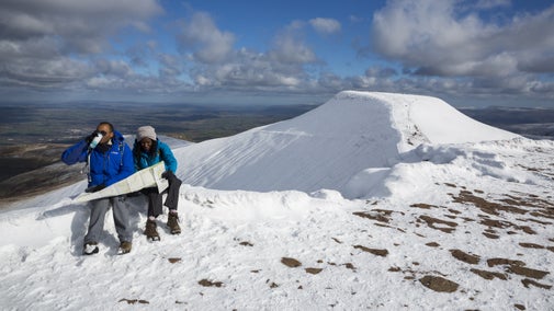
Only part of this route is waymarked, so please ensure you have a map and compass with you, check the weather before setting off and be prepared for a day out in the mountains. The route also takes you through several farms, therefore you are likely to encounter livestock.
More near here
The legendary trail of Dinas Emrys
Enjoy a pleasant walk past waterfalls and through beautiful oak woodland to reach this summit of this legendary hill, where Merlin once trod and where a dragon still sleeps.

Gelert's grave walk
This walk leads you from the village centre, along River Glaslyn's banks to Gelert's grave site. You'll also discover the legend of Gelert & Prince Llywelyn which gave the village its name.

Aberglaslyn, Llyn Dinas and Cwm Bychan walk
Explore Aberglaslyn gorge, the waters of Llyn Dinas, the beautiful village of Beddgelert and Cwm Bychan copper mine on this challenging route in Eryri (Snowdonia).

Craflwyn Ranger Run
Discover a landscape steeped in legend and rich in history as you run the ranger's route and learn about some of the work carried out in the area, to help keep it special and rich in wildlife.

Get in touch
Our partners

We’ve partnered with Cotswold Outdoor to help everyone make the most of their time outdoors in the places we care for.
You might also be interested in
Walking in Wales
Explore wide open landscapes, gentler coastal strolls or energetic hikes for something a little more challenging. We've rounded up some of the best places to walk in Wales.

Cotswold Outdoor: our exclusive walking partner
Learn about the National Trust’s ongoing partnership with Cotswold Outdoor. Find out how they help us care for precious places and the exclusive discount available for National Trust supporters.

Staying safe at National Trust places
The special places in National Trust care sometimes come with a few risks for visitors, be it coastline or countryside. Find out how to keep safe throughout your visits.

Follow the Countryside Code
Help to look after National Trust places by observing a few simple guidelines during your visit and following the Countryside Code.

Things to see and do at Hafod y Llan
Discover things to do at Hafod y Llan farm, Eryri (Snowdonia), Wales on the slopes of Yr Wyddfa (Snowdon) including walks and nature to see.

The history of Hafod y Llan
Find out about the rich history of Hafod y Llan farm in Eryri (Snowdonia), Wales starting in the 12th century.

Walking
Explore some of the finest landscapes in our care on coastal paths, accessible trails, woodland walks and everything in between. Find the best places to walk near you.

Holiday cottages in Eryri (Snowdonia)
With its towering mountains, deep gorges and pristine lakes, Parc Cenedlaethol Eryri (Snowdonia National Park) is an ideal holiday destination for outdoor enthusiasts and nature lovers alike. Stay at one of our holiday cottages in Eryri (Snowdonia) and explore this special part of Wales.


