Skip to content
Signpost and stile on Ditchling Beacon, East Sussex
Signpost and kissing gate at Ditchling Beacon | © National Trust Images/Gary Cosham
Sussex

Walk through history at Ditchling Beacon

Uncover secrets from thousands of years of history on this short but steep walk around Ditchling Beacon. Discover the remains of an Iron Age hillfort, evidence of early industry and ancient farming trackways as you learn how to read the lumps and bumps in the ground beneath your feet.

Total steps: 6

Total steps: 6

Start point

Ditchling Beacon car park, postcode: BN6 8XG.

Step 1

Head west on the South Downs Way from Ditchling Beacon car park and go up the ramp through the gate into Ditchling Beacon Nature Reserve (Sussex Wildlife Trust). You will see the site of an Iron Age hillfort. Although extensive ploughing has damaged the bank and ditch earthworks, there are still a few remains of the former structure discernible.

Step 2

Walk through the hillfort and look out for a sandstone boundary stone that marks the boundary between Ditchling and Westmeston Parishes. Ahead you'll see the Ditchling Ordnance Survey trig point.

Step 3

A grassy path splits off from the flint track on your right-hand side – take this path and walk over the brow of the hill. Go through the kissing gate into Ditchling Down and then turn right downhill. Take care on the steep path.

Step 4

Cross over the stile in front of you and, after a short stretch, go through a kissing gate on your left. Cross over another stile and then turn right over one more stile before heading down some steps into a big field. Head towards the newly planted hedge in front of you and, with it on your right, walk to the end of the field.

Step 5

Go over the stile in front of you, turn right on to Burnthouse Bostal and climb up the scarp slope to the top of the Downs. The sunken track is bounded by coppiced and pollarded Ash trees. The track opens up and, as it bends to the right, keep following it up the slope. When you get near the top of the slope, keep the bushes to your right and 100m further on you'll reach a gate. Go through this, turn left and you are now back on the South Downs Way.

Step 6

Walk on till you reach another gate. Look out for Burnthouse dewpond on your right and, a bit further on, you'll see a burial mound on your left. As you carry on walking back towards the car park you'll see another dewpond along with some Anglo Saxon burial mounds before reaching a gate that takes you back into the Sussex Wildlife Reserve. Keep on the South Downs Way until you reach Ditchling Beacon car park.

End point

Ditchling Beacon car park, postcode: BN6 8XG.

Trail map

Map of the walk route
The route map | © Crown copyright and database rights 2013 Ordnance Survey

You made it

Share your experience

More near here

A view across Blackcap on the Ditchling to Ashcombe Bottom walk
Trail
Trail

Ditchling to Ashcombe Bottom walk 

A 6-mile walk across the South Downs in Sussex from Ditchling to Ashcombe Bottom.

Activities
Walking
DistanceMiles: 6 (km: 9.6)

Get in touch

Our partners

Cotswold Outdoor

We’ve partnered with Cotswold Outdoor to help everyone make the most of their time outdoors in the places we care for.

Visit website 

You might also be interested in

A view the footpath at Ditchling Beacon with visitors walking in the distance and sunlight hitting the grass and trees.
Place
Place

Ditchling Beacon 

Panoramic views from the top of world

East Sussex

Fully open today
Misty view across the Sussex Downs at dawn from Ditchling Beacon, East Sussex
Article
Article

Things to see and do at Ditchling Beacon 

Close to Brighton, Ditchling Beacon is the highest point in East Sussex. Come for the views, the wildlife, picnics, walks, kite-flying and the remains of an Iron Age hillfort.

Walkers climbing rocks against a bright blue sky with the mountains in the distance at Sugarloaf, Monmouthshire

Walking 

Explore some of the finest landscapes in our care on coastal paths, accessible trails, woodland walks and everything in between. Find the best places to walk near you.
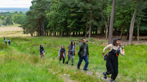
Ancient trees on the walk up to Croft Ambre Croft Castle, Herefordshire.
Article
Article

Places to walk inspired by myths and legends 

Discover tales of treasure guarded by dragons and mischievous imps that lead travellers astray at these places you can go for a walk selected for their links to local myths and legends.

Visitor walks along a dirt path at Godolphin Hill on a summer's day
Article
Article

Hill and mountain walks 

Discover a range of memorable and historic trails from around the UK, suitable for families, nature lovers, seasoned adventurers or relaxed ramblers.

A group of people in a hiking group are being guided on a hike by rangers at Marsden Moor, West Yorkshire
Article
Article

Cotswold Outdoor: our exclusive walking partner 

Find out more about the National Trust’s ongoing partnership with Cotswold Outdoor as our exclusive walking partner.

An aerial view of an adult and baby walking a dog along a path at Baggy Point, Devon
Article
Article

Staying safe at National Trust places 

The special places in National Trust care sometimes come with a few risks for visitors, be it coastline or countryside. Find out how to keep safe throughout your visits.