Birds, rocks and seals walk at Marloes
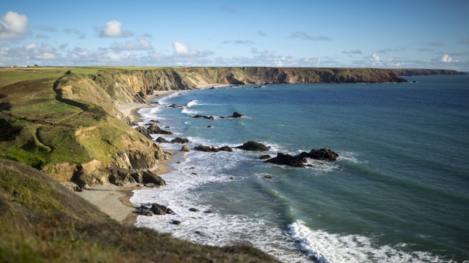
A circular walk around the Marloes Peninsula, with its sandstone rocks on the south side and volcanic rocks on the north side. Enjoy great views of Pembrokeshire’s islands and a sea teeming with wildlife.

Start:
Marloes Sands car park, grid ref: SM789082
1
From the south end of Marloes Sands car park turn right by the emergency phone, following signs to YHA and toilets. A short distance past the toilets, take a path to the left, through a self-closing gate signposted to the beach. At the next self-closing gate, the islands of Skokholm and Gateholm come into view.
2
On reaching the coast path, you'll see Marloes Sands to your left. Turn right and continue towards Gateholm Island. As you come level with Gateholm, Skokholm is ahead of you, with Skomer coming into view on the right.
Marloes Sands
This popular beach is covered at high tide. Gateholm Island, to your right, is a prehistoric settlement only reachable at low tide.
3
Continue along the coast path and through the Iron Age fort. Enjoy the dramatic sedimentary rock formations along the coast. Skomer Island and Midland Isle gradually come into view. Grassholm, white with gannets in summer, can be seen on the horizon from the Iron Age fort.
4
At a footbridge, shortly before a white cottage, take the left fork towards more Iron Age ramparts. Follow the path round the coastline of the Deer Park.
5
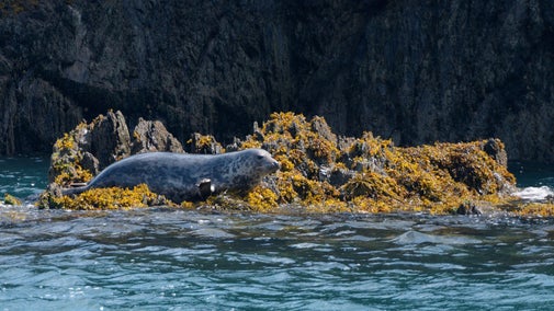
The treacherous waters of Jack Sound lie between Deer Park and Midland Isle, while Wooltack Point offers spectacular views across St Bride's Bay. Seal pups can be spotted on the small beaches at the west end of Deer Park in late summer and Jack Sound is a popular haunt for porpoises.
The Deer Park
There were never deer in Deer Park but it's an important Iron Age fort, as well as an exciting coastal landscape. It's the best place to spot baby seals in late summer.
6
There are wonderful panoramic views from the former Coastguard Hut, which is now used by the National Coastwatch Institute. Leave Deer Park by the path down through the ramparts of the Iron Age fort and through the gate.
7
Turn left towards Martin's Haven and the Skomer embarkation point. Just before the beach, follow the coast path right and up the steps.
Martin's Haven
The tiny harbour is the departure point for Skomer Island. It's also the base for the Skomer Marine Nature Reserve currently one of only two in the UK (the other being Lundy).
8
The path continues east - with St Brides Bay to the left and West Hook Farm to the right. Enjoy the magnificent views across St Brides Bay towards Newgale, the Solva Coast, St Davids Peninsula and Ramsey Island.
9
After just over a mile, leave the coast path. Turn right through a self-closing gate and a 'West Hook Farm' National Trust omega sign. Then cross three fields to the road.
10
Turn left and walk along road past Trehill Farm. 440yd (400m) past the farm, turn right by two semi-detached cottages and down the track leading back to the car park. 110yd (100m) past the turning, a track to the right leads to a hide overlooking Marloes Mere.
End:
Marloes Sands car park, grid ref: SM789082