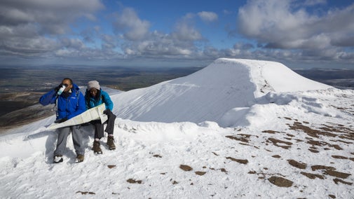
Bannau Brycheiniog (Brecon Beacons) horseshoe ridge circular walk
Wales
Try this challenging circular upland mountain walk with the National Trust in the heart of the Bannau Brycheiniog (Brecon Beacons), Wales. Experience far-reaching views towards Pen y Fan into the Cwm Sere valley. Look out for a Bronze Age burial cairn and evidence of military firing ranges.
Start point
Taf Fechan car park, grid ref: SO038169Trail information
*Come prepared for unpredictable mountain weather. A map and compass, waterproofs, and a whistle and torch are all essential for this walk, as the weather is very changeable in these mountains. For further details, please see Terrain section
**A challenging upland walk that includes steep climbs and a flat ridge, walking on made and unmade footpaths.
Prepare for unpredictable weather
A map and compass, waterproofs, and a whistle and torch are all essential for this walk, as the weather is very changeable in these mountains
More near here
Pen y Fan and Corn Du circular walk
Follow this strenuous, circular mountain walk on well-made footpaths to the summit of Pen y Fan and Corn Du in the Brecon Beacons.

Henrhyd Falls and Nant Llech walk
Explore the Graig Llech Gorge and tranquil Nant Llech Valley on this adventurous Bannau Brycheiniog (Brecon Beacons) walk to see the highest waterfall in South Wales.

Upper Tarell Valley walk
This 5-mile walk along an 18th-century track is packed with history, passing the remains of farmsteads once inhabited during the heyday of the coach road. Enjoy wildlife and views of Craig Cerrig-Gleisiad National Nature Reserve in the Bannau Brycheiniog..

Get in touch
Pont ar Daf car park (access to Pen y Fan), Near Storey Arms, Libanus, Powys, LD3 8NL
Our partners

We’ve partnered with Cotswold Outdoor to help everyone make the most of their time outdoors in the places we care for.
You might also be interested in
Walking in Wales
Explore wide open landscapes, gentler coastal strolls or energetic hikes for something a little more challenging. We've rounded up some of the best places to walk in Wales.

Exploring Pen y Fan and Corn Du
Lose your head in the clouds as you climb Pen y Fan and Corn Du, the two highest peaks in southern Britain. This is one of the most recognisable skylines in the UK. Discover wild walks and scenery in the remote heart of Bannau Brycheiniog (Brecon Beacons).

Visiting Henrhyd Falls and Graig Llech Woods
Discover Henrhyd Falls and watch the waterfall plunge into the heavily wooded gorge of the Nant Llech. The surrounding Graig Llech Woods are a haven for mosses and lichen. This natural green space is also enjoyed by birdwatchers due to the wide variety of woodland birds.

Cotswold Outdoor: our exclusive walking partner
Learn about the National Trust’s ongoing partnership with Cotswold Outdoor. Find out how they help us care for precious places and the exclusive discount available for National Trust supporters.

Staying safe at National Trust places
The special places in National Trust care sometimes come with a few risks for visitors, be it coastline or countryside. Find out how to keep safe throughout your visits.

Follow the Countryside Code
Help to look after National Trust places by observing a few simple guidelines during your visit and following the Countryside Code.

Walking
Explore some of the finest landscapes in our care on coastal paths, accessible trails, woodland walks and everything in between. Find the best places to walk near you.


