Become a member
Join today and help protect nature, beauty and history – for everyone, for ever. Enjoy access to more than 500 places with National Trust membership.
Explore the diverse landscape of the Brecon Beacons
Pont ar Daf car park (access to Pen y Fan), Near Storey Arms, Libanus, Powys, LD3 8NL
| Asset | Opening time |
|---|---|
| Countryside | Dawn - Dusk |
| Ticket type | With Gift Aid | Without Gift Aid |
|---|---|---|
| All day: | £7.50 |
| Ticket type | With Gift Aid | Without Gift Aid |
|---|---|---|
| All day: | £10.00 |
| Ticket type | With Gift Aid | Without Gift Aid |
|---|---|---|
| All day: | £12.00 |
Free parking at NT car parks for NT members and Blue Badge holders. Main National Trust car park at Pont ar Daf, off A470: £7.50 per car, £10 per motorhome/minibus, £12 per coach. Cwm Gwdi car park (OS: SO024248): £4 per car, £8 motorhomes/minibuses. Alternatives not all National Trust
Welcome on leads, please be aware of livestock
22kW electric vehicle charging points are available in the main car park. Chargers can be accessed using mobile app, RFID card, or contactless payment device. Visit our EV charging provider RAW Charging’s website to download the app before your visit. Chargers are only available to visitors during property opening hours.
Electric vehicle charging point - more informationParking: There are designated accessible parking bays available at Pont ar Daf, providing improved access for visitors with mobility needs. While Cwm Gwdi car park does not have marked accessible bays, it is level and surfaced for easier use. Pathways and Open Spaces: Access to the area is via gates or stiles. Mountain paths vary in slope and surface, ranging from grassy trails to gravel and stone-pitched pathways. These paths can be uneven and differ in width, requiring care when navigating. Visual Information: Five information boards are located at key points, including Storey Arms, Pont ar Daf, Cwm Gwdi, and the Tarell Valley footpath. These boards offer valuable details about the area, its trails, and local points of interest.
Pathways and open space - access is by gate or stile. Mountain paths are sloped, uneven and a mixture of grass, gravelled and stone pitched surfaces, which vary in width
The Taff Trail travels along the western and eastern fringes of the property from Brecon (12 km / 8 miles) and also approaches the property from Talybont-on-Usk to the east.
Pont ar Daf car park (access to Pen y Fan), Near Storey Arms, Libanus, Powys, LD3 8NL
Top tips for planning your walk and staying safe in the Brecon Beacons mountain range.
Looking for places to explore with your four-legged friend? Central Brecon Beacons is just the place for you.

The footpaths criss-crossing Pen Y Fan in the Brecon Beacons mountain range are subject to erosion and they are maintained by a team of National Trust rangers and volunteers using traditional techniques.

The highest peak in southern Britain and one of the most recognisable skylines in the UK.
This waterfall cascades for 90 feet – and you can walk behind it if you dare.
Once a Victorian military training camp, now a car park – and the start of some challenging walks.
This glaciated valley in the foothills of the Brecon Beacons is home to semi-ancient woodlands.
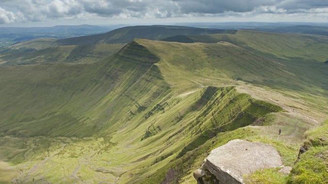
Lose your head in the clouds as you climb Pen y Fan and Corn Du, the two highest peaks in southern Britain. This is one of the most recognisable skylines in the UK. Discover wild walks and scenery in the remote heart of Bannau Brycheiniog (Brecon Beacons).

Top tips for planning your walk and staying safe in the Brecon Beacons mountain range.

Discover Henrhyd Falls and watch the waterfall plunge into the heavily wooded gorge of the Nant Llech. The surrounding Graig Llech Woods are a haven for mosses and lichen. This natural green space is also enjoyed by birdwatchers due to the wide variety of woodland birds.

Explore the Graig Llech Gorge and tranquil Nant Llech Valley on this adventurous Bannau Brycheiniog (Brecon Beacons) walk to see the highest waterfall in South Wales.

A challenging circular upland mountain walk that takes you into the heart of the Bannau Brycheiniog for the most spectacular views. Experience far-reaching view towards Pen y Fan into the Cwm Sere valley and look out for a Bronze Age burial cairn and evidence of military firing ranges.

Follow this strenuous, circular mountain walk on well-made footpaths to the summit of Pen y Fan and Corn Du in the Brecon Beacons.

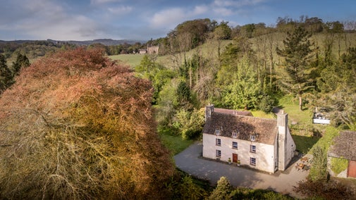
A traditional farmhouse with wooden floors, and a log burner on the beautiful Dinefwr Park.
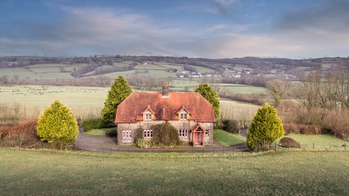
Nestled on the edge of the Dinefwr Park Estate with a gorgeous garden overlooking the valley, Penparc is a fabulous base for exploring the Welsh countryside
Sorry, there are no upcoming events at this place
The Bannau Brycheiniog (Brecon Beacons) offer a spectacular landscape rich in natural beauty. Free from light and noise pollution it's the perfect respite from the chaos of modern life. Whether you're seeking challenging walks, wide open spaces or secluded waterfalls, the Bannau Brycheiniog provides the best of them all. Pen y Fan, the highest point in southern Britain, stands proudly flanked by Corn Du and Cribyn. From Fan y Big looking west towards the Beacons you can get the most stunning views in the whole area. You can also be sure to miss the crowds on this less-visited peak. For a gentler amble, head to the upper Tarell Valley, which runs from Libanus to the Storey Arms. There are plenty of meandering walks through ancient woodland, where you can enjoy views of Craig Cerrig Gleisiad, Fan Frynach and the central Beacons.
The tragic story of a five-year-old boy who became lost on the mountains of Bannau Brycheiniog (Brecon Beacons ) in the summer of 1900. This sad story has been re-told down through generations of families and has touched the hearts of many. A memorial stands as a reminder of discovery and loss.

The footpaths criss-crossing Pen Y Fan in the Brecon Beacons mountain range are subject to erosion and they are maintained by a team of National Trust rangers and volunteers using traditional techniques.

There are several opportunities to volunteer in the Bannau Brycheiniog. You can meet and greet visitors at Pont ar Daf car park or you can join the Lengths team and help the rangers repair upland footpaths.

There are plans to build an upgraded car park at Pont ar Daf, the most popular spot for hiking Pen y Fan. It will accommodate up to more cars, minibuses, coaches and bikes as well as provide toilets and changing facilities.

Join today and help protect nature, beauty and history – for everyone, for ever. Enjoy access to more than 500 places with National Trust membership.
By sharing your email address you’re agreeing to receive marketing emails from the National Trust and confirm you’re 18 years old or over. Please see our for more information on how we look after your personal data.