Skip to content
View looking up at a red kite in flight with the background of a bright blue sky over Lyveden, Northamptonshire.
Red kites are among the birds of prey to look out for on your walk | © National Trust Images / Mike Selby
Yorkshire

Farmland, big skies and birds of prey walk

A gentle walk through farms, meadows and pastures, with wide open spaces and a great chance of spotting birds of prey like red kites, buzzards and kestrels.

Total steps: 4

Total steps: 4

Start point

Brimham Rocks car park, grid ref SE 206650

Step 1

From the Brimham Rocks car park, go back the way you entered – but before reaching the public road turn right down the track marked 'Private Road to Druids Cave Farm'. After about 80yd (75m) – just before the track passes between a gap in a wall with a National Trust boundary marker – there's a footpath to your left. Take this path and then the left fork immediately afterwards to continue to the road. Cross the road and take the footpath signposted 'Nidderdale Way'. Follow the path for about 0.6 miles (1km) to a stile at the boundary of Brimham Rocks. Go over the stile and straight on, then through a gate, passing the track to Riva Hill Farm on your left. Continue straight on for about 275yd (250m) to a junction where the paved track turns left and another track forks to the right.

Step 2

Take the paved track to your left, towards Warsill Parish Hall, continuing for around 660yd (600m) until you pass South Lane on your left. After another 330yd (300m) or so, the paved road ends and the route continues straight on as a farm track. After about 820yd (750m), it bends right with Low Farm on your left. Stay on the track – passing High Gill Moor Farm on your right – for another 440yd (400m) until you reach a road: Careless House Lane. Turn right onto the road. Around 220yd (200m) on, where the road bends sharp left, there's a lane straight ahead with a sign to 'Gilmore Foods'.

Step 3

Follow the lane through Gill Moor Farm, where it becomes a track. Continue on the track looking out for a wind turbine. Just past it, the track bends right and then left. At the left bend, on your right, there's a gate with a footpath marker on the left-hand post. Go through the gate and follow the track straight on for about 0.6 miles (1km), over several fields, until you reach a stone-chip drive crossing your path, with Woodfield House to your left and Woodfield Farm to your right. Head straight on over the drive, directly towards an electricity pole around 110yd (100m) away, which has the Nidderdale Way path beside it. Follow the path down and over a small bridge then through pastures for about 880yd (800m) until you reach a T-junction with another track. From here, you can see Park House to your right.

Step 4

Turn right onto the track and head up towards Park House, around 220yd (200m) away. Immediately before Park House, bear left following the track across the grass and between two walls into a field. The path continues through two fields. Go straight on through them, alongside the field boundaries, until you reach some steps over a wall. Climb over and, ignoring the stile opposite, turn right up the track. This is Nidderdale Way but this section is known as Monk Wall as it's on the route that was used by the monks from Fountains Abbey. Follow the track for about a third of a mile (0.5km) until you rejoin the outward route at the start of Step 2. Turn left here and retrace your steps straight on, all the way back to your starting point at Brimham Rocks car park.

End point

Brimham Rocks car park, grid ref SE 206650

Trail map

Ordnance Survey map of the Brimham Rocks farmland, wide open skies and birds of prey walk, Yorkshire
The Brimham Rocks farmland, wide open skies and birds of prey walk, Yorkshire | © Crown copyright and database rights 2013 Ordnance Survey

You made it

Share your experience

More near here

Stacked rock formation at Brimham Rocks, with blue sky above
Trail
Trail

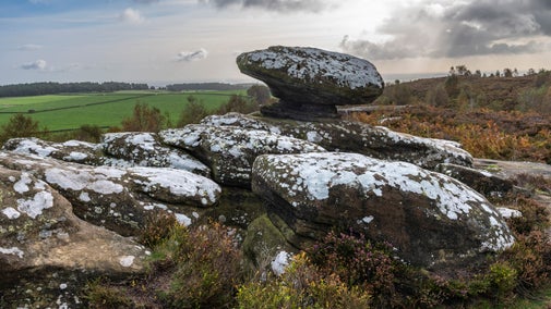
Circular walk at Brimham Rocks 

This short walk will show you the highlights of Brimham from the dramatic rock formations, to the heather moorland.
Activities
Walking
DistanceMiles: 1.3 (km: 2.08)
Brimham Rocks, Yorkshire
Trail
Trail

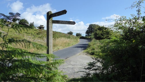
Moorland and meadows walk at Brimham Rocks 

Explore the diverse landscapes around Brimham Rocks, home to a wide range of pondlife, plus wild cotton and waist-high bracken.
Activities
Walking
DistanceMiles: 4.7 (km: 7.52)
Looking out on the castle rocks at Brimham Rocks, North Yorkshire
Trail
Trail

Monks' walk from Brimham Rocks to Fountains Abbey 

Walk in the monks' footsteps from Brimham Rocks to Fountains Abbey, following an ancient trail with views from Riva Hill to Brimham Rocks.

Activities
Walking
DistanceMiles: 7.5 (km: 12)
A wide view across the surrounding countryside from Brimham Rocks, North Yorkshire
Trail
Trail

Brimham Rocks boundary walk 

Enjoy a circular walk around the boundary of Brimham Rocks and discover panoramic views of the Yorkshire countryside.
Activities
Walking
DistanceMiles: 3.5 (km: 5.6)

Get in touch

Brimham Moor Road, Summerbridge, Harrogate, North Yorkshire, HG3 4DW

Our partners

Cotswold Outdoor

We’ve partnered with Cotswold Outdoor to help everyone make the most of their time outdoors in the places we care for.

Visit website 

You might also be interested in

Exploring Brimham Rocks in autumn
Article
Article

Exploring Brimham Rocks 

From rocks to moorland, Brimham Rocks offers a host of different of features for visitors. Take a look at the highlights of what you might see on your next visit.

Two girls eating ice cream with a woman at Brimham Rocks
Article
Article

Eating and drinking at Brimham Rocks 

Looking for some refreshment during your visit to Brimham Rocks? You can find a selection of food and drinks at the refreshment kiosk open everyday 10am - 4:30pm. Every bite of a sausage roll or crunch of an ice-cream cone helps to protect this special place.

Man climbs on rocks in the summertime
Activity
Activity

Outdoor activities at Brimham Rocks 

There are plenty of ways to explore Brimham Rocks, from walking and cycling, to orienteering and geocaching. Discover the outdoor activities on offer.
Visitors walking around the ruins at Fountains Abbey and Studley Royal Water Garden, Yorkshire

Walking in Yorkshire 

Discover some of the best walks in Yorkshire, from rugged Pennine beauty spots to parkland and meadows perfect for a family stroll.

A group of people in a hiking group are being guided on a hike by rangers at Marsden Moor, West Yorkshire
Article
Article

Cotswold Outdoor: our exclusive walking partner 

Find out more about the National Trust’s ongoing partnership with Cotswold Outdoor as our exclusive walking partner.

An aerial view of an adult and baby walking a dog along a path at Baggy Point, Devon
Article
Article

Staying safe at National Trust places 

The special places in National Trust care sometimes come with a few risks for visitors, be it coastline or countryside. Find out how to keep safe throughout your visits.

A visitor carrying a backpack and walking along a footpath at Divis and the Black Mountain with stone walls either side, the countryside visible in the background.
Article
Article

Follow the Countryside Code 

Help to look after National Trust places by observing a few simple guidelines during your visit and following the Countryside Code.

Walkers climbing rocks against a bright blue sky with the mountains in the distance at Sugarloaf, Monmouthshire

Walking 

Explore some of the finest landscapes in our care on coastal paths, accessible trails, woodland walks and everything in between. Find the best places to walk near you.