
Become a member
Join today and help protect nature, beauty and history – for everyone, for ever. Enjoy access to more than 500 places with National Trust membership.
The National Trust's oldest nature reserve, and England's most famous fen
Lode Lane, Wicken, Ely, Cambridgeshire, CB7 5XP

| M | T | W | T | F | S | S |
|---|---|---|---|---|---|---|
Open
Closed
| Asset | Opening time |
|---|---|
| Nature reserve | Closed |
| Café | Closed |
| Car Park | Closed |
| Cycle hire | Closed |
| Shop | Closed |
| Visitor Centre | Closed |
| Ticket type | With Gift Aid | Without Gift Aid |
|---|---|---|
| Car | £3.20 |
| Ticket type | With Gift Aid | Without Gift Aid |
|---|---|---|
| Adult (18+) | £11.00 | £10.00 |
| Child (5-17) under 5s free | £5.50 | £5.00 |
| Family (2 Adults and up to 3 children) | £27.50 | £25.00 |
| 1 adult, up to 3 children | £16.50 | £15.00 |
| Group (Adult 18+) | £9.50 | |
| Group (Child 5-17) | £4.75 |
| Ticket type | With Gift Aid | Without Gift Aid |
|---|---|---|
| Car | £3.50 |
| Ticket type | With Gift Aid | Without Gift Aid |
|---|---|---|
| Adult (18+) | £12.10 | £11.00 |
| Child (5-17) under 5s free | £6.10 | £5.50 |
| Family (2 Adults and up to 3 children) | £30.30 | £27.50 |
| 1 adult, up to 3 children | £18.20 | £16.50 |
| Group (Adult 18+) | £10.45 | |
| Group (Child 5-17) | £5.23 |
The Docky Hut cafe is next to the Visitor Centre.
Our car park is located mid way down Lode Lane; follow the lane on foot to find the Visitor Centre, cafe and start of all walks on the Fen. Members need to scan their membership card for a free parking ticket; non-members pay and display is £3.20 (payment by cash or via JustPark app requiring download). Blue badge parking is free of charge
Dogs under close control are welcome on Adventurers' Fen and the wider reserve paths, as well as in the Visitor Centre/shop. Assistance dogs only on Sedge Fen (Boardwalk, Woodland Walk and Summer Nature Trail)
The shop is in the Visitor Centre; there is also a small selection of second-hand books.
Toilets are in the car park, and also in the Learning Centre located behind the cafe. Please note the adapted toilet at the car park is no longer available - please use the adapted facility in the Learning Centre
Blue Badge parking and drop-off point. Accessible toilets and routes. Wheelchairs available. Assistance dogs on Sedge Fen.
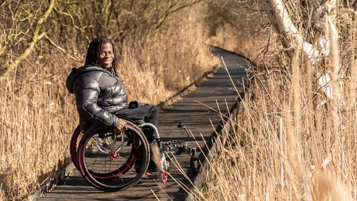
Our circular Boardwalk and Woodland Walk on Sedge Fen are accessible routes, including access into two hides. Assistance dogs only on these routes. The Lodes Way cycle path going out towards Adventurers' Fen is also accessible. All dogs under close control welcome on this route.
The accessible toilet is located in the Learning Centre toilets.(Building behind the cafe)
There are designated parking spaces in our main car park, plus two in front of the Visitor Centre.
Dropping off in front of the Visitor Centre is possible.
Benches are located around the Boardwalk, fewer on other walking routes.
There are 2 wheelchairs available to borrow, suitable for use on the Boardwalk , woodland walk and Lodes Way.
Take a look at the events we have coming up this year
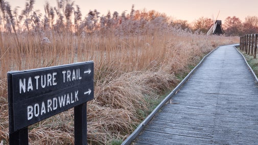
If outdoor activities and learning about nature sound like a good day out for your family, Wicken Fen is the right place for you. Discover everything you need to plan your family day out, from events and activities for kids to hiring bikes.

We have been working to ensure as many people as possible can experience Wicken Fen's nature and history, making it a welcoming place for everyone who visits. Discover key access information to help you plan a visit to Wicken Fen.
Explore the diverse landscape at Wicken Fen, abundant with wildlife, flora and fauna. Discover the ancient Sedge Fen, grazing herds of Konik ponies and the iconic windpump.

Wicken Fen is a two pawprint rated place. To help us ensure our visitors, dogs and wildlife get along together, there are a few do’s and don’ts to take note of if you’re bringing your dog with you. Find out more here.

Paths lead through the historic undrained core of the Fen, lush with wetland plants and rich in wildlife.
Wet grassland, reedbeds, and the Mere attract wildfowl and waders. Grazed by herds of Konik ponies and Highland cattle.
Landscape-scale nature conservation in action, with wildlife moving in as Wicken Fen grows.
Traditional fenland cottage, built using local materials, and furnished in 1930s style. Fenman's workshop in the garden.
Working wooden windpump, the last in the Fens. Occasionally in action.
Information about sightings, routes and activities. Large windows overlooking the Sedge Fen; family discovery area to inspire your visit.
Docky Hut Café offers light lunches, hot and cold drinks, cakes and other treats, with indoor and outdoor seating.
Gifts, homeware, garden accessories and local produce, plus nature- and wildlife-inspired books.
Discover everything you need to plan your family day out

Wicken Fen was the first nature reserve to be managed by the National Trust. Today it’s one of Europe's most important wetlands, with over 10,000 recorded species.

Explore the diverse landscape at Wicken Fen, abundant with wildlife, flora and fauna. Discover the ancient Sedge Fen, grazing herds of Konik ponies and the iconic windpump.

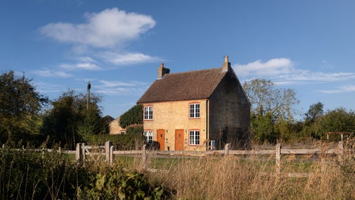
Stay in Wicken Rose Cottage, uniquely placed next to the National Trust’s oldest nature reserve and England’s most famous fen. With an abundance of wildlife and walks from the doorstep, this semi-detached cottage offers a snug spot for two.
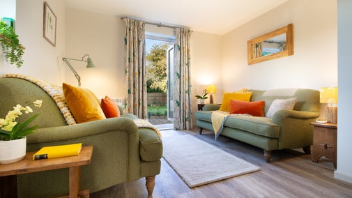
Stay in Wicken Cladium Cottage, uniquely placed next to the National Trust’s oldest nature reserve and England’s most famous fen. With an abundance of wildlife and walks from the doorstep, this semi-detached cottage offers a snug spot for four.
Explore the fens on two wheels or on foot. Enjoy an easy family ride to see Konik ponies or discover the wildlife in the wider reserve.
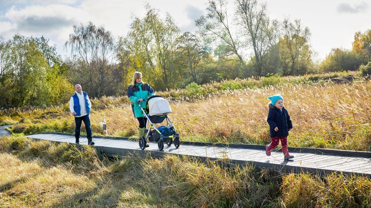
A 3-mile walk, exploring new areas of wetland habitat, reed beds and the mere.
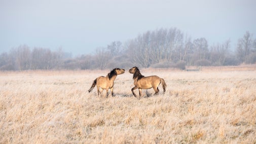
Explore part of Wicken Fen following the four Lodes on a trail is a great walk for catching a glimpse of grazing herds including Konik ponies and Highland cattle. Stop off at one of the hides to look for bittern, waterfowl and marsh harriers. It's the perfect walk for all the family to enjoy this season.

A short walk around Wicken's ancient Sedge Fen, a unique remnant of undrained fenland.
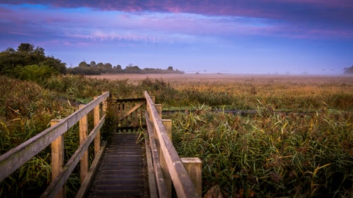
Visit the Docky Hut Café and try our freshly baked sausage rolls and hot snacks or buy a gift in the shop as a souvenir of your visit.


Stay in Wicken Rose Cottage, uniquely placed next to the National Trust’s oldest nature reserve and England’s most famous fen. With an abundance of wildlife and walks from the doorstep, this semi-detached cottage offers a snug spot for two.

Stay in Wicken Cladium Cottage, uniquely placed next to the National Trust’s oldest nature reserve and England’s most famous fen. With an abundance of wildlife and walks from the doorstep, this semi-detached cottage offers a snug spot for four.
Delve into the fascinating world of owl pellets to discover what’s on the menu for the owls at Wicken Fen! This a great workshop for children and adults alike, so please book a place for everyone who wants to 'have a go'!
This spring, treat the whole family to a world of adventure at Wicken Fen on an Easter trail.
Another fantastic crafty workshop that children and adults alike will enjoy, so please book a space for everyone that wants to have a go. Suitable for children age 5+. Must be accompanied by an adult.
Wicken Fen, one of Europe's most important wetlands, supports an abundance of wildlife. More than 10,000 species have been recorded, including a spectacular array of plants, birds and dragonflies.
The raised boardwalk and lush grass droves allow easy access to a lost landscape of flowering meadows, sedge and reedbeds, where you can encounter rarities such as hen harriers, water voles and bitterns.
Wicken Fen Vision, an ambitious landscape-scale conservation project, is opening up new areas of land to explore. Our grazing herds of Highland cattle and Konik ponies are helping to create a diverse range of new habitats.
A fenland nature reserve in Cambridgeshire has recorded its 10,000th species of wildlife – becoming, experts believe, the first known UK site of its kind to do so.
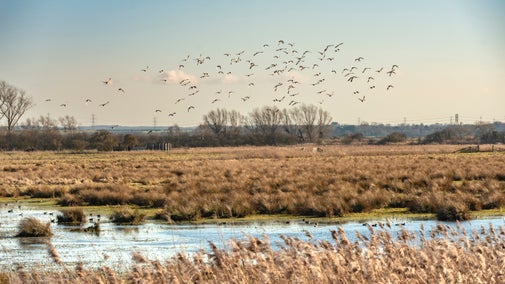
Adopt a Plot at Wicken Fen set to help restore nature

Learn about some of the work we carry out at Wicken Fen Nature Reserve throughout the year to conserve this important landscape for visitors, plants and animals alike.

Learn how we’re planning to care for Wicken Fen Nature Reserve with an ambitious vision to create and preserve a diverse landscape for people and for the wildlife that lives here.
Learn more about the Cambridgeshire County Council project to construct a new bridge over Burwell Lode.
Wicken Fen's ambitious project plans to restore 590 acres (239 hectares) of peatland.
The Living Lowlands Programme is a £3 million programme of work that sits at the heart of our vision for the future of lowland peat habitats. Focussing on iconic lowland landscapes and working with a range of stakeholders, the programme aims to restore a functioning lowland ecosystem on carbon-rich peaty soils.
Listen to the Voices of the Fen invites you to actively listen to the voices of many different species at Wicken Fen. Activities and installations will reveal hidden sound worlds we may not usually notice, from underwater, underground and inside trees.
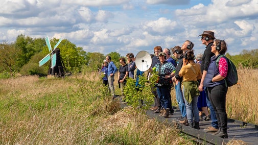
We’ve cared for Wicken Fen National Nature Reserve for over 125 years. Discover its history and how we continue to look after this very special place.

1 May 2024 marked 125 years since the National Trust acquired two hectares at Wicken Fen in Cambridgeshire. It also marked 25 years since the Wider Wicken Fen Vision was launched, a 100 year plan to protect this special place for wildlife and people.


Join today and help protect nature, beauty and history – for everyone, for ever. Enjoy access to more than 500 places with National Trust membership.
By sharing your email address you’re agreeing to receive marketing emails from the National Trust and confirm you’re 18 years old or over. Please see our for more information on how we look after your personal data.